Pustozersk
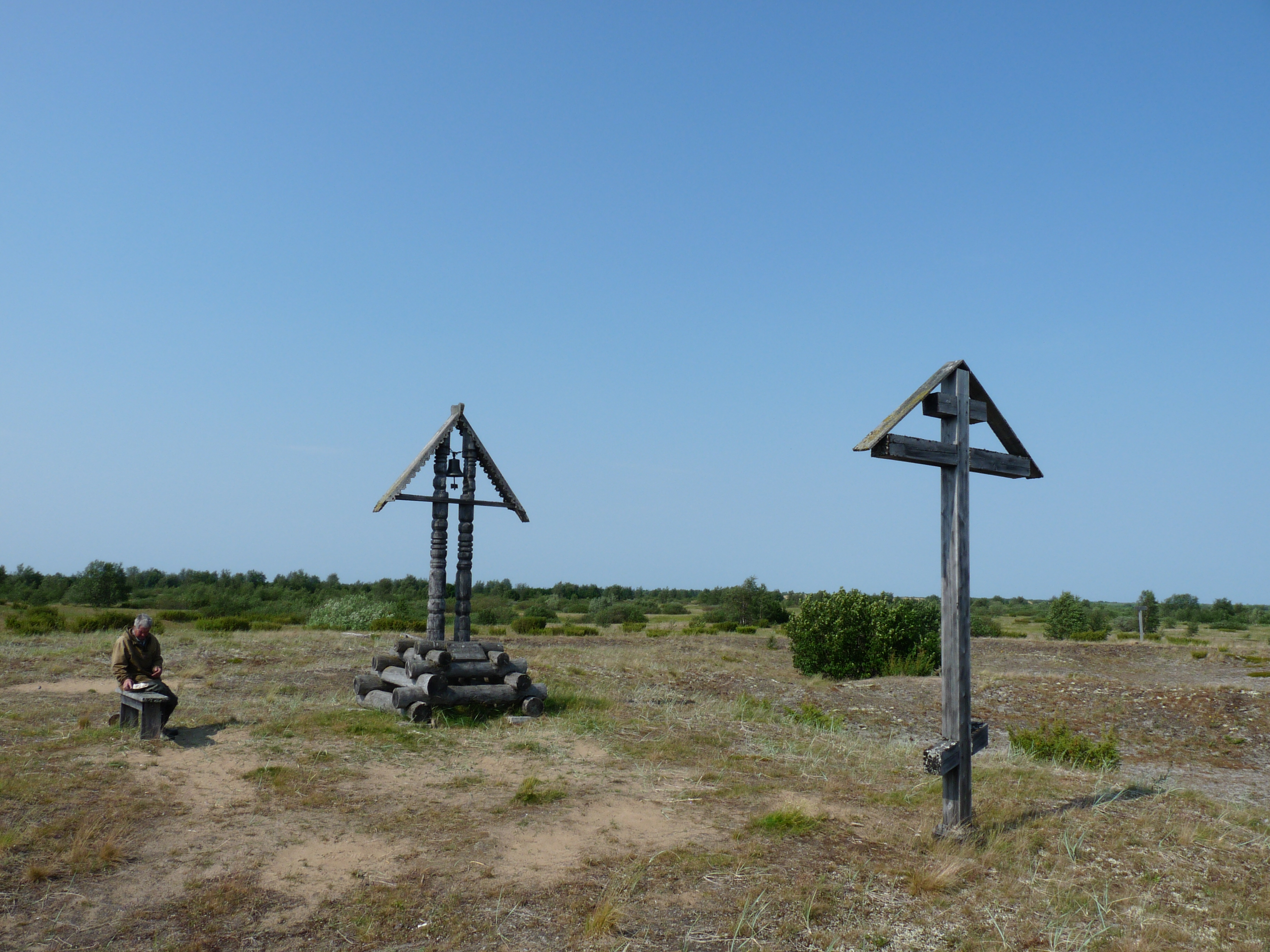
The name means "place of empty lakes," and emptiness is what Pustozersk has become. Founded in 1499 as the most distant northern outpost of Muscovy, this town on the lower Pechora River once served as a military fort, an administrative capital, and a place of exile for some of Russia's most notable political and religious prisoners. The last resident left in 1962. Today, wooden memorial crosses mark the site where the fiery Old Believer priest Avvakum was burned at the stake, and archaeological excavations reveal the outlines of a settlement that endured for nearly five centuries before the Arctic finally reclaimed it.
Muscovy's Northern Reach
In 1499, Princes Semyon Kurbsky and Pyotr Ushaty led an expedition to the lower reaches of the Pechora River and founded Pustozersk on barren, deserted ground -- hence the name, derived from the Russian words for "empty" and "lakes." It was the first Russian settlement on the Pechora and the most northerly outpost of the Muscovite state, built to serve as a military fort guarding the empire's Arctic frontier. The town appeared on Gerard Mercator's 1595 map as "Pustozera," evidence that even European cartographers recognized its significance as a landmark on the edge of the known world.
Exiles and Heretics
Pustozersk's remoteness made it a natural destination for the unwanted. During the 17th century, the town's most active period, the Muscovite state banished some of its most prominent figures here. Artamon Matveyev, a powerful boyar and diplomat, spent years in Pustozersk after falling from favor. Vasily Galitzine, once one of the most influential men in Russia, endured exile in this frozen outpost. But the most famous exile was Avvakum Petrovich, the outspoken Old Believer priest who refused to accept the liturgical reforms of Patriarch Nikon. Avvakum spent fifteen years imprisoned in Pustozersk before being burned at the stake in 1682. An ornate wooden cross now marks the spot, drawing pilgrims and historians to a place that most people abandoned centuries ago.
A Slow Vanishing
Pustozersk's decline began in the 18th century, when a more convenient southern route to Siberia through the Ural Mountains rendered the town's position strategically irrelevant. Trade shifted, populations drifted away, and the Arctic settlement slowly contracted. By 1924, Pustozersk had lost its city status entirely. A contemporary observer described it as "not a city, but an ordinary, small northern village, numbering 25-30 houses and about forty non-residential buildings." The contraction continued through the 20th century with brutal acceleration.
The Last Residents
During World War II, forty-one residents of Pustozersk fought for the Soviet Union; nineteen never returned. Refugees temporarily swelled the population to 106, but the postwar years brought a swift collapse. By 1951, only twenty-eight people remained. Eight years later, in 1959, just six souls held on. The last residents departed in 1962, and Pustozersk became a ghost town. The wooden Church of the Transfiguration, the only structure to survive the abandonment, was dismantled and moved to the nearby village of Ustye on Lake Gorodetskoye -- a building saved by relocation from a place that could no longer sustain even a single family.
Echoes in the Tundra
Today Pustozersk lies about twenty kilometers southwest of Naryan-Mar, the capital of the Nenets Autonomous Okrug. The site is recognized as a federal cultural heritage monument, and archaeological excavations have revealed the foundations and artifacts of a settlement that shaped Russia's relationship with its Arctic territories for centuries. Memorial crosses stand where Avvakum burned, visited by those who make the journey across the tundra to honor a man who chose death over compromise. From the air, nothing distinguishes this patch of subarctic ground from the surrounding landscape of moss, lichen, and shallow lakes -- the empty lakes that gave the town its name.
From the Air
Site located at approximately 67.54°N, 52.59°E on the lower Pechora River, about 20 km southwest of Naryan-Mar (ULAM). The area is flat lowland tundra with numerous lakes and river channels. No structures remain visible from altitude. Best approached from Naryan-Mar Airport. The Pechora River provides the primary visual reference for navigation to the site.