Pyha-Luosto National Park
Ripple marks left by ocean waves are still visible in the rock here, frozen into quartzite nearly two billion years ago. The fells of Pyha-Luosto National Park are among the oldest geological formations on Earth, remnants of an ancient mountain range that once rivaled the Himalayas in height but has been ground down by time and ice into the rounded summits that now define the skyline of Finnish Lapland. Established in 2005 by merging the historic Pyhatunturi National Park -- Finland's oldest, dating to 1938 -- with the Luosto area, the park covers 142 square kilometers of fells, old-growth forest, aapa bogs, and one of the most dramatic gorges in Scandinavia.
Mountains Worn to Memory
The park's backbone is a 35-kilometer quartzite ridge system comprising twelve distinct fell summits, the southernmost major fell chain in Finland. Noitatunturi rises to 540 meters, Ukko-Luosto to 514 -- modest heights that belie the violence of their origins. These rocks formed from coastal sand deposited on an ancient seabed, compressed and metamorphosed over geological time into the hard quartzite that resists erosion better than the softer stone around it. The result is a landscape of stubborn survivors: fells that have endured nearly two billion years of weathering, glaciation, and tectonic drift. At certain outcrops, you can run your fingers over wave ripples preserved from that primordial ocean, a tactile connection to a world that predates complex life itself.
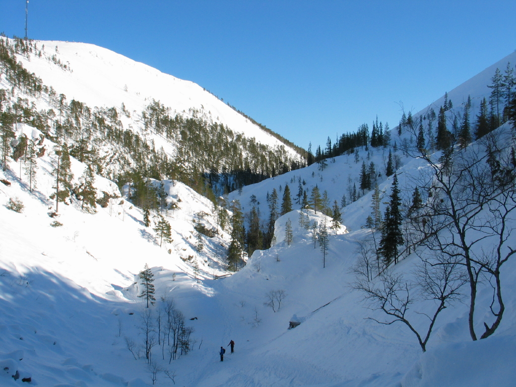
The Deepest Cut
Isokuru is Finland's deepest gorge, plunging over 200 meters between the fell walls. It was carved by glacial meltwater during the last Ice Age, when vast ice sheets retreated and their runoff sliced through the quartzite ridge with astonishing force. The gorge separates fell summits that were once continuous, a dramatic reminder of what moving water can accomplish given sufficient time and volume. In winter, Isokuru fills with snow and ice, creating a silent, otherworldly corridor. In summer, the microclimate within the gorge supports plant species that struggle to survive on the exposed fell tops above, a sheltered pocket of green in an otherwise austere landscape.
Gems from Sacred Ground
On Lampivaara fell, within the park's boundaries, sits one of the only active amethyst mines in Europe open to the public. The amethyst formed roughly two billion years ago in the same geological processes that created the fells themselves, crystallizing deep within the ancient mountains. Visitors can dig for their own stones -- a deliberate approach to extraction that avoids heavy machinery and ensures the mine will last for centuries. The Sami people who lived here long before any mining operation considered these fells sacred. The name Pyha itself means holy, and in 1648, a minister named Esaias Fellman performed a group christening of local Sami at Lake Pyhakasteenlampi, a moment when old beliefs and new religion met on this ancient ground.
Trails Between Two Villages
The fell villages of Pyha and Luosto anchor the park's eastern and western edges, connected by a 30-kilometer hiking trail that traverses the heart of the landscape. Shorter trails of varying difficulty branch off from both villages, and in winter the network expands to include cross-country skiing and snowshoeing routes. The Naava Nature Centre in Pyha village offers exhibitions on the park's ecology and geology. Wilderness huts, lean-tos, and campfire sites are scattered throughout the backcountry, supporting multi-day treks through old coniferous forests and across the open bogs that fill the lowlands between fells. Mountain biking trails thread the terrain in summer. Whatever the season, the park rewards those who venture beyond the trailhead with a silence broken only by wind, birdsong, and the occasional crack of frost.
From the Air
Located at 67.07N, 26.97E in Finnish Lapland, spanning the municipalities of Sodankyla, Pelkosenniemi, and Kemijarvi. The fell chain is visible from altitude as a distinct linear ridge rising above the surrounding boreal forest. Isokuru gorge is identifiable as a deep notch in the ridge. Nearest airport is Sodankyla airfield (EFSO). Rovaniemi Airport (EFRO) lies approximately 150 km southwest. The fell summits reach 540 m (Noitatunturi). Best viewed from the south or west where the ridge profile is most dramatic.