Qinghai-Tibet Railway
Every seat has its own oxygen outlet. The locomotives are turbocharged to compensate for running on half an atmosphere of air, and every passenger train carries a doctor. These are the operating conditions of the Qinghai-Tibet Railway, the highest rail line in the world, stretching 1,956 km from Xining in Qinghai Province to Lhasa in Tibet. Over 960 km of its track runs above 4,000 meters, and at Tanggula Pass the rails reach 5,072 meters -- higher than any other railway point on Earth. When the Golmud-to-Lhasa section opened on July 1, 2006, it brought the first train tracks to Tibet and connected the plateau to the rest of China by rail for the first time in history.
Building on Frozen Ground
The first 815 km from Xining to Golmud took 26 years, from 1958 to 1984. The remaining 1,142 km to Lhasa had to wait until engineers could solve a problem that had defeated earlier attempts: permafrost. About half the Golmud-Lhasa section crosses ground that is barely permanently frozen -- solid in winter, muddy in summer, and sensitive enough that the heat from a passing train can destabilize it. Where the permafrost was relatively stable, embankments of large rocks sufficed. In the most fragile zones, engineers elevated the tracks on pile-driven foundations sunk deep into the ground, essentially building bridges over thawing earth. Portions of the track use ammonia-based heat exchangers, passively cooling the ground beneath the rails much like the Trans-Alaska Pipeline System keeps its supports frozen. Construction on this section started June 29, 2001, involved over 20,000 workers and 6,000 pieces of equipment, and cost $3.68 billion. It was finished in five years.
Records in Thin Air
The railway collects superlatives the way its trains collect passengers. Tanggula railway station, at 5,068 meters, is the highest in the world -- nearly 290 meters above Galera station in Peru and Condor station in Bolivia, the highest in the Americas. The Fenghuoshan tunnel, at 4,905 meters, is the highest rail tunnel anywhere. The line includes 675 bridges totaling 160 km in length, and 550 km of track laid directly on permafrost. Bombardier Transportation built 361 special high-altitude passenger carriages with enriched-oxygen systems and UV protection, including 53 luxury sleeper cars for tourist service. Signs in the carriages appear in Tibetan, Chinese, and English. Trains run from Beijing, Shanghai, Chengdu, Chongqing, Guangzhou, Lanzhou, and Xining, carrying up to 1,000 passengers during peak season at speeds of 120 km/h -- dropping to 100 km/h over the permafrost sections.
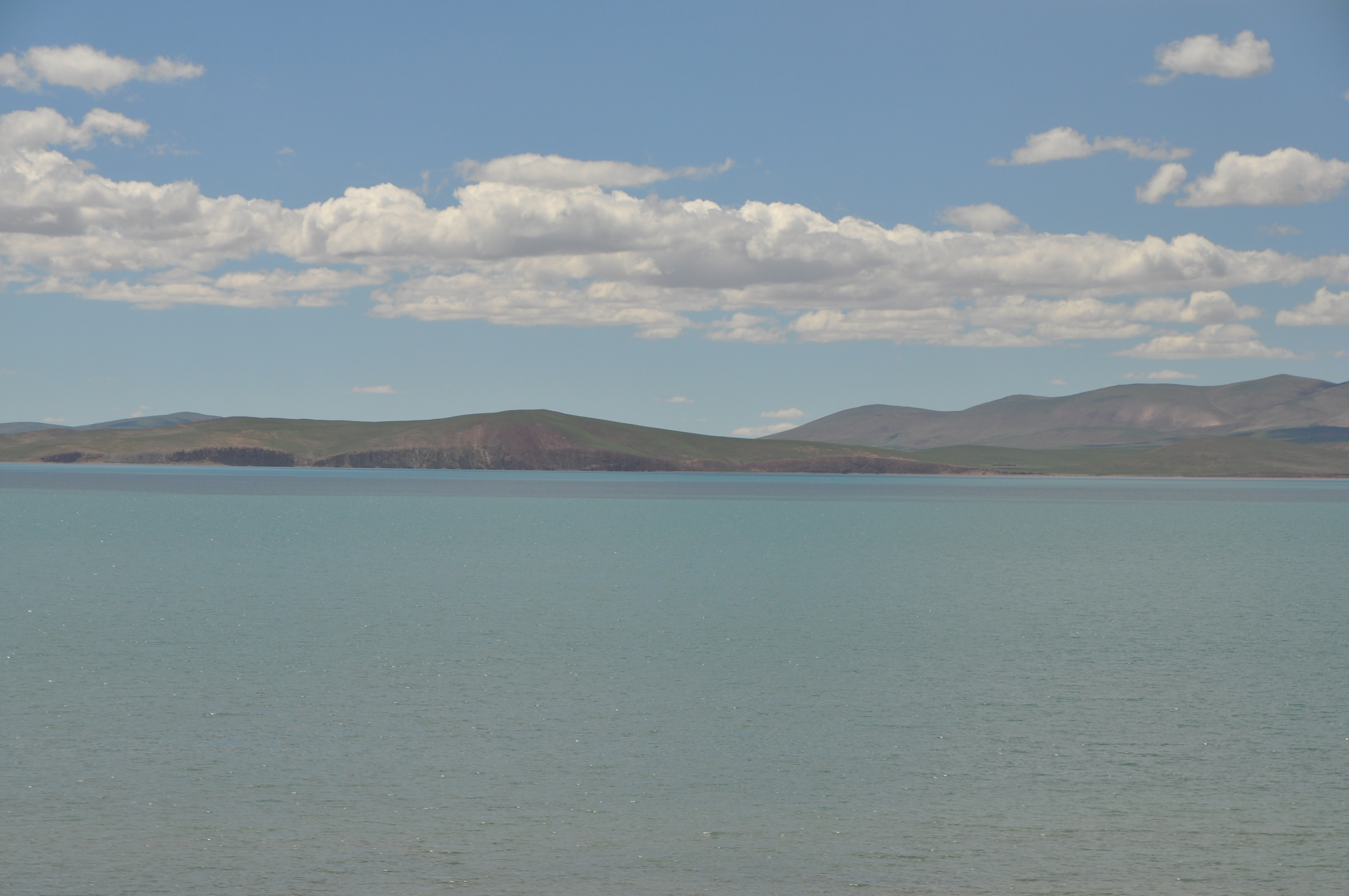
The View from the Carriage Window
Between Xining and Golmud, the train skirts the vast blue expanse of Qinghai Lake. South of Golmud, the scenery enters a different register entirely. The Kunlun Mountains rise on both sides, and the line passes through the Kekexili grasslands where Tibetan antelope migrate -- 33 wildlife crossing bridges were built specifically to keep their routes open. The Tuotuo River Bridge carries tracks over one of the Yangtze's headwater streams. At Tanggula Pass, passengers look out at a landscape stripped to its essentials: rock, ice, sky. Descending toward Lhasa, the Nyenchen Tanglha Mountains appear, their peaks often buried in cloud. The Damxung grasslands give way to the Lhasa River valley, and then the train pulls into Lhasa station, its journey complete. Folk singer Han Hong captured the route's hold on the Chinese imagination with her song Tianlu -- Road to Heaven.
Contested Rails
The railway's significance extends well beyond engineering. Built as part of China's Western Development strategy, it slashed the cost of transporting goods to Tibet from 0.38 RMB per tonne-kilometer by road to 0.12 RMB by rail. Before the railway, 100 RMB of purchasing power in Lhasa was equivalent to only 54 RMB in coastal China, largely because of transport costs. But the Tibetan government-in-exile has argued that the railway facilitates an influx of Han Chinese settlers and accelerates the erosion of Tibetan culture. Chinese state media counters that the line has increased pilgrimage to Lhasa and opened access to education and employment for Tibetans. Environmental concerns persist as well -- climate change could raise plateau temperatures by two to three degrees Celsius, enough to destabilize the permafrost the railway depends on. The extension to Shigatse opened in 2014, and plans are underway to push tracks toward the Nepal border at Gyirong.
From the Air
The railway runs from Xining (ZLXN) at 2,275m to Lhasa (ZULS) at 3,570m, crossing terrain above 5,000m at Tanggula Pass. The track is visible from altitude as a thin line across the otherwise empty plateau, particularly in the Golmud-Lhasa section. Look for the distinctive elevated track sections on permafrost and the bridges spanning river valleys. Coordinates center approximately 33.0°N, 96.0°E. Expect extreme altitude conditions, thin air affecting engine performance, and rapidly changing mountain weather. The Kunlun Mountains and Tanggula Mountains create significant terrain challenges.