Qualicum National Wildlife Area
The name Qualicum means "where the dog salmon run." For generations, the Coast Salish people, specifically the Qualicum First Nation, gathered here each fall to harvest chum salmon from the rivers flowing through what is now the Nanaimo lowland. They also harvested abalone, oysters, geoducks, and horse and butter clams from the rich estuarine waters. When the Canadian government established the Qualicum National Wildlife Area in 1977, it was recognizing what Indigenous peoples had known for millennia: this narrow strip of lowland between the Jordan River and the Johnstone Strait is one of Vancouver Island's most biologically productive landscapes.
The Last Oak Ecosystem
Among the wildlife area's most remarkable features is its Garry oak ecosystem, centered on the only oak species native to British Columbia. These gnarled, drought-resistant trees anchor communities of extraordinary diversity, with upwards of a hundred plant and animal species depending on the dark, rich soil beneath their canopies. But Garry oak ecosystems are vanishing across the province, victims of habitat loss and urban development. The oaks that survive here do so because the wildlife area provides what development cannot: undisturbed ground, natural fire cycles, and the freedom to grow at their own slow pace. Their leathery leaves, evolved to minimize water loss, are a testament to the dry-summer climate of Vancouver Island's eastern coast.
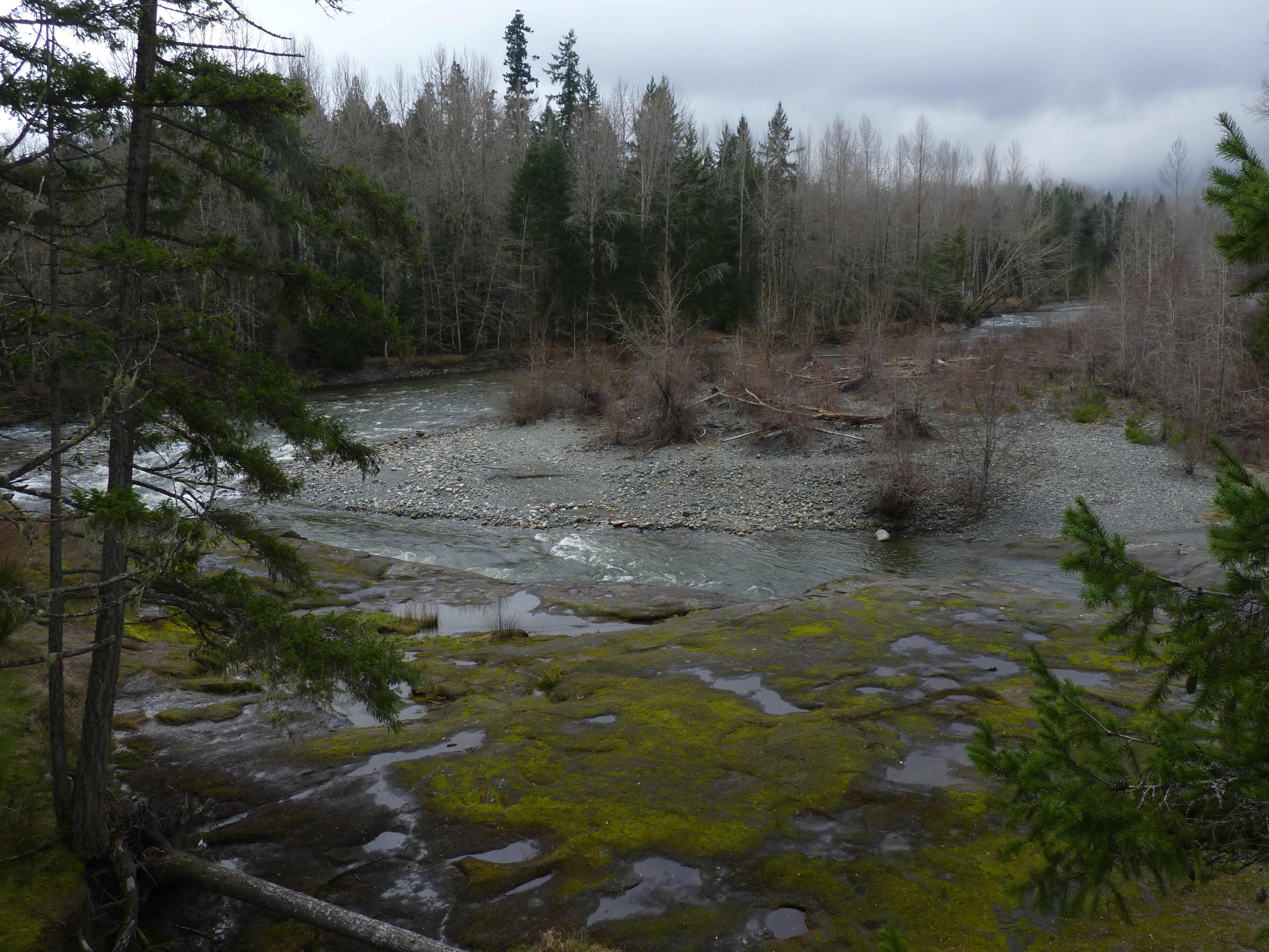
Herons, Salmon, and the Salish Sea
More than 60 species of water birds inhabit or pass through the Qualicum NWA, including the great blue heron, a species listed as endangered in British Columbia. The herons nest in woodlands adjacent to estuaries, stalking the shallows with mechanical patience, but they are exquisitely sensitive to human disturbance and will abandon their nests if people approach too closely. Research has shown that these birds take roughly 3 percent of juvenile fish heading out to the Salish Sea, a reminder that the wildlife area functions as a single interconnected system where forest, estuary, and ocean meet. Brant geese are the one exception to the area's hunting prohibition, with limited waterfowl hunting permitted at the Rosewall Creek unit.
Invaders at the Gate
Not everything thriving in the Qualicum NWA belongs here. Reed canary grass, originally from temperate Europe and Asia and likely introduced to British Columbia as a cultivar in the 1800s, has spread through the area's wet soils and riverbanks, crowding out native ground cover and reducing biodiversity. Japanese knotweed, brought from East Asia as an ornamental garden plant in 1901, is even harder to control: digging it up fragments the roots, each fragment capable of sprouting a new plant. Giant hogweed, whose seeds remain viable in soil for up to 15 years and whose toxic sap causes burns on contact with skin, adds another dimension to the management challenge. Parks Canada deploys herbicide, biological, and mechanical control methods, but the battle is ongoing and the invaders are patient.
Whose Land, Whose Plan
The Qualicum NWA sits on the traditional territory of the Coast Salish First Nations, yet two BC Parks management plans related to the area, the Little Qualicum Falls Park plan of 1989 and the Rosewall Creek Park plan of 2003, made little or no mention of consultation with Indigenous peoples. The Rosewall Creek plan acknowledged a "lack of detailed knowledge of natural and cultural values" and expressed an intention to include First Nations in developing a cultural inventory. Twenty minutes down the road, Qualicum Beach draws tourists to its beaches and forests, a popular destination shaped by far more human intervention than the wildlife area it borders. The contrast between the two landscapes underscores what protection means in practice: not just fences and regulations, but the deliberate choice to let a place remain what it was before anyone thought to name it.
From the Air
Located at 49.367N, 124.492W on the east coast of Vancouver Island, near the town of Qualicum Beach. The wildlife area occupies lowland terrain along rivers and estuaries visible from altitude. Nearest airport is Comox Valley Airport (CYQQ), approximately 40 km northwest. Qualicum Beach is visible along the coast as a developed strip. Recommended viewing altitude 3,000-5,000 ft AGL for context on the estuary and forest boundaries.