Queen Charlotte Airlines Flight 102
The Consolidated Canso A was never supposed to be there. On the night of October 17, 1951, the converted flying boat designated CF-FOQ should have been approaching Vancouver, not the darkened slopes of Mount Benson above Nanaimo. But somewhere over the black waters between Kitimat and the southern tip of Vancouver Island, pilot Douglas Duncan McQueen made a navigational error that would kill everyone aboard -- twenty passengers and three crew -- in what was then the deadliest aviation disaster in British Columbia's history.
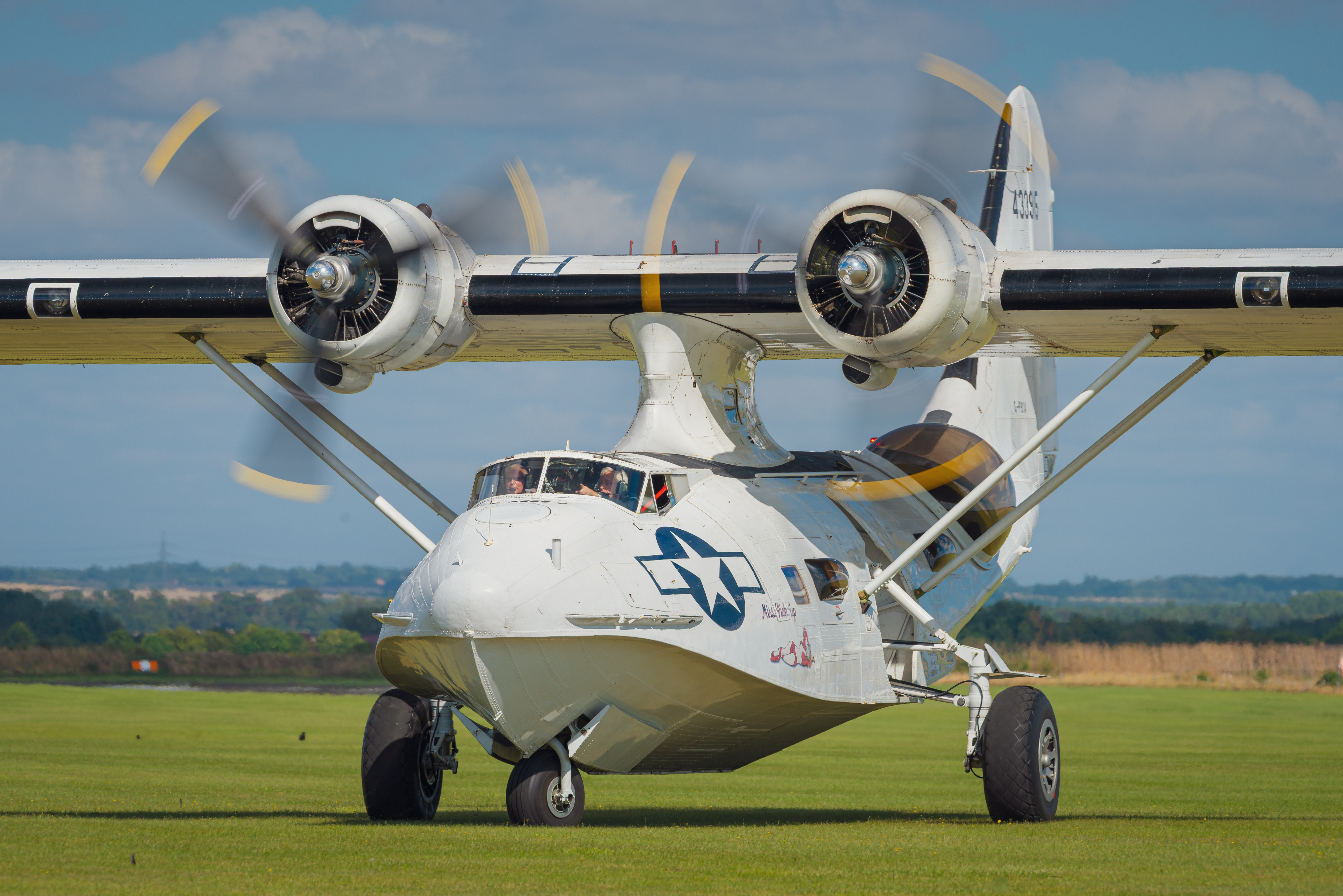
A Flying Boat Called Polar Bear
CF-FOQ had lived several lives before its last flight. Manufactured in 1941 as a Consolidated Canso A -- the Canadian-built variant of the famous PBY Catalina flying boat -- the aircraft served through the war years before the Hudson's Bay Company purchased it in 1947, naming it Polar Bear. By April 1951, it had been sold again, this time to Queen Charlotte Airlines, a small regional carrier that connected the remote coastal communities of British Columbia. The airline's routes threaded through some of the most challenging airspace in North America: mountain-rimmed fjords, unpredictable weather, and settlements accessible only by water or air. Flying boats were the workhorses of this coast, and the Canso A was built for exactly this kind of service.
Twenty Workers Heading Home
The passengers that evening were aluminum workers -- employees of Alcan, the company transforming the wilderness around Kitimat and Kemano into one of the world's largest aluminum smelting operations. Seven boarded at Kemano and thirteen more joined at Kitimat, all bound for Vancouver after shifts in the remote industrial camps of northern BC. In the cockpit sat McQueen, a World War II veteran with considerable experience, alongside First Officer Jiginder Singh Johl and radio operator Ray Williams. Johl had earned his commercial pilot's license just the year before, in March 1950, and had already survived one emergency -- a forced landing on Johnstone Strait during a blizzard in which all eighteen passengers walked away alive.
Night, Cloud, and a Fatal Mistake
What went wrong unfolded in darkness. The flight departed southbound under visual flight rules, but conditions deteriorated as the aircraft moved down the coast. Visibility shrank. The investigation that followed concluded that McQueen likely mistook the lights of Nanaimo for those of Vancouver -- a navigational error that placed the aircraft on a collision course with Mount Benson, which rises over 1,000 meters just west of the city. The probable cause, investigators determined, was the continuation of VFR flight at night under restricted visibility, compounded by inadequate pre-flight preparation. McQueen had not obtained the latest meteorological information before departure. The aircraft struck the mountain and was destroyed on impact. There were no survivors.
A Province Reckons with Its Skies
The crash reverberated across British Columbia. At the time, it was the deadliest aviation accident the province had ever seen -- a grim milestone for a region that depended on bush pilots and flying boats to connect its scattered communities. The loss of twenty Alcan workers hit the industrial camps of Kitimat and Kemano hard, communities already defined by their isolation and the daily risks their workers accepted. Mount Benson, visible from Nanaimo on clear days, became a quiet memorial. The wreckage on its slopes served as a reminder of how thin the margin was between routine and catastrophe in coastal aviation, where weather could shift without warning and a single navigational misjudgment could prove fatal.
From the Air
The crash site is on Mount Benson at approximately 49.15N, 124.05W, west of Nanaimo on Vancouver Island. Mount Benson rises to 1,019 meters. Nearby airports include Nanaimo Airport (CYCD) approximately 15 km to the south. The terrain west of Nanaimo is mountainous with rapid elevation changes. Exercise caution in reduced visibility conditions in this area.