Quito
Quito straddles the equator at 2,850 meters in the Andes, the highest official capital city in the world, surrounded by volcanoes whose snow-capped peaks are visible on clear days. The Spanish founded the city in 1534 on the ruins of an Inca city itself built over earlier settlements; the colonial center they created became, in 1978, one of the first UNESCO World Heritage Sites. Quito holds 2.8 million people in the metropolitan area, Ecuador's political capital while Guayaquil claims commercial dominance. The old town that UNESCO recognized is the largest and best-preserved in the Americas, its churches and monasteries and plazas intact in ways that other colonial cities cannot match.
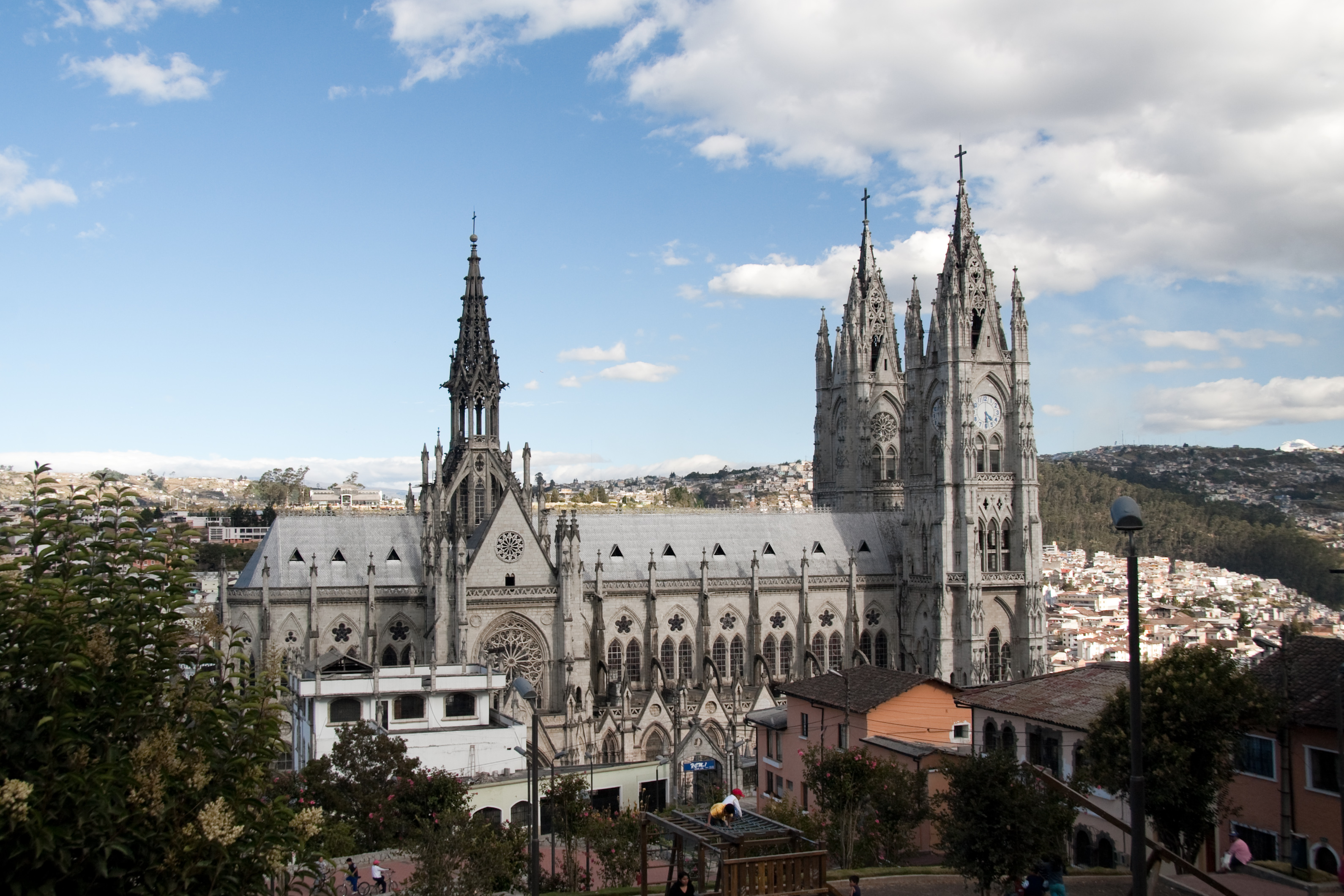
The Colonial Center
Quito's colonial center covers 320 hectares, the largest in the Americas, its churches and convents and civic buildings representing three centuries of Spanish construction. The Compania de Jesus church, whose interior is covered in gold leaf, represents Baroque excess at its most extravagant; the San Francisco monastery complex covers three city blocks. The plazas that organize the center - Plaza Grande, Plaza San Francisco, Plaza Santo Domingo - provide the public spaces that colonial urbanism required.
The preservation has been deliberate. The UNESCO designation brought resources and attention; the restrictions it imposed prevented the modernization that destroyed colonial centers elsewhere. The result is a working historic district, the buildings still used for commerce and residence, the streets still carrying traffic, the preservation successful because the center remains alive rather than becoming museum.
The Volcanoes
Quito sits in a valley between two volcanic cordilleras, the peaks that surround the city including Pichincha to the west, Cotopaxi to the south, Cayambe to the north. Pichincha erupted as recently as 1999, dusting the city with ash; Cotopaxi's 2015 activity prompted evacuation planning. The volcanoes that provide Quito's dramatic setting also represent ongoing risk, the seismic activity that created the Andes continuing to reshape them.
The teleferico cable car climbs Pichincha to over 4,000 meters, providing views that on clear days encompass multiple volcanic peaks. The hiking trails that continue from the cable car station reach the summit crater. The volcanoes are accessible in ways that proximity to a capital city makes possible, the dramatic landscape becoming weekend excursion for residents and visitors alike.
The Middle of the World
The Mitad del Mundo monument marks what 18th-century French scientists calculated as the equator's location, the site now a tourist complex complete with museum and gift shop. The actual equator, GPS measurements have revealed, runs several hundred meters north - the monument marks French precision, not geographic accuracy. The Intinan Museum at the actual equator offers experiments with water draining and egg-balancing that physics does not actually support.
The equator's proximity gives Quito marketing advantage that accurate geography does not require. The straddling photos, the certificates commemorating the crossing, the souvenirs proclaiming hemispheric transition - these serve tourism regardless of scientific precision. The Middle of the World is Quito's kitsch, the tourist trap that every visitor visits and few find memorable beyond the photographs.
The Mariscal
La Mariscal is Quito's tourist and nightlife district, the neighborhood where hostels and bars concentrate, where international visitors gather in proximity that the colonial center's dispersed attractions do not provide. The plaza Foch anchors the district, its restaurants and clubs filling nightly with travelers and locals who prefer international atmosphere to traditional entertainment. The neighborhood has the benefits and drawbacks that tourist districts everywhere share.
The Mariscal transformation from residential to commercial has been controversial. The noise and crime that nightlife attracts, the prices that tourism inflates, the character change that visitor concentration produces - these concern longtime residents and urban planners. Yet the district provides the services that travelers require, the aggregation that makes tourism function. The Mariscal is where Quito's visitors sleep even if its residents increasingly do not.
The Elevation
Quito's elevation - 2,850 meters - makes it cooler than tropical location suggests and harder on visitors than altitude-adjusted residents notice. The temperature rarely exceeds 20°C or falls below 10°C, the spring-like consistency that drew Spanish colonizers from hotter lowlands. The altitude affects visitors differently than it affects Cusco's higher elevation, the soroche less common but still possible, the breathlessness that steep colonial streets produce not always attributable to incline alone.
The elevation creates the climate that makes Quito livable. The heat that coastal Guayaquil suffers, the humidity that tropical latitude usually brings, the temperature variations that seasons elsewhere impose - none of these apply. The perpetual spring is geographic gift, the altitude compensating for equatorial location, the combination creating conditions that colonial planners recognized and modern residents continue to appreciate.
From the Air
Quito (0.18S, 78.47W) sits in an Andean valley at 2,850m elevation. Mariscal Sucre International Airport (SEQM/UIO) is located 18km northeast of the city center with one runway 18/36 (4,100m). The old airport within the city was closed in 2013. High altitude significantly affects aircraft performance. The colonial center is visible in the valley. Volcanoes surround the city - Pichincha to the west, Cotopaxi to the south. The terrain is mountainous with challenging approaches. Weather is subtropical highland - cool year-round, with wet season October-May. Afternoon clouds and thunderstorms common. The Mitad del Mundo equator monument is north of the city.