Raigad Fort
In 1674, the English trader Henry Oxenden climbed to the top of Raigad and recorded what he found: "We arrived at the top of that strong mountain about sun set, which is fortified by nature more than art, being off very difficult access." He counted roughly 300 buildings, a raja's court, houses for ministers of state -- and noted that the mountain was "impregnable except the treachery of some in it betrays it." Oxenden was there to witness something extraordinary: the coronation of Chhatrapati Shivaji Maharaj as king of the Maratha Empire. Raigad was not just a fort. It was a capital city in the sky.
A Capital Carved from Cliff
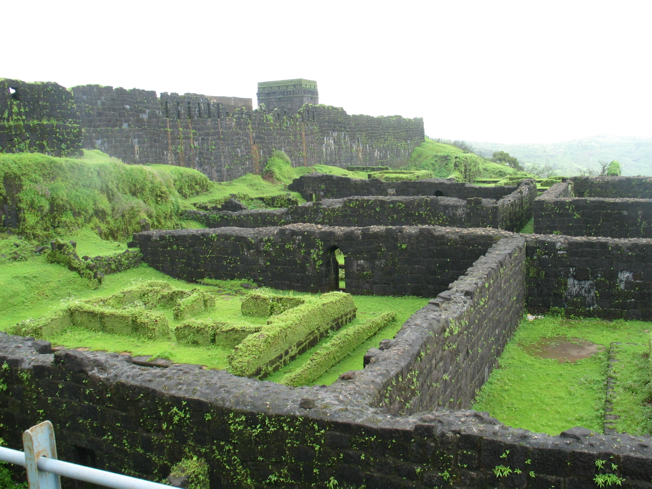
Raigad rises 820 meters above its base in the Sahyadri range of the Western Ghats, accessible only by ascending 1,737 steps carved into near-vertical rock. Shivaji and his chief engineer Hiroji Indulkar transformed what had been known as Rairi fort into a fortified capital after Shivaji was crowned king of the Maratha Kingdom of the Konkan. The main palace was built of wood -- only the base pillars survive today. Six chambers with private restrooms made up the queen's quarters, all windowless for security. Three watchtowers stood in front of the palace grounds, though one was destroyed during a later bombardment. The fort overlooked an artificial lake called Ganga Sagar, and its king's court was acoustically designed so that a voice at the throne could be heard clearly from the main doorway, the Nagarkhana Darwaja.
Doors for Kings, Queens, and the Condemned
The Maha Darwaja -- the Great Door -- was the only main pathway to the fort, flanked by two massive bastions and locked at sunset each evening. But Raigad had several entrances, each with its own purpose and story. The Mena Darwaja on the south side served as the private entrance for royal women. The Palkhi Darwaja on the north was reserved for the king and his convoy. To its right, three deep, dark chambers are believed to have served as granaries. And then there was Takmak Tok -- the execution cliff, from which sentenced prisoners were thrown to their deaths. The area has since been fenced off, but the sheer drop remains as vertiginous as the justice it once dispensed.
The Milkmaid and the Bastion
Among the fort's legends, one stands out for its unlikely hero. A milkmaid named Hirakani from a nearby village had come to sell milk to the fort's residents and was still inside when the gates closed at sunset. Hearing her infant son crying from the village below, she climbed down the sheer cliff face in pitch darkness rather than wait until dawn. When she later repeated the feat for Shivaji himself, he rewarded her bravery -- but he was also a military strategist. Recognizing that the cliff she had descended represented a vulnerability, Shivaji ordered a bastion built over the spot. It still bears her name: Hirakani Buruj. It is a rare fortification named not for the general who ordered it but for the mother whose courage revealed its necessity.
Memorials on the Mountaintop
The ruins of Raigad's main market avenue lead to the Jagdishwar Mandir, where Hiroji Indulkar's name is engraved on the first step -- the engineer honored alongside the king. Nearby stands the samadhi of Indulkar himself, and beside it, the memorial to his dog Waghya, whose devotion became part of the fort's lore. At the base village of Pachad, the samadhi of Rajmata Jijabai, Shivaji's mother, marks another chapter of the story. In 1886, the freedom fighter Bal Gangadhar Tilak founded the Shri Shivaji Raigad Smarak Mandal to preserve the fort's memory. That organization later built the Raigad Ropeway, completed in 1996, which carries visitors from the base to the summit in four minutes -- a journey that once required an hour-long trek up those 1,737 steps.
From the Air
Raigad Fort is located at approximately 18.235N, 73.445E in the Sahyadri range of the Western Ghats, about 25 km northwest of Mahad. From the air, the fort appears as a flat-topped mesa rising dramatically from surrounding valleys, with sheer cliff faces on all sides. The ruins and ropeway infrastructure are visible at altitude. Nearest airports include Pune International (VAPO, approximately 130 km northeast) and Chhatrapati Shivaji Maharaj International, Mumbai (VABB, approximately 170 km north). Best viewed at 3,000-8,000 feet AGL in clear weather. The surrounding terrain is mountainous with limited landing options.