Rakhine State
A sacred bronze Buddha, sixteen feet tall, was sawed into pieces and carried over the Arakan Mountains in 1784. The Mahamuni Image had watched over the Kingdom of Mrauk U for centuries, and its forced removal to the Burmese capital at Amarapura marked the end of Rakhine independence in a way no treaty ever could. Today the image sits in a temple in Mandalay, layered in gold leaf applied by generations of devotees -- but in Rakhine State, the wound of that seizure has never fully closed. This narrow strip of coast along the Bay of Bengal, separated from the Burmese heartland by the north-south wall of the Arakan Mountains, has spent most of its history as a place apart: independent, defiant, and perpetually caught between larger powers.
A Kingdom Behind the Mountains
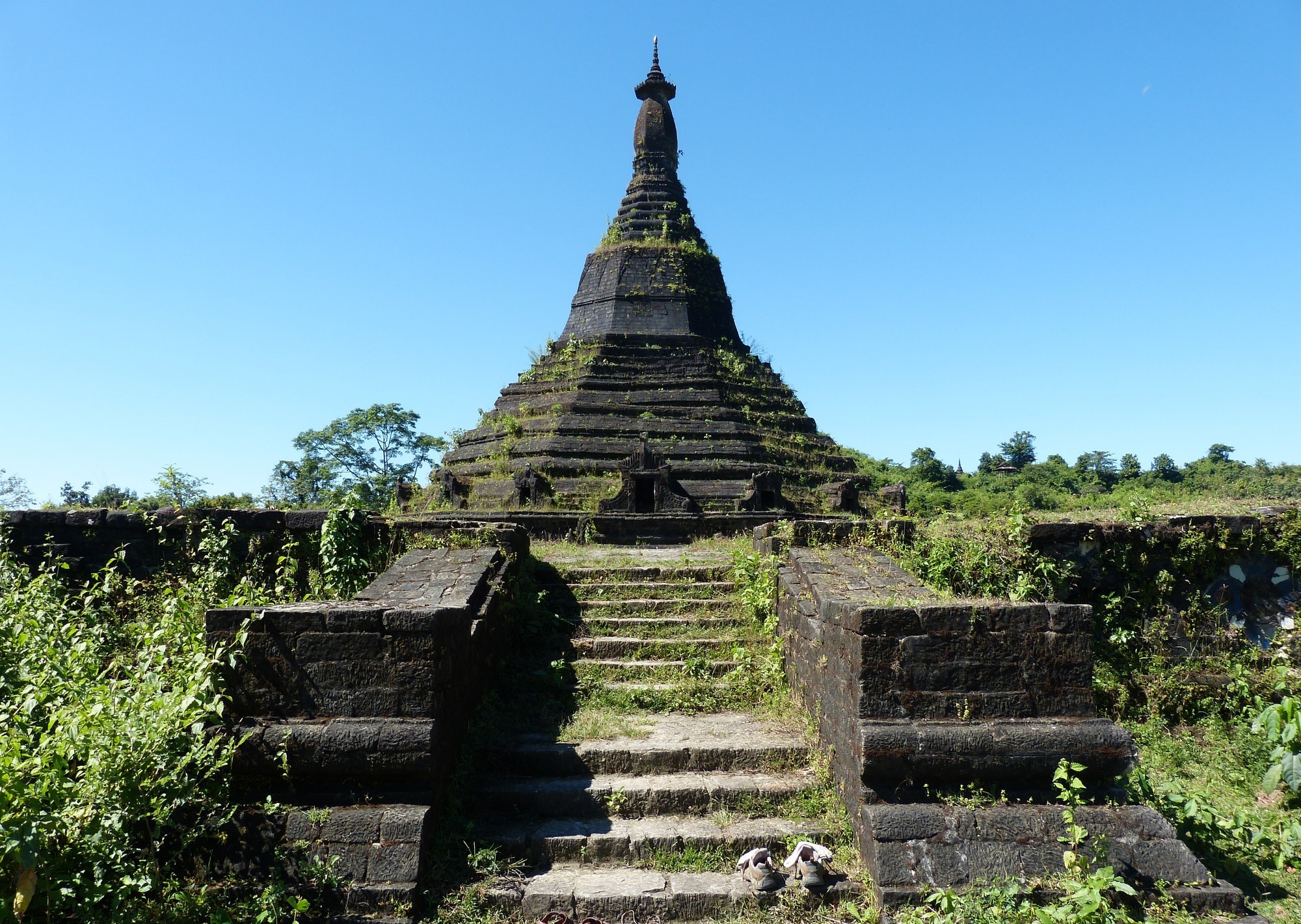
Rakhine's geography is its defining fact. The Arakan Yoma -- a mountain chain running the full length of the state -- creates a natural barrier between the western coast and the interior plains of Myanmar. For centuries, this isolation allowed an independent civilization to flourish. Beginning in the 400s, Tibeto-Burman peoples migrated westward over the mountains and settled the coastal lowlands along the Kaladan River. By the 1100s, they had consolidated into kingdoms whose capitals shifted through Dhanyawadi, Waithali, and the Laymro period before reaching their peak at Mrauk U. The Kingdom of Mrauk U, founded in 1430, became a significant maritime power, minting its own silver coins inscribed in Brahmi script and trading across the Bay of Bengal. Portuguese mercenaries served in its armies. Its kings ruled for over 350 years until the Konbaung dynasty's invasion ended Rakhine sovereignty in January 1785.
Conquest and the Colonial Pivot
When King Bodawpaya's forces overran Mrauk U, they did not simply conquer territory -- they dismantled a civilization. The last king, Maha Thammada Raza, was captured along with his queen, ministers, monks, and artisans and deported to Amarapura. Gold and silver regalia, bronze statues, weapons, and sacred manuscripts were hauled away as trophies. Rakhine rebels fled across the border into British-controlled Bengal, and when Burmese troops pursued them, the resulting tensions drew Britain into direct conflict with Burma. The First Anglo-Burmese War erupted in 1824, and by the Treaty of Yandabo in 1826, Burma ceded Rakhine to the British East India Company. In a pointed reversal, British soldiers took the great bell from the Mahamuni shrine as their own war prize. It still sits in a temple in Nadrai, India -- a relic of a relic, thousands of miles from either its original home or its forced one. Under British rule, Akyab (now Sittwe) became the administrative capital, and Rakhine was folded into the colonial province of Burma.
War, Independence, and Unrest
During British rule, Rakhine became a center of resistance. Monks like U Ottama and U Seinda led insurgencies against colonial authority. When Japan occupied Burma during World War II, Rakhine saw fierce fighting -- the Arakan Campaign of 1942-43 and the Battle of Ramree Island became some of the Pacific theater's most brutal engagements. The Japanese granted Rakhine its own Arakan Defense Force, which eventually switched allegiance and turned against its patrons in early 1945. After Burmese independence in 1948, Rakhine became a division within the new union, but the old desire for self-governance never disappeared. From the 1950s onward, movements for secession and restored Arakan independence gathered strength, a pattern of autonomy-seeking that would intensify dramatically in the decades to come.
Fractures and Crisis
The 21st century brought Rakhine State's tensions into global view. In June 2012, severe communal violence between ethnic Rakhine Buddhists and Rohingya Muslims killed at least 88 people, burned 4,600 homes, and displaced approximately 100,000. The political exclusion of Rakhine parties deepened resentment: after the Arakan National Party won a majority of state-level votes in 2015, the national government refused to share executive power. In January 2018, police opened fire on thousands of protesters in Mrauk U who had gathered to commemorate the 233rd anniversary of the fall of the Mrauk U Kingdom, killing seven. Elections in 2020 were cancelled in nine Rakhine townships, effectively silencing the region's political voice.
The Arakan Army's Rise
Following Myanmar's military coup in February 2021, the Arakan Army -- the armed wing of the ethnic Rakhine movement -- emerged as one of the most effective resistance forces in the country. By late 2021, the AA and its political wing, the United League of Arakan, controlled roughly 75 percent of Rakhine's townships. In October 2023, Operation 1027, launched by a coalition including the AA, captured over 130 military outposts across northern Shan State. By late 2024, the military junta held only Sittwe, Kyaukpyu, and Munaung townships; the Arakan Army controlled or contested the rest. The AA has begun establishing local governments in the territory it holds. Whether this becomes autonomy, statehood, or full independence remains an open question -- but for a region that lost its sovereignty when the Mahamuni Image was carried away in pieces nearly 250 years ago, the trajectory speaks for itself.
From the Air
Rakhine State stretches along Myanmar's western coast at approximately 19.5N, 94.0E. The Arakan Mountains (Rakhine Yoma) run north-south, creating a dramatic barrier visible from altitude. The capital Sittwe sits at the mouth of the Kaladan River on the Bay of Bengal. Nearest major airports include Sittwe Airport (VYSW). Offshore islands such as Ramree and Cheduba are visible from cruising altitude. Best viewed descending along the coastline where the mountains meet the sea.