Ramona, San Diego County, California
Before it was Ramona, it was Nuevo. Before it was Nuevo, it was Santa Maria Valley — the name given to the broad inland basin between the mountains east of Poway and the desert edge. The Spanish land grant that covered this terrain, Rancho Valle de Pamo, passed through a sequence of owners after Mexican rule ended: an Ortega, a Stokes, an Etcheverry, and finally a man named Milton Santee who bought 3,855 acres in 1886 and subdivided it into the town that needed a name. The post office rejected Nuevo as already taken. Somewhere in the selection process, someone reached for a novel: Helen Hunt Jackson's 1884 romantic story of California's rancho era, whose heroine was called Ramona. The name stuck. The book's portrait of Spanish California had little to do with the actual place, but the word sounded like the valley — open, warm, just slightly out of time.
The Rancho Underneath
The land beneath present-day Ramona was granted in 1843 by Governor Manuel Micheltorena to José Joaquín Ortega and Edward Stokes — an unusual pairing of a prominent Californio and an English sailor from Hawaii who had converted to Catholicism and married into the territory. The grant, Rancho Valle de Pamo, covered 17,709 acres. Ortega was a brother-in-law of Pío Pico, the last Mexican governor of California. Stokes did not outlast the American conquest: he died in the aftermath of the Battle of San Pasqual in 1846. The rancho was patented to the heirs in 1872 under American land law. By then the Luiseño and Kumeyaay people who had inhabited the valley long before the grant had been displaced from the land that bore their histories.
The Valley Settles
Milton Santee's subdivision in 1886 created the street grid around which Ramona grew. The Southern California land boom of the 1880s brought settlers looking for acreage and mild climate; the Santa Maria Valley offered both. Agriculture arrived in the usual sequence: orchards first, then cattle, then diversified farming. The valley's inland position — protected from coastal fog by a ridge to the west, warmer in winter than the coast, drier in summer — turned out to suit wine grapes in ways that took a century to fully appreciate. In the decades after the late twentieth century, Ramona's wine industry expanded steadily, with vineyards stretching across the hillsides above town. The Ramona Valley AVA now designates the area as a recognized wine-producing region. The valley that once grew hay now grows Zinfandel, Syrah, and Cabernet Sauvignon.
What the Town Became
Ramona is a census-designated place — not incorporated, governed by the county rather than its own city council. Its population reached 21,468 in 2020. The businesses along Main Street follow the pattern of any backcountry California town: hardware stores, feed suppliers, family restaurants, and, increasingly, wine tasting rooms catering to visitors from the coast. The Ramona Grasslands, north of town, preserve stretches of open country where the valley's pre-development character remains visible from the air: wide, golden in late summer, traced by seasonal streams. The valley sits roughly forty miles from the Pacific but feels farther. The marine layer rarely makes it this far inland. By mid-morning on most summer days, the sky above Ramona is clear blue and the temperature climbs well past what the coast reaches. This is not a beachside California. It is the other one — drier, quieter, and older.
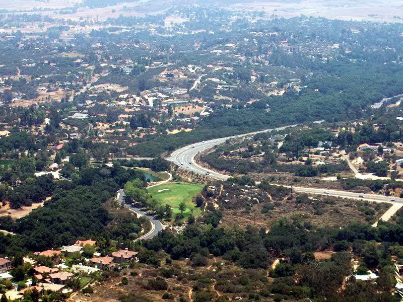
From the Air
Ramona is located at approximately 33.042°N, 116.871°W in the Santa Maria Valley, northeast of San Diego. The town is visible from altitude as a grid of development in a broad inland basin surrounded by chaparral ridges. Recommended viewing altitude 4,000–7,000 ft MSL in clear conditions. Nearby airports: KRNM (Ramona Airport, ~2 nm north — a key landmark), KSEE (Gillespie Field, ~16 nm southwest). The Ramona grasslands are visible to the north, and wine country hillsides to the east.