Ratu Boko
In Javanese, Ratu Boko means "Stork King." Nobody knows who the Stork King actually was. The name comes from folklore, not from any inscription found among the ruins, and the site itself refuses to declare its own purpose. It is not a temple, though it contains shrines. It is not clearly a palace, though fortified walls and a dry moat suggest something worth defending. Perched on a plateau 196 meters above sea level, three kilometers south of the Prambanan temple complex, Ratu Boko commands a panoramic view of the entire Kewu Plain -- Mount Merapi smoking on the northern horizon, the spires of Prambanan and Sewu below. Whatever this place was, whoever built it chose the best seat in the house.
Neither Temple nor Town
Most Classic-period archaeological sites in Central Java and Yogyakarta are remains of Hindu or Buddhist temples. Ratu Boko is the conspicuous exception. Spread across 16 hectares in two hamlets -- Dawung and Sambireja -- in the village of Bokoharjo, the site displays fortified gates, walled enclosures, bathing pools, meditation caves, and what appear to be foundation stones for wooden buildings long since rotted away. Scholars have argued for three different interpretations. Some believe it was the palace of the Mataram kingdom, the same dynasty that built the temples scattered across the plain below. Others read it as a Buddhist monastery, citing inscriptions in pre-Nagari script and Sanskrit that describe the construction of a shrine for Avalokitesvara and reference a monastery modeled after Abhayagiri Vihara in Sri Lanka. A third camp suggests it was a royal retreat -- a place for rest and recreation rather than governance or prayer. The evidence supports all three readings and settles none of them.
Inscriptions That Deepen the Mystery
The stone inscriptions found at Ratu Boko confirm that the site was occupied during the 8th and 9th centuries, but they raise as many questions as they answer. Five inscriptions describe the construction of a Buddhist shrine. Three dated inscriptions in Old Javanese and poetic Sanskrit recount the erection of two lingga -- Hindu symbols of Shiva -- and bear the date 778 Saka, equivalent to 856 CE, the same year King Pikatan inaugurated the Hindu Prambanan temple on the plain below. Another undated inscription mentions a lingga named Hara, erected at the order of King Kalasobhawa. A golden plate found at the site bears the inscription "Om Rudra ya namah swaha," a form of worship to Rudra, another name for Shiva. Hindu statues of Durga, Ganesha, and Garuda share the site with three unfinished Dhyani Buddhas. The place did not choose between faiths; it practiced both.
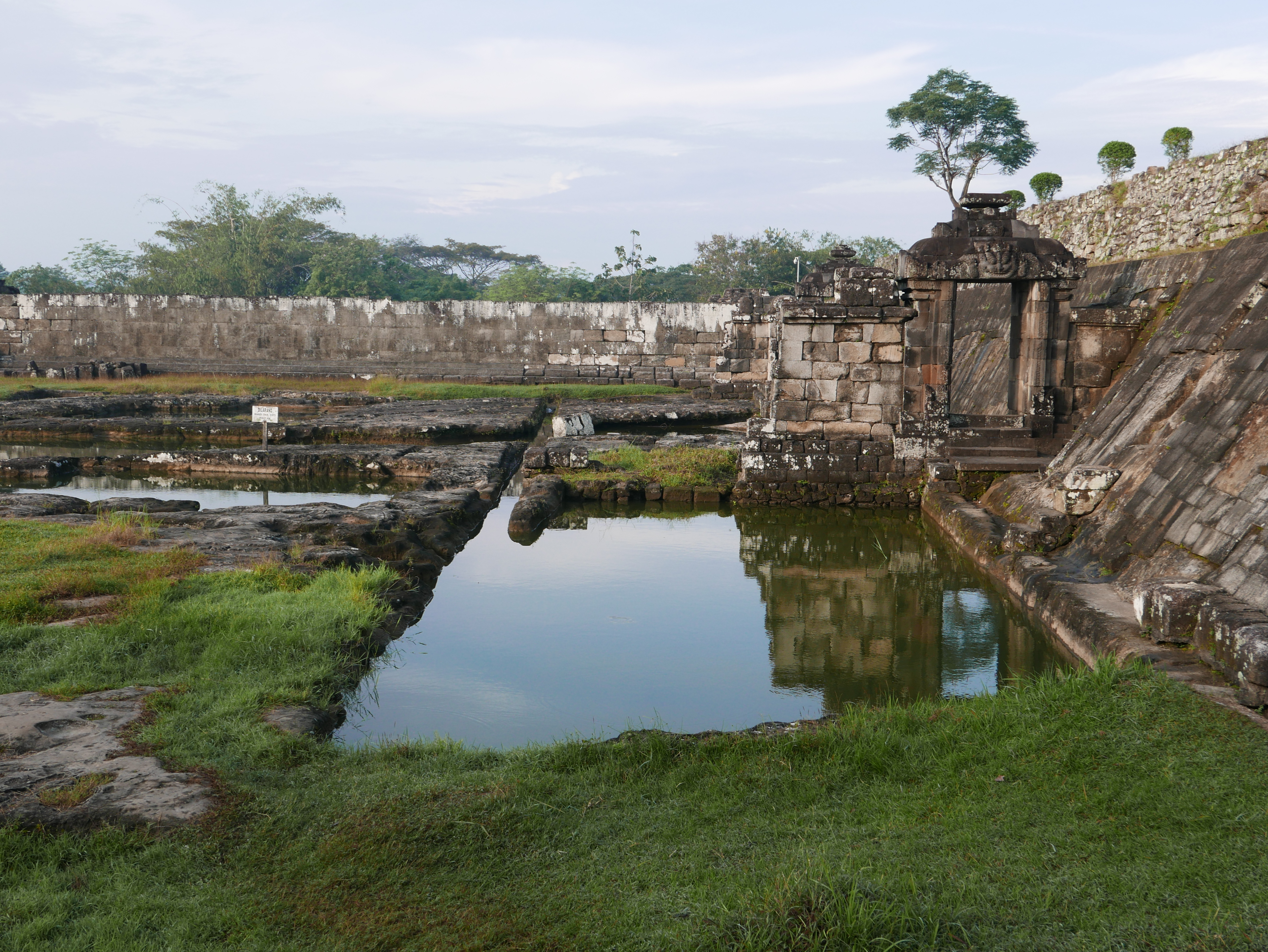
The Waters of Amerta
On the eastern side of the pendopo, a lower terrace holds several andesite-walled enclosures connected by paduraksa gates and a gallery. Local tradition calls this area the kaputren -- the women's quarter -- and identifies its pools as pleasure gardens for a king and his court. One pool in particular, called Amerta Mantana, remains sacred to Hindu worshippers today. They believe its waters bring luck, and they use them during the Tawur Agung ceremony, held one day before Nyepi, the Balinese Day of Silence, as part of a ritual of purification meant to return the earth to its original harmony. From the stone terraces east of the pool, visitors look across a valley to Candi Barong, a Hindu temple complex on the opposite hillside, its stepped courtyard climbing the slope in the middle distance.
Caves for the Devoted
Isolated from the rest of the complex, at its northern edge, two caves carved from sedimentary rock served what was almost certainly a contemplative purpose. The upper cave is called Gua Lanang -- Male Cave -- and the lower is Gua Wadon -- Female Cave. In front of Gua Lanang sits a pond and three stone effigies identified as representations of Aksobhya, one of the five Dhyani Buddhas. The caves probably functioned as meditation chambers, which bolsters the monastery interpretation of the site. But a palace might also have included space for spiritual practice, and a royal retreat would have needed quiet places above all else. The caves, like everything at Ratu Boko, fit multiple stories at once.
The Princess Turned to Stone
If archaeology refuses to name the site's builder, folklore does not hesitate. The legend of Loro Jonggrang connects Ratu Boko, the Prambanan temple, and the Sewu complex in a single narrative. King Boko's daughter, Princess Loro Jonggrang, rejected the marriage proposal of Prince Bandung Bondowoso, who had killed her father and seized his kingdom. Forced to accept, she imposed a condition she thought impossible: Bandung must build a thousand temples in one night. The prince summoned spirits from the earth, and by near-dawn they had raised 999 structures. Loro Jonggrang ordered her maids to pound rice and light fires to simulate sunrise. The roosters crowed, the spirits believed morning had come, and they vanished underground. Enraged at the deception, Bandung cursed the princess, turning her to stone. She became, according to tradition, the statue of Durga that still stands in the northern chamber of the Shiva temple at Prambanan -- known to this day as Loro Jonggrang, the Slender Maiden.
From the Air
Located at 7.77S, 110.49E on a hilltop plateau about 3 km south of the Prambanan temple complex in the Special Region of Yogyakarta, Indonesia. The site sits 196 m above sea level on a northwestern spur of the Sewu Mountains. From the air, the fortified gates and terraced layout are visible on the hilltop, with the Prambanan Plain and its temple compounds spread below to the north. Mount Merapi (2,930 m) is prominent on the northern horizon. Candi Barong is visible on a hillside across the valley to the east. Nearest airport: WAHH (Adisucipto International Airport), approximately 8 km northwest.