Ray, Iran
Tehran did not build Ray. Ray built Tehran. For millennia, this city on the southern Iranian plateau was the metropolis -- a capital of empires, a crossroads on the Silk Road, a center of science and commerce so important that the Achaemenid emperor Darius carved its name into the cliff face at Behistun. The Medes governed from here. Alexander the Great's general Seleucus renamed it Europos. The Parthians called it Arsacia and minted coins in its workshops. Then came the Mongols in the thirteenth century, and Ray was shattered. The small town to its north, Tehran, eventually absorbed what remained. Today Ray exists as the twentieth district of Greater Tehran, its eight-thousand-year archaeological record paved over by apartment blocks and metro stations. Its nickname -- Mother of Tehran -- carries the particular melancholy of a parent outlived by a child who has forgotten the debt.
Before the Word Was Written
At Cheshme-Ali, a hill in northern Ray, archaeologists from the University of Pennsylvania and the Boston Museum of Fine Arts unearthed artifacts dating to approximately 6,000 BC during excavations between 1933 and 1936, led by Erich Schmidt. The settlement belonged to the Central Plateau Culture, one of the earliest agricultural communities on the Iranian highlands. Seven-thousand-year-old pottery and tools from the site are now displayed in museums in Iran, Chicago, and Philadelphia. The hill itself has not fared as well. Real estate development in the 1980s and 1990s leveled most of it. A Qajar-era rock relief from 1831, depicting Fath-Ali Shah in a hunting scene carved directly over a Sasanian relief of an earlier Persian emperor, still survives at the site -- a physical palimpsest of Iranian history, each dynasty overwriting the one before.
Capital of Empires
Ray's political history reads like a catalog of Iranian civilization. Under the Sasanian Empire, the city sat near the imperial center, home to the powerful House of Mehran and the House of Spandiyad, two of the Seven Great Houses of Iran. When the Arab Muslim armies arrived in 643, the last Sasanian king of Ray, Siyavash, son of Mehran, fell in battle. The conquerors used the city as a military camp, then rebuilt it as Mohammadiya under the Abbasid Caliphate. The Buyid dynasty made Ray a capital in the tenth century, equipping it with rapid postal service for official correspondence. That era ended violently in 1029, when Mahmud of Ghazni sacked the city. A zealous Sunni, Mahmud had large numbers of the local Ismaili and Mazdakite population crucified and burned the books of Ray's great library. The Seljuk Turks later restored Ray as an imperial capital in the eleventh century, when the city reached its greatest extent and its bazaar thrived on Silk Road commerce.
The Physician's City
Ray's most famous son may be Muhammad ibn Zakariya al-Razi -- known in the West as Rhazes -- the ninth-century physician, philosopher, and alchemist who is considered one of the most important figures in the history of medicine. He wrote over two hundred medical texts and was among the first to distinguish between smallpox and measles. The scholars of Ray were so numerous that people from the city were simply called 'Razi,' a surname still common today. Harun al-Rashid, the Abbasid caliph immortalized in the One Thousand and One Nights, was also born here. The Radhanites, medieval merchants who maintained trade routes across Eurasia when few others dared, may take their name from the city as well -- one of several etymologies that link these traders, some of Jewish origin, to Ray's commercial heritage.
Sacred Layers
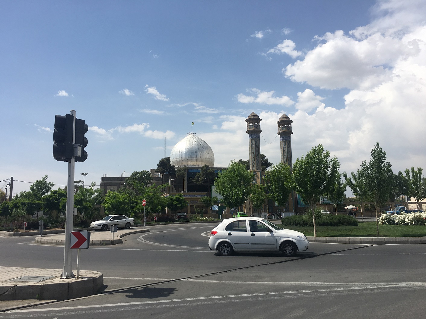
Ray's religious landscape tells a story of transformation. The Bahram Fire Temple, a Zoroastrian sanctuary from the Sasanian era, still stands in ruins. Nearby, the Bibi Shahrbanu Shrine occupies the site of a former temple to Anahita, the ancient Iranian goddess of waters. The shrine was converted to a Muslim holy site and is claimed as the burial place of Shahrbanu, a legendary Sasanian princess said to have married Husayn ibn Ali, grandson of the Prophet Muhammad. Scholars suspect the name shahrbanu -- 'lady of the land' -- was originally an epithet of Anahita herself. A tenth-century Tower of Silence, where Zoroastrians once placed their dead in the open air, was built on a nearby hilltop but soon appropriated by Muslims. The ninth-century Shah Abdol-Azim Shrine, containing the tomb of a fifth-generation descendant of Hasan ibn Ali, remains Ray's principal Islamic sanctuary. Between 1886 and 1888, this shrine's importance prompted Iran's first railway -- a short steam line the locals called 'the smoky machine.'
Ruins and Renewal
By the mid-nineteenth century, Ray was mostly rubble, its only settlement clustered around the Shah Abdol-Azim Shrine. The Mongol devastation of the thirteenth century had never truly been reversed. Tehran grew while Ray waited. The site witnessed another act of erasure: Reza Shah's mausoleum, completed around 1950 near the shrine, was demolished in 1980 after the Revolution on orders from Sadegh Khalkhali, a cleric Khomeini had appointed to lead the Revolutionary Courts. Today, the Tehran Metro connects Ray to the capital that consumed it. The twelfth-century Tughrul Tower -- a circular brick monument from 1140 attributed to Tughrul I, founder of the Seljuk Empire -- still stands, a solitary survivor. Excavations continue in collaboration between Iranian institutions and the University of Bradford. Somewhere beneath the traffic and apartment towers, the oldest city in Tehran province carries on, its past measured not in centuries but in millennia.
From the Air
Located at 35.5975N, 51.4344E within southern Greater Tehran. From the air, Ray blends into Tehran's urban sprawl but is distinguishable by the golden dome of the Shah Abdol-Azim Shrine and the Tughrul Tower. The Behesht-e Zahra cemetery lies to the south. Nearest airports: Mehrabad International Airport (OIII), approximately 20 km northwest, and Imam Khomeini International Airport (OIIE), about 35 km southwest. Best viewed at 3,000-5,000 feet; the Bibi Shahrbanu mountains (1,535 m) rise to the east, providing a geographic reference point.