Red Flag Canal
The people of Linxian had a water problem, and they solved it with hammers. In the arid foothills of the Taihang Mountains, 80 kilometers northwest of Anyang in northern Henan, farmers had endured chronic drought for generations. The Zhang River flowed tantalizingly close, just across the border in Shanxi Province, but the water might as well have been on the moon for all the good it did Linxian's parched fields. So beginning in the early 1960s, tens of thousands of workers carved a canal through cliff faces, bored through 42 tunnels, and diverted the river across the mountains to their waiting farmland. They did it entirely by hand.
Water from Shanxi
The canal begins near the point where three provinces meet: Henan, Shanxi, and Hebei. A dam on the Zhang River, which flows from the Shanxi highlands before becoming the border between Hebei and Henan near Handan, captures water and feeds it into the main channel. From there the canal winds along the flanks of the Taihang Mountains, clinging to cliff faces where workers carved ledges from solid rock. The main channel runs 71 kilometers, but the distribution branches extend the system to a claimed total length of 1,500 kilometers, reaching into the fields of what is now called Linzhou district.
Initiated in the Great Leap Forward
The Red Flag Canal was conceived during the Great Leap Forward, Mao Zedong's disastrous campaign to rapidly industrialize China through mass mobilization. While many Great Leap projects ended in failure and famine, the canal was one of the rare successes, though it was not completed until 1965, years after the campaign itself had been abandoned. The construction relied on the same mass labor that characterized the era, but here the goal was achievable and the engineering sound. Workers without access to power tools or heavy machinery chipped away at the mountainside day after day, creating a channel wide enough to carry irrigation water across terrain that would challenge modern construction equipment.
Propaganda and Film
The Red Flag Canal became one of the most celebrated achievements in Chinese state media. It was featured in propaganda campaigns both domestically and internationally as proof of what workers could accomplish through collective effort and local initiative. Several films were made about its construction, and it appeared regularly in official narratives as a symbol of self-reliance. In 1972, Italian filmmaker Michelangelo Antonioni visited Linxian while filming his documentary Chung Kuo, Cina, a portrait of China during the Cultural Revolution. The film's unflinching eye displeased Chinese authorities, who later condemned it, but the canal sequences captured the scale of the engineering and the landscape it traversed.
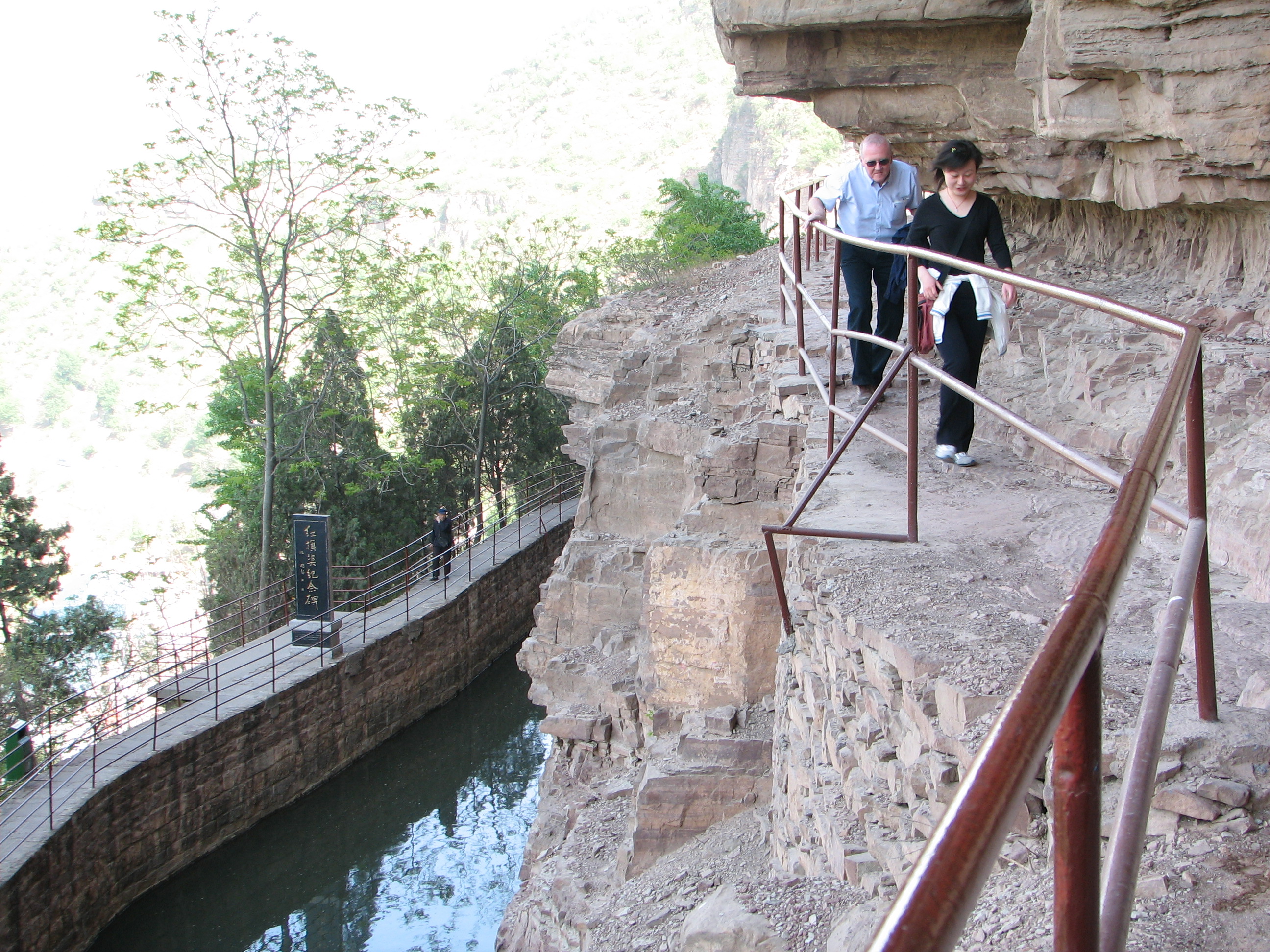
The Tiger's Mouth Cliff
The most dramatic section of the canal is at Tiger's Mouth Cliff, where the channel is built directly onto the face of a sheer rock wall. Photographs of this section, with water flowing calmly through a narrow channel carved into a vertical cliff hundreds of meters above the valley floor, have become iconic images of the project. The canal here seems to defy gravity, a ribbon of water threaded through impossible terrain by workers who had no safety equipment, no engineering degrees, and no option of failure. The fields it irrigates still depend on it, decades later, a testament to labor that was both ideologically motivated and practically necessary.
From the Air
The Red Flag Canal is located at approximately 36.35°N, 113.76°E, winding along the Taihang Mountains northwest of Anyang in northern Henan Province. From altitude, the canal is visible as a thin line tracing the contours of the cliff faces along the mountain range. The Tiger's Mouth Cliff section is particularly distinctive. Nearest major airport is Zhengzhou Xinzheng International (ZHCC/CGO), about 180 km south. Anyang Airport is closer but has limited service. Recommended viewing altitude: 3,000-5,000 feet AGL to trace the canal's path along the cliff faces.