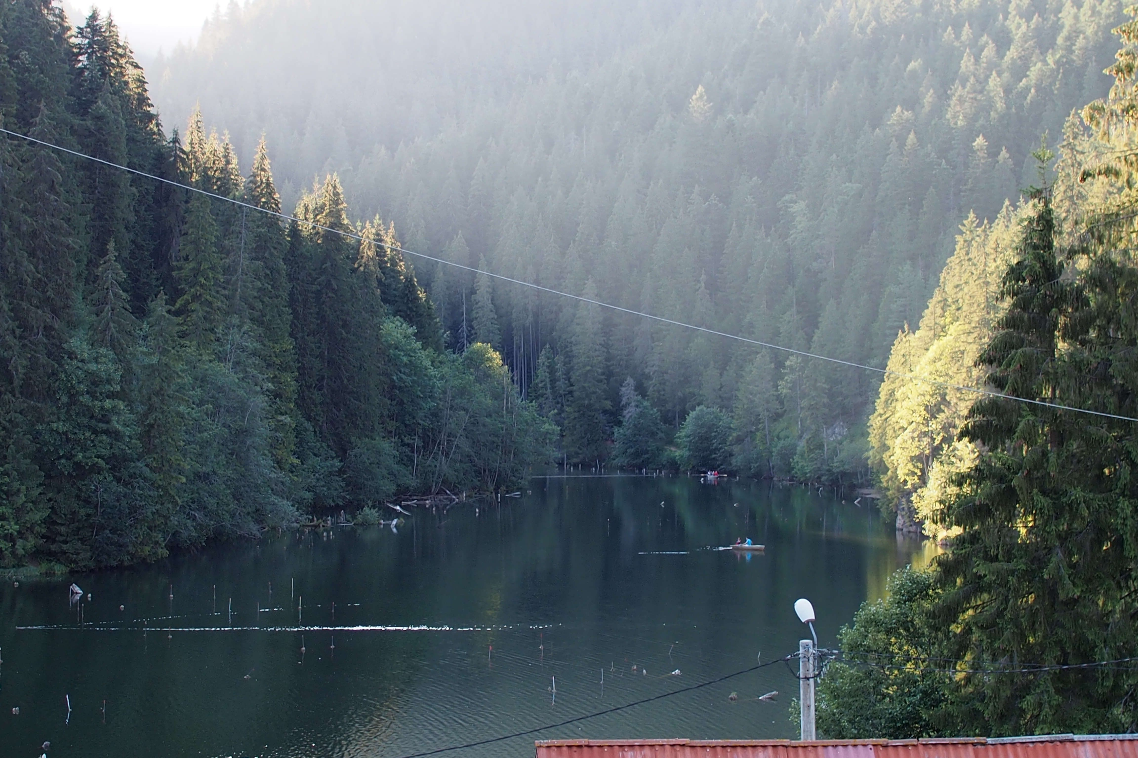
Red Lake (Romania)
On January 23, 1838, at 6:45 in the evening, the earth shook with a force later estimated at 6.9 on the Richter scale. In the Hasmas Mountains of Romania's Eastern Carpathians, the northwestern slope of Mount Ghilcos gave way. Clay deposits left behind by the last ice age slid into the narrow valley of the Bicaz River, sealing it shut. Water rose behind the new dam, flooding the fir forest that filled the valley floor. The trees drowned but did not fall. They petrified, and their trunks still stand in the lake today, pale and skeletal beneath the surface, giving the place an atmosphere that is equal parts beautiful and haunted.
Born from Catastrophe
The exact circumstances of the lake's birth remain a matter of scholarly debate. Franz Herbich, a 19th-century naturalist, dated the formation to 1838, tying it to the January earthquake, which struck again in February. But Ditroi Puskas Ferenc, writing in his History of Borsec, suggested the lake may have formed a year earlier, in 1837, triggered by violent storms and heavy rains rather than seismic activity. What is certain is that the landslide moved an enormous mass of clay, glacial deposits from the Pleistocene that had sat on Mount Ghilcos's slope for thousands of years, waiting for the right trigger. The debris created a natural dam roughly 60 meters high, impounding approximately 587,503 cubic meters of water. In its first years, the lake expanded upstream, reaching about a kilometer into the valley, before the natural dam eroded enough to stabilize the water level at its current height.
The Drowned Forest
What makes Red Lake unlike any other mountain lake in Romania is its ghost forest. When the valley flooded, the fir trees did not rot. The mineral-rich water and cold temperatures preserved them, and over time the submerged trunks petrified, turning to stone while remaining upright. From a boat on the lake's surface, you can look down through the water and see them standing in rows beneath you, pale columns in a submerged cathedral. The lake's name, Lacul Rosu, comes not from the trees but from the iron-rich sediments washed down from the surrounding peaks, particularly from Muntele Ucigaas, the Killer Mount, whose reddish rock tints the water and the shoreline. The combination of red-tinted water and ghostly tree stumps creates a landscape that looks designed for a Romanian fairy tale, though it was made by nothing more than gravity and water.
A Ring of Mountains
The lake sits in a natural amphitheater of peaks. Suhardul Mic and Suhardul Mare guard the north. The Podu Calului Mountains rise to the southwest. Licaas and Chishovos stand to the northwest, Fagetul Ciucului to the northeast, and the ominously named Killer Mount to the east. Four major streams and twelve temporary watercourses feed the lake, including the Vereschiu, Licaas, Suhardul, and Paraul Oii. The Bicaz River flows out of the lake's eastern end and continues northeast toward the Bicaz Gorge, one of the most dramatic limestone canyons in Europe, just a few kilometers downstream. The surrounding valley is sheltered from wind, creating a microclimate with temperatures above the average for the region's mountain depressions. Clean air rich in natural aerosols and the scenic setting have drawn visitors since the early 1900s, when spa tourism first brought development to the area.
Where Water Meets Stone
Red Lake is young by geological standards, less than two centuries old, and it is still evolving. The natural dam continues to erode slowly, though the water level has long since stabilized. Sediment from the feeding streams gradually fills the basin, a process that will, over centuries, reduce the lake's depth and eventually transform it into marshland. For now, the lake covers 11.5 hectares with a perimeter of roughly 2,830 meters. Its position at the gateway to the Bicaz Gorge makes it a natural stopping point for travelers on the DN12C, the road that connects Transylvania to Moldavia through one of the most spectacular mountain passes in the Carpathians. But the lake is more than a roadside attraction. It is a reminder of how quickly the landscape can be remade. One evening in January, the mountains moved. The river stopped. A forest drowned and turned to stone. The result is one of the strangest and most beautiful lakes in southeastern Europe.
From the Air
Red Lake (Lacul Rosu) is located at 46.789N, 25.787E in the Hasmas Mountains. From the air, the lake is visible as an elongated body of water at the western entrance to the Bicaz Gorge, with the distinctive stumps of petrified trees visible in shallow areas. Best viewed at 2,000-4,000 feet AGL. The Bicaz Gorge (Cheile Bicazului) extends northeast from the lake as a dramatic limestone canyon. Nearest airports are Targu Mures (LRTM, approximately 115 km west) and Bacau (LRBC, approximately 105 km east). Gheorgheni lies to the southwest, Bicaz to the northeast.