Red River of the North
Most rivers carve valleys. The Red River of the North never bothered. Its gradient is roughly one foot per mile -- so slight that the river lacks the energy to cut a gorge or even maintain a decisive channel. Instead, it meanders across the silty bed of glacial Lake Agassiz, an enormous body of water that formed at the end of the Wisconsin glaciation some 11,500 years ago and then drained away, leaving behind the flattest terrain in North America and some of its richest soil. The Red begins where the Bois de Sioux and Otter Tail rivers meet on the border of Wahpeton, North Dakota, and Breckenridge, Minnesota. Then it does something unusual: it flows north, tracing the Minnesota-North Dakota border, crossing into Manitoba, and emptying into Lake Winnipeg, whose waters eventually reach Hudson Bay through the Nelson River. That northward flow is the source of the river's beauty and its recurring catastrophe.
A Valley That Isn't
The Red River Valley is one of the great misnomers in North American geography. The Red River did not create it. The 'valley' is actually the bed of Lake Agassiz, an ice-age lake so vast it once covered much of Manitoba, northwestern Ontario, northern Minnesota, and eastern North Dakota. When the Laurentide Ice Sheet retreated, its meltwaters pooled in this depression for thousands of years, depositing layer upon layer of fine sediment. Those lacustrine soils became the parent material for some of the most productive farmland on Earth. The resulting landscape is so flat that from the air it resembles a table, the geometry of agricultural fields stretching to every horizon in perfect regularity. The river itself is a modest thread winding through this enormity, easy to miss at altitude until spring arrives and the thread becomes a lake again.
Fur Traders and Oxcart Trails
The Red River's watershed once belonged to Rupert's Land, the vast concession claimed by the Hudson's Bay Company across north-central North America. French fur traders and the Metis people established communities along the river long before the British defeated France in the Seven Years' War and took control of French possessions in Canada. The river became a commercial highway, its waters carrying furs downstream and trade goods upstream. The Red River Trails -- nineteenth-century oxcart routes developed originally by the Metis -- connected settlements on both sides of what would eventually become an international border. Settlers of the Red River Colony farmed the rich floodplain, and their primary settlement grew into Winnipeg, Manitoba's capital, situated at the river's confluence with the Assiniboine River at a place called The Forks. Today the Red is designated a Canadian Heritage River, recognized for the trade and settlement it made possible.
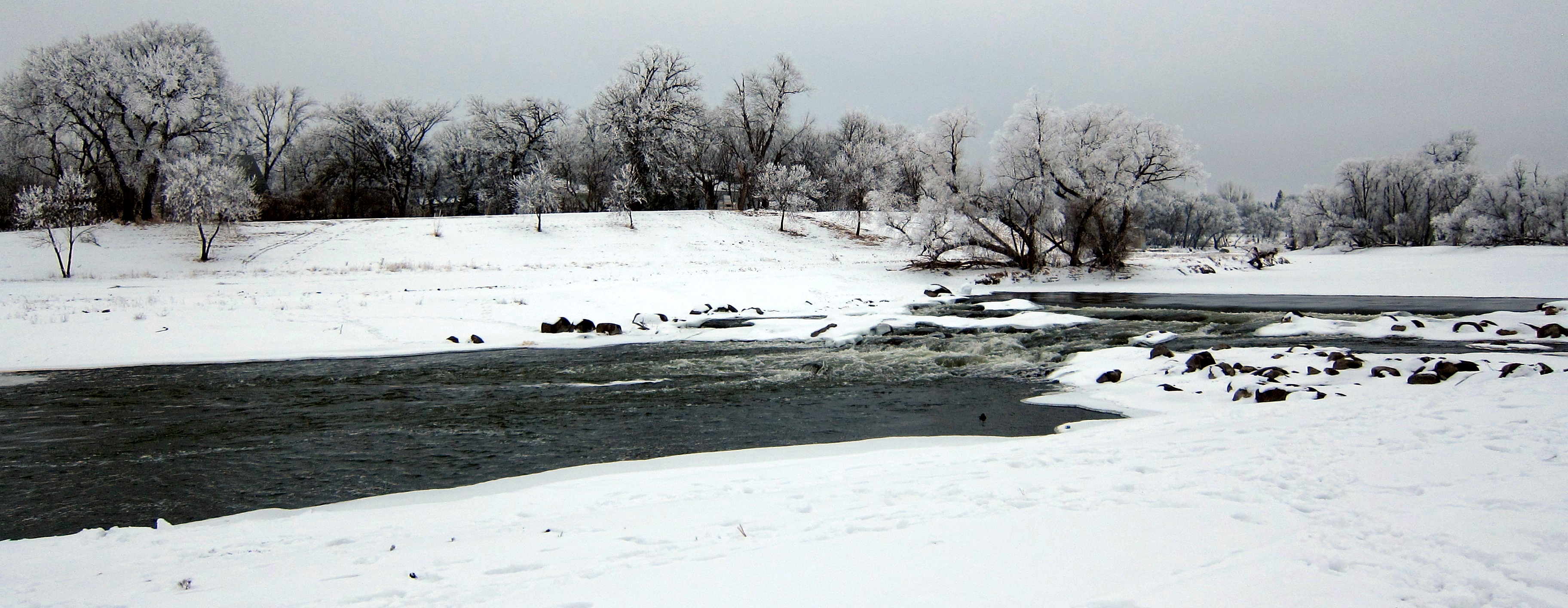
When the Ancient Lake Returns
The northward flow that makes the Red River geographically distinctive also makes it dangerous. Snowmelt begins in the warmer south and pushes water northward into regions still locked in ice. The floodwaters have nowhere to go on that impossibly flat lakebed, so they spread -- recreating, in miniature, the ancient lake. Major historic floods struck in 1826, 1897, 1950, 1997, 2009, and 2011. The 1950 flood breached eight dikes protecting Winnipeg, flooded vast stretches of farmland, destroyed four of eleven city bridges, and forced the evacuation of nearly 70,000 people. Damage reached between $900 million and $1 billion. The catastrophe prompted construction of the Red River Floodway, completed in 1968, which diverts floodwaters around Winnipeg through a massive channel. Critics initially derided it as overbuilt -- it was then the second-largest earth-moving project in the world, after the Panama Canal -- but it has been used for flood control at least 20 times and has saved an estimated CA$10 billion in damages.
The Flood of the Century
In the spring of 1997, the Red River delivered what became known as the Flood of the Century. Total damages reached $3.5 billion. Grand Forks, North Dakota, and East Grand Forks, Minnesota, bore the worst of it: 75 percent of Grand Forks was evacuated, and all of East Grand Forks. Entire residential neighborhoods along the river were inundated, and many homes had to be demolished. The aftermath reshaped both cities. Working with FEMA and the state of Minnesota, officials cleared the floodplains and prohibited future construction, creating the Greater Grand Forks Greenway -- a corridor of parks, bike trails, and green space designed to absorb future floods. Dike systems were built on both sides. In East Grand Forks, engineers installed a removable flood wall downtown so residents would not lose their connection to the river that had just devastated them. In Winnipeg, the Floodway was pushed to capacity but held, sparing the city from Grand Forks's fate.
Twin Cities on a Border River
The Red River's role as a state and international boundary has created a distinctive geography of paired cities: Wahpeton and Breckenridge at the headwaters, Fargo and Moorhead in the middle reach, Grand Forks and East Grand Forks farther north. Each pair shares a river, a floodplain, and an economy, while belonging to different states with different laws and tax structures. At the Canadian border near Emerson, Manitoba, the river crosses from the United States into Canada and continues north to Winnipeg, where it meets the Assiniboine at The Forks. From there it flows onward through the vast Netley-Libau Marsh -- a freshwater delta where the Red spreads into Lake Winnipeg. This wetland, divided between Netley Marsh to the west and Libau Marsh to the east, marks the river's final transformation from prairie stream to something wilder and less contained.
From the Air
The Red River of the North originates at approximately 46.264°N, 96.599°W at the confluence of the Bois de Sioux and Otter Tail rivers between Wahpeton, ND and Breckenridge, MN. The river flows north, forming the ND-MN border, passing through Fargo-Moorhead and Grand Forks-East Grand Forks before crossing into Manitoba and reaching Winnipeg. The river is visible from altitude as a meandering dark line through extremely flat agricultural terrain. Key airports along its course include Hector International Airport (KFAR) at Fargo, Grand Forks Air Force Base (KRDR), and Winnipeg James Armstrong Richardson International Airport (CYWG). The Red River Floodway channel is visible southeast of Winnipeg as a large artificial diversion canal. Best viewed at 5,000-10,000 feet where the contrast between the winding river and the geometric farmland is most striking. During spring flooding (March-May), the river can expand dramatically across the flat lakebed, creating temporary inland seas visible from high altitude.