Rehoboth, Namibia
Steam rises from the ground on cold winter mornings in Rehoboth, curling off natural hot-water springs that have drawn people to this spot for centuries. The Damara people, specifically the community known as the Ainiin, called the site Gaobnaus -- Fountain of the Falling Buffalo -- after they discovered the springs following the disruption of the Damara cohesion in the sixteenth century. When the Nama later passed through, they renamed it Anes, meaning "place of smoke," for the vapors that hung above the water. In 1845, a German missionary named Franz Heinrich Kleinschmidt arrived with the Swartbooi clan and gave the place a name from the Hebrew Bible: Rehoboth, meaning "broad, open places." The name stuck. The hot springs still flow. And the layers of naming -- Damara, Nama, biblical -- compress the entire contested history of this Namibian crossroads into a single word.
Arrivals and Expulsions
The Ainiin community had settled at Nawases, 11 kilometers northeast of present-day Rehoboth, by the mid-1700s, deliberately keeping their distance from the springs so as not to frighten away the game that gathered there. The Swartbooi Nama clan arrived in 1845 with Kleinschmidt, who established a Rhenish Mission Station. But the region was already caught in a cycle of displacement. The Oorlam Afrikaners, who had reached Windhoek in 1840, feuded violently with the Swartbooi Nama for a quarter-century. In 1864, the Orlam attacked, and the Nama abandoned Rehoboth, fleeing to the Erongo region. The area sat largely empty -- except for the Ainiin people, who sheltered the remaining Swartbooi Nama through the violence.
The Basters' Constitution
In 1868, a community known as the Basters migrated out of the Cape Colony in southern Africa. Mixed-heritage descendants of Cape settlers and indigenous Khoisan peoples, they had faced increasing marginalization under colonial racial hierarchies. By 1870, they had moved north into the territory and received permission to settle at Rehoboth at the peace conference of Okahandja on 23 September 1870. Two years later, they enacted their Paternal Laws -- a written constitution that established self-governance for the Rehoboth Basters. Their numbers grew rapidly: 333 people in 1870, 800 by 1874, 1,500 by 1885. The surrounding region became known as the Rehoboth Gebiet, and the community became so closely identified with the town that they were simply called Rehobothers.
Treaties and Betrayals
In 1885, Baster Kaptein Hermanus van Wyk signed a Treaty of Protection and Friendship with the German Empire, trading recognition of colonial authority for a degree of autonomy. Relations held for more than twenty years. Then came the First World War. In 1914, Germany conscripted Baster soldiers to guard South African prisoners -- a direct violation of the terms under which the men had enlisted. The Basters revolted. German forces responded by attacking Rehoboth itself, committing atrocities against civilians and assaulting refugees who had fled to the mountain of Sam Khubis. Despite repeated attacks with superior weapons, the Germans could not dislodge the Baster position. They retreated the following day. South Africa occupied the territory in 1915, but colonial control brought no peace. In 1925, a second rebellion broke out at Rehoboth. This time, the response was overwhelming: colonial troops arrived with machine guns, two warplanes overhead, and arrested more than 600 people.
A Town Divided by Roads and History
Today Rehoboth is a town of roughly 40,800 people, situated on a high plateau 90 kilometers south of Windhoek along the B1 national road, just north of the Tropic of Capricorn. The B1 bisects the town from north to south and also serves as the boundary between its two electoral constituencies: Rehoboth Urban West and Rehoboth Urban East. The town is divided into eight neighborhoods called blocks. Blocks A, B, and C are the oldest, with block B holding most of the public services and shops. Block D is the wealthiest. Block E, the poorest, was designated for Black residents under apartheid. The Baster community remains the majority population, and their Paternal Laws of 1872 still hold cultural significance. The Ainiin Traditional Authority, under Chief Hans Eichab -- who carries the traditional regnal title "Great Leopard" -- maintains governance of the indigenous Damara community.
Water in a Dry Land
Rehoboth receives a sparse 240 millimeters of rain in an average year, though the 2010-2011 season delivered a record 731 millimeters. The Oanob Dam, about six kilometers from town, supplies fresh water. To the west lies the Gamsberg Nature Reserve. A railway station connects Rehoboth to the national rail network, and a private landing strip near the dam accommodates small aircraft. The hot springs that gave this place its earliest names still surface through the plateau, a reminder that the ground here has always offered something the surrounding landscape does not. From the Damara who named it for a falling buffalo to the Nama who saw smoke to the Basters who built a constitution, Rehoboth has been shaped by people drawn to a rare resource in an arid land -- and by the conflicts that such resources inevitably attract.
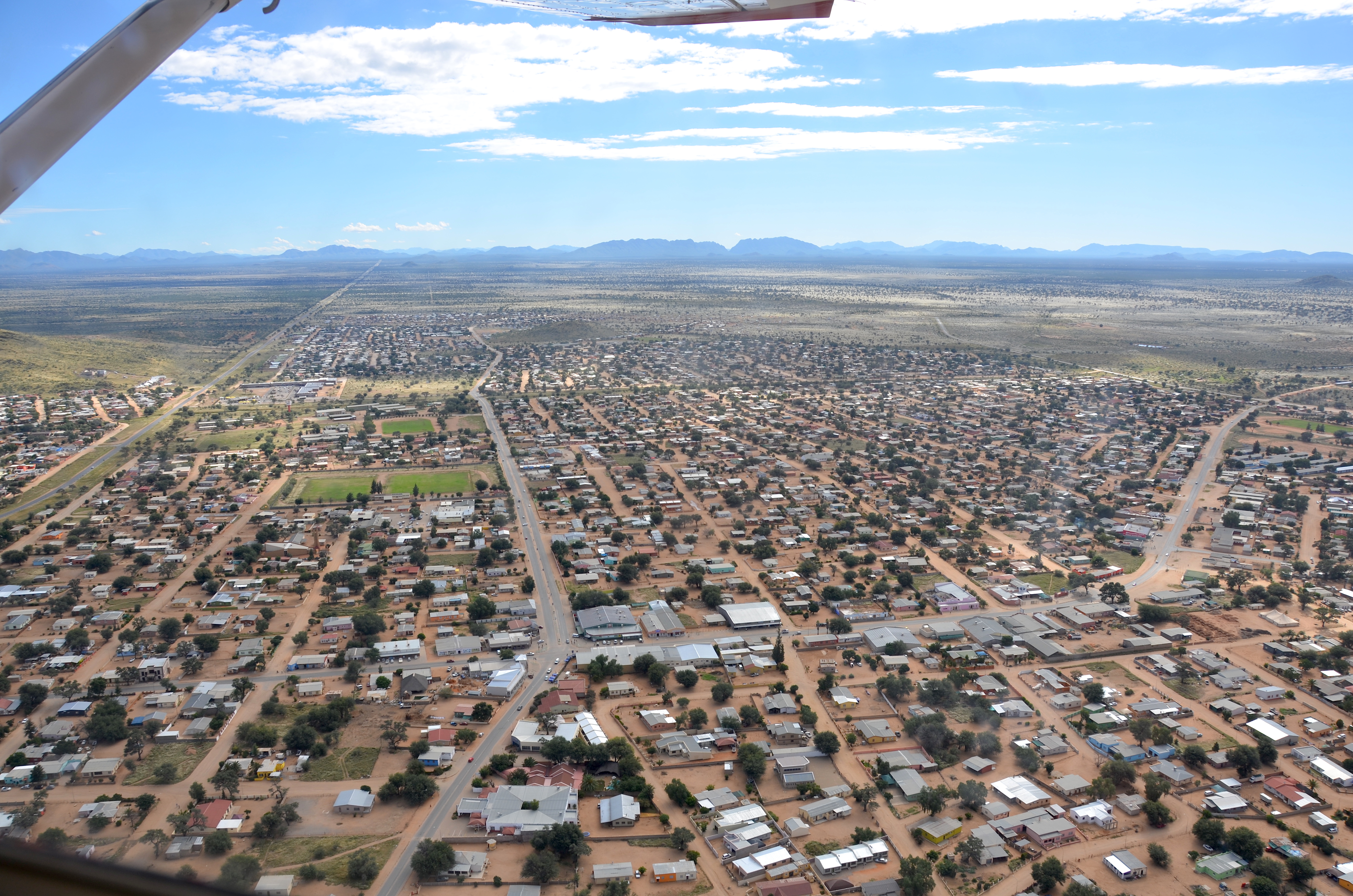
From the Air
Rehoboth is located at 23.32S, 17.08E on a high plateau in the Hardap Region of central Namibia, 90 km south of Windhoek along the B1 highway. The town sits just north of the Tropic of Capricorn. From 4,000-7,000 feet AGL, the town layout bisected by the B1 road is visible, with the Oanob Dam to the southeast. A private landing strip is located near the dam. Hosea Kutako International Airport (FYWH) near Windhoek is the nearest major airport, approximately 100 km north. The terrain is semi-arid plateau with generally good visibility.