Richelieu River
Three names for one river tell three centuries of conflict. The French called it the Riviere Iroquois because of the warriors they encountered paddling its waters. They renamed it the Chambly River after the fort they built to hold them back. It finally became the Richelieu, honoring Cardinal Richelieu, the powerful minister under Louis XIII who helped shape New France from across the Atlantic. This single waterway, flowing northward from Lake Champlain to the St. Lawrence, has carried Iroquois war parties, French soldiers, British Loyalists, and American invaders. Every army that wanted to move between Montreal and New York passed through here, and the forts they built to control it still stand along its banks.
A River That Flows the Wrong Way
The Richelieu is one of only three rivers in Quebec that flow from south to north, the others being the Chateauguay and the Chaudiere. This quirk of geography made it the natural corridor between Lake Champlain and the St. Lawrence River, a passage that every military strategist from Samuel de Champlain to the generals of the American Revolution recognized as critical. The river drains a watershed that supports nearly 340,000 people across 65 municipalities. Over 70 percent of the surrounding land is devoted to agriculture, making it one of Quebec's most densely populated rural corridors at 140 inhabitants per square kilometre. The landscape rests on sedimentary bedrock formed during the Cambrian period, roughly 450 million years ago, later reshaped by the glaciers that once covered the region and the Champlain Sea that flooded these lowlands in their wake. The Monteregian Hills, a chain of volcanic intrusions, punctuate the valley's flat horizon.
The Corridor of Forts
Jacques Cartier discovered the mouth of the Richelieu in 1535. Samuel de Champlain reached it in 1603 and returned in 1608 and 1609, traveling upriver through Lake Champlain as far as modern-day Albany, New York. The encounters with Iroquois nations along this route gave the river its first French name. To defend the corridor, the French built Fort Sainte-Therese in 1665 and deployed the Regiment de Carignan-Salieres along the river's length. Ile aux Noix, an island in the upper Richelieu, became the site of Fort Lennox, now a national historic site. Fort Chambly, Fort Saint-Jean, and the Saint-Ours Canal locks all followed, each installation tightening French and later British control over the waterway. After the British conquest of New France in 1759-1760 and the American War of Independence, the Crown offered land along the Richelieu to military veterans and Loyalists. During the Lower Canada Rebellion of 1837, the battles of Saint-Denis and Saint-Charles erupted along these same banks, turning the river into a stage for Quebec's fight for self-determination.
From War Road to Pleasure Route
By the 19th century, the Richelieu transformed from a military corridor into an economic thoroughfare. The cities of Sorel and Saint-Jean-sur-Richelieu, both incorporated in the 1850s, grew directly from the river traffic. Today the Chambly Canal, with its nine locks, allows pleasure boats to bypass the rapids at Saint-Jean-sur-Richelieu and Chambly. Connected to the Champlain Canal and the Hudson River on the American side, the Richelieu forms part of the Lakes to Locks Passage, a navigable route stretching from the St. Lawrence all the way to New York City and the Erie Canal. Along the canal, the Piste cyclable du Canal-de-Chambly follows the old towpath as a bicycle route, part of Quebec's province-wide Route Verte network. Fort Chambly draws thousands of visitors each September for a beer and food festival. The river that once funneled armies now carries kayakers, cyclists, and birders.
Fifty Species and One That Exists Nowhere Else
The Richelieu is home to more than 50 species of fish, but it is the copper redhorse that makes biologists hold their breath. This species, Moxostoma hubbsi, is endemic to Quebec, found nowhere else on Earth, and the Richelieu holds one of its last spawning grounds. In 2001, the Vianney-Legendre fish ladder was built at the Saint-Ours Canal dam to help threatened species navigate upstream. In 2002, the Pierre-Etienne Fortin wildlife refuge was established specifically to protect a copper redhorse breeding site, closed to the public from late June through late July during spawning season. The river's north-south axis also makes it a critical bird migration corridor. Near Saint-Jean-sur-Richelieu, staging areas host thousands of geese and ducks each autumn, along with peregrine falcons and golden eagles. But the ecosystem is fragile. A 1998 study found over 13 percent of fish in some stretches had abnormalities, and the spring of 2011 brought devastating floods that damaged or destroyed more than 3,000 homes in Quebec and 750 in Vermont.
Layers of Stone and Time
Beneath the agricultural fields and river towns, the Richelieu valley holds a geological record that spans hundreds of millions of years. The Utica shale underlying the region, rich in mica and quartz, has drawn attention for its shale gas potential. The Lorraine Group formations, dark gray and studded with sandstone lenses, cover most of the area. These rocks formed when the region lay submerged beneath ancient seas at the end of the Ordovician era. Tectonic forces lifted the land, glaciers scoured it, and the post-glacial Champlain Sea deposited thick layers of clay, some reaching considerable depth. Nearly half the banks of the Richelieu remain in a natural state, and the surrounding forests belong to the maple-hickory bioclimatic domain, sheltering sugar maples, silver maples, bur oaks, American elms, and black ash. Water chestnut, an invasive species first detected at the river's mouth in the late 1990s, now demands annual harvesting campaigns to prevent it from smothering the native flora. The Richelieu carries the weight of deep time and recent urgency in equal measure.
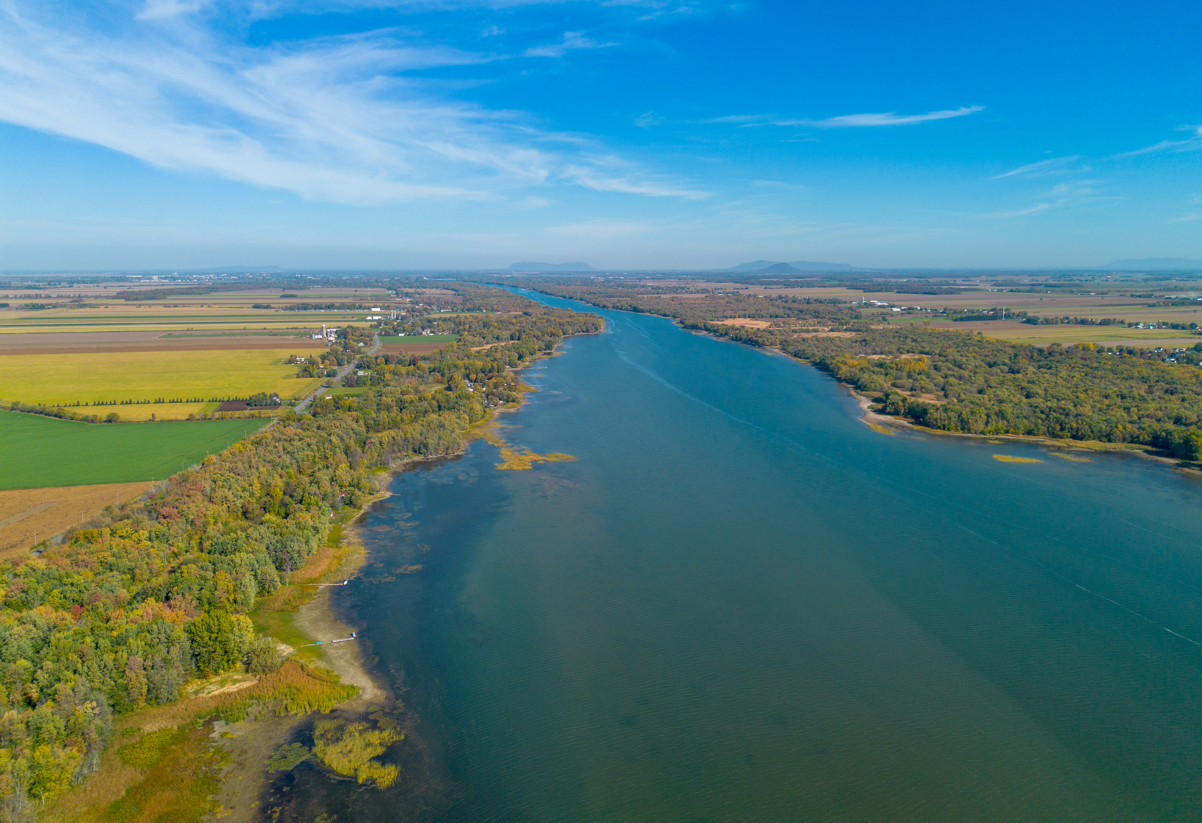
From the Air
The Richelieu River flows northward from Lake Champlain to the St. Lawrence, visible as a prominent water feature at 46.05°N, 73.12°W. From cruising altitude, the river traces a clear line through the flat agricultural plain of the Monteregie region, with the Monteregian Hills rising to the west. Key landmarks include the Chambly Basin where the river widens, Ile aux Noix with Fort Lennox, and the confluence with the St. Lawrence at Sorel-Tracy. Nearest airports include Saint-Jean-sur-Richelieu (CYJN) and Montreal/Saint-Hubert (CYHU). Best viewed at 3,000-6,000 feet AGL to trace the full corridor from Lake Champlain to the St. Lawrence.