Richmond-San Rafael Bridge
Frank Lloyd Wright was not impressed. When he saw the Richmond-San Rafael Bridge rising from San Pablo Bay in 1953, the legendary architect declared it 'the most awful thing I've ever seen' and reportedly called for its destruction. The engineers who designed it - the same team that had built the celebrated Bay Bridge - knew exactly what they were doing. They had chosen function over form, creating a span that dips and rises like a steel roller coaster across 5.5 miles of open water, connecting Marin County to the East Bay in the most practical way possible.
Three Decades of Dreams
The story of the Richmond-San Rafael Bridge begins with competing visions in the 1920s. In 1927, two rival proposals emerged almost simultaneously: Roy O. Long wanted a suspension bridge between Point Orient and McNear's Point, while Charles Van Damme of the Richmond-San Rafael Ferry Company favored a route from Castro Point to Point San Quentin. The ferry operator had an obvious stake in the outcome - his franchise rights ran until the 1950s, and any bridge would cost him his business. The rivals eventually merged their plans in 1928, but the Depression and World War II stalled all progress. Meanwhile, a more ambitious dreamer named T.A. Tomasini spent two decades pursuing an elaborate scheme involving bridges and tunnels connecting San Francisco, Marin, and Alameda counties. He lost his rights in 1941 after being opposed by Earl Warren, yet he was still scrambling to revive his plans as late as 1948.
The Roller Coaster Takes Shape
Construction finally began in 1953, and when the bridge opened on September 1, 1956, it was the world's second-longest bridge behind only the Bay Bridge. Its distinctive profile - the 'roller coaster span' or 'bent coat hanger' as locals call it - came from a cost-saving decision. The engineers designed both cantilever spans identically, which meant the uphill approach to one elevated section was duplicated on the downhill side, creating a dip in the middle. Since the two navigation channels are not parallel, the bridge also curves rather than following a straight line. The result is a structure that undulates across the bay, rising over two ship channels before finally reaching Marin. The lower deck opened to traffic on August 20, 1957, giving drivers three lanes in each direction.
Engineering for Earthquakes
The bridge's greatest test came not from criticism but from the earth itself. In 2001, an extensive seismic retrofit began, designed to let the fifty-year-old structure withstand a 7.4-magnitude earthquake on the Hayward Fault and an 8.3-magnitude quake on the San Andreas Fault. The aging concrete causeway on the Marin side was nearly completely replaced. Workers fabricated massive 500-ton precast concrete segments in Petaluma and barged them to the site. Each month, a 900-ton barge-mounted crane lifted new sections into place during nighttime closures. The work was completed on September 22, 2005, at a final cost of $778 million - $136 million below the revised estimate. The retrofit came at a human cost: two workers lost their lives during construction.
The Northern Gateway
Today the Richmond-San Rafael Bridge carries Interstate 580 as the northernmost east-west crossing of San Francisco Bay. When it opened, it was the last Bay Area bridge to replace a ferry service, ending the era of the Richmond-San Rafael Ferry Company. In 1981, the bridge was officially renamed the John F. McCarthy Memorial Bridge, honoring the California State Senator who championed its creation. A protected bike and pedestrian path opened on the upper deck in November 2019, after decades of advocacy. The bridge has closed due to high winds at least three times, and chunks of concrete have occasionally fallen from upper to lower deck - a reminder that this practical, unglamorous workhorse continues to earn Wright's architectural scorn while reliably moving hundreds of thousands of commuters across the bay.
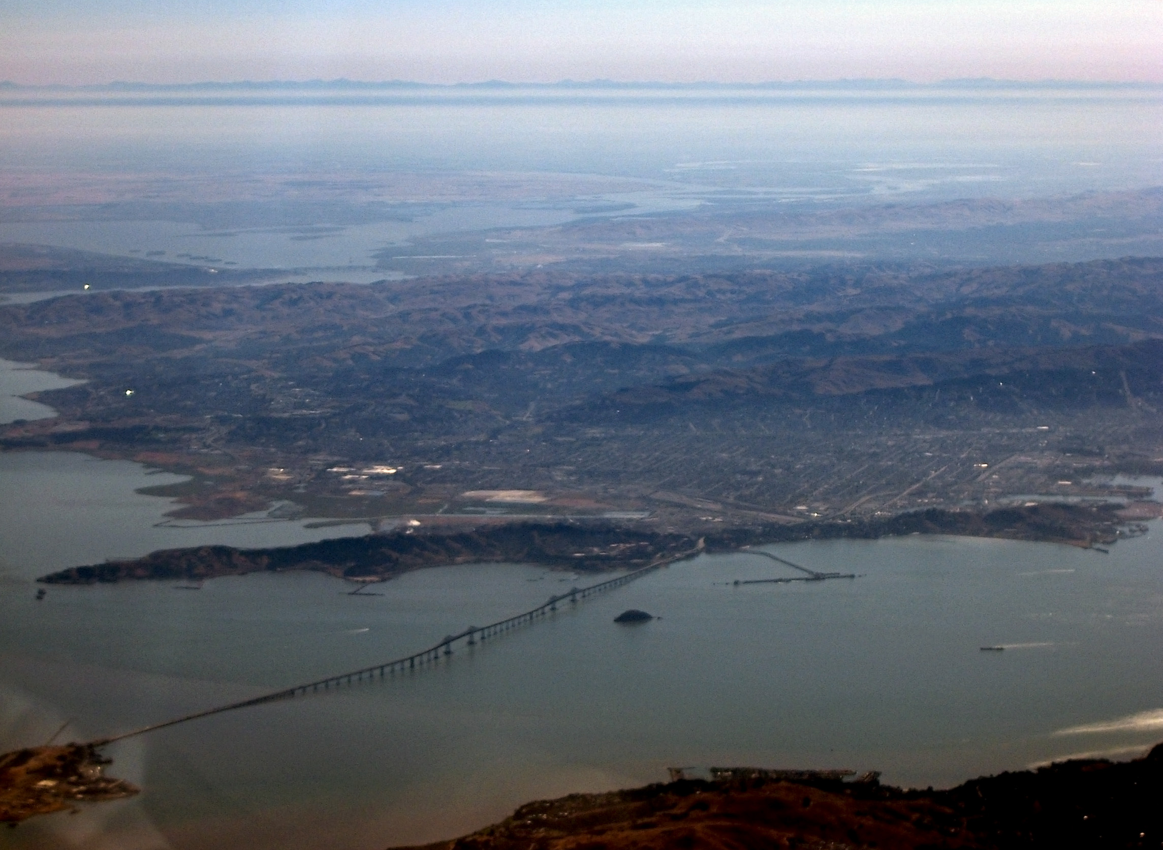
From the Air
The Richmond-San Rafael Bridge crosses San Pablo Bay at coordinates 37.9347N, 122.4338W. Its distinctive double-decker design and roller-coaster profile are clearly visible from the air. The bridge runs roughly east-west, connecting Richmond on the east shore to San Rafael on the west. Best viewed at 2,000-3,000 feet AGL. Nearby airports include Oakland International (KOAK, 15nm south) and Buchanan Field (KCCR, 12nm east). The bridge is the northernmost crossing of San Francisco Bay.