Riohacha
Three legends, one axe. In the first, a young Wayuu man rescues a lost and parched Spanish battalion and guides them to a river; the grateful captain rewards him with an axe and names the place El Rio de La Hacha. In the second, the captain loses his own axe while fording the same river and names it in consolation. In the third, explorers find a beautiful axe buried in the riverbank, proof that someone arrived before them. Nobody agrees on how the axe got there, but everyone agrees on what it became: Riohacha, capital of Colombia's La Guajira Department, a Caribbean port city at the mouth of the Rancheria River where the desert meets the sea. The Wayuu, who were here long before any Spaniard lost anything, call it Suchiimma - Land of the River - in their Wayuunaiki language. They also call it Portal de Perlas, the Gateway of Pearls, and the Capital of the Magical Arreboles, for sunsets so vivid they seem to belong to a Garcia Marquez novel. Which is fitting, because Garcia Marquez set several of his own stories here.
Pearl Divers and Pirate Fire
When the German explorer Nikolaus Federmann founded a settlement at nearby Cabo de la Vela in 1535, the Spanish quickly discovered what the Wayuu already knew: the waters offshore were thick with pearl oysters. Vast quantities of pearls drew traders, wealth, and inevitably, pirates. The original settlement was destroyed in a raid, so the city government did something cunning - they relocated the entire city to the mouth of the Rancheria River, hoping to confuse attackers long enough to rebuild. The trick bought a few years of peace. By 1564, the English pirate John Hawkins forced residents to purchase his cargo of enslaved Africans at gunpoint, with the local governor's quiet collusion. Hawkins returned in 1568 with his young second cousin Francis Drake in tow. Drake came back on his own in 1596, pillaging the city in search of gold and pearls. Between the pearl wealth and the pirate destruction, Riohacha's early centuries were a cycle of accumulation and loss, each rebuilding layered atop the ashes of the last.
The Admiral from Riohacha
Walk through downtown Riohacha and you will find the Almirante Padilla Plaza, named for the city's most celebrated son. Jose Prudencio Padilla rose from this Caribbean port town to become an admiral in the revolutionary navy during Colombia's war of independence from Spain. His ships operated out of the same harbor that pirates had once terrorized, but now they carried the fight for sovereignty. Padilla became a hero in both Colombia and Venezuela, and his legacy anchors the city's sense of identity. The airport bears his name. So does the central plaza, where his statue watches over the daily commerce of a city that has always been defined by its relationship to the sea. Another notable Riohachan, Luis Antonio Robles Suarez, broke barriers as the first Afro-Colombian lawyer and politician, a reminder that this multicultural port has long produced people who refused to accept the boundaries set for them.
Marquez Country
Gabriel Garcia Marquez, Colombia's Nobel Prize-winning novelist, mentioned Riohacha multiple times across his body of work. In his autobiography Living to Tell the Tale, he identified a house in the city as the place where he was conceived. That house still stands, a quiet landmark in a city that served the writer as both setting and source material. The magical realism that made One Hundred Years of Solitude and Love in the Time of Cholera famous did not emerge from nowhere - it grew from the Caribbean coast's particular blend of heat, myth, and improbable reality. Riohacha, where three incompatible legends explain a single place name and the sunsets genuinely look like fiction, is exactly the kind of place that produces that literature. The city does not trade heavily on the Garcia Marquez connection the way other Colombian towns do, but the literary DNA is unmistakable in its streets and stories.
Desert on the Caribbean
Riohacha defies the tropical Caribbean postcard. The Sierra Nevada de Santa Marta, one of the world's tallest coastal mountain ranges, casts a powerful rain shadow over the La Guajira Peninsula, turning the landscape semi-arid despite its seaside position. The city receives just 746 millimeters of rainfall a year, and most of that falls in narrow windows: May, and then August through November. For the remaining seven months, only thirteen days bring rain on average. Humidity, however, stays high year-round, creating an oppressive combination of heat and moisture without the relief of a downpour. The xeric scrub and steppe-like terrain look nothing like the lush green Caribbean of Cartagena or Santa Marta. It is a landscape of hardy plants and Wayuu resilience - a people whose culture was shaped by this arid environment long before the Spanish arrived, and who remain the predominant population of the region today.
Where the Dividivi Blooms
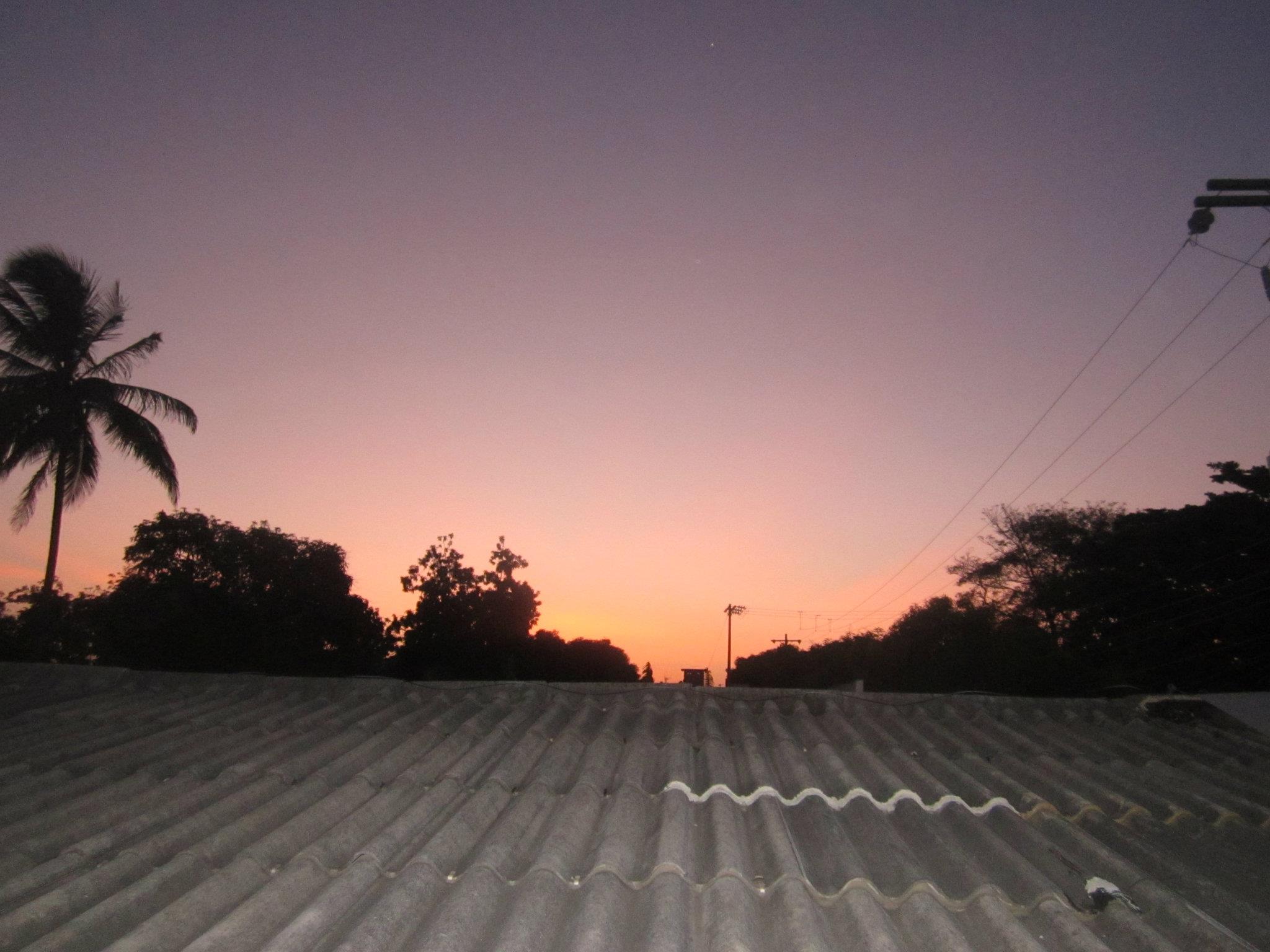
Every year from June 29 to July 1, Riohacha hosts the National Festival of the Dividivi, named for the wind-sculpted trees that dot the Guajira Peninsula. The final day of the festival doubles as a celebration of the creation of the La Guajira Department in 1964, when Riohacha was elevated from a modest Caribbean town to a departmental capital. The festival weaves together the cultures that define the city: Wayuu traditions, Afro-Colombian rhythms, and the mestizo heritage that earned Riohacha the nickname Mestiza del Nordeste. Colorful Wayuu mochilas - handwoven bags that can take weeks to complete - line the Avenida Primera along the waterfront. The sandy beach stretches along the city's edge, and at sunset the arreboles set the sky on fire in shades that photographers struggle to capture and that locals never tire of watching. It is a city comfortable in its contradictions: desert and sea, indigenous and colonial, provincial and proud.
From the Air
Located at 11.54N, 72.91W on Colombia's Caribbean coast at the mouth of the Rancheria River. Almirante Padilla Airport (SKRH) serves the city with connections to Bogota, Valledupar, Santa Marta, Barranquilla, and Aruba. From altitude, look for the sandy coastline meeting arid terrain - the rain shadow of the Sierra Nevada de Santa Marta is visible to the southwest as a dramatic mountain wall. The Guajira Peninsula extends northeast into the Caribbean, one of the driest landscapes in South America. Best viewed at 5,000-10,000 feet to appreciate the desert-meets-ocean geography. The Rancheria River mouth is a clear landmark where fresh water enters the Caribbean.