Ripple Rock
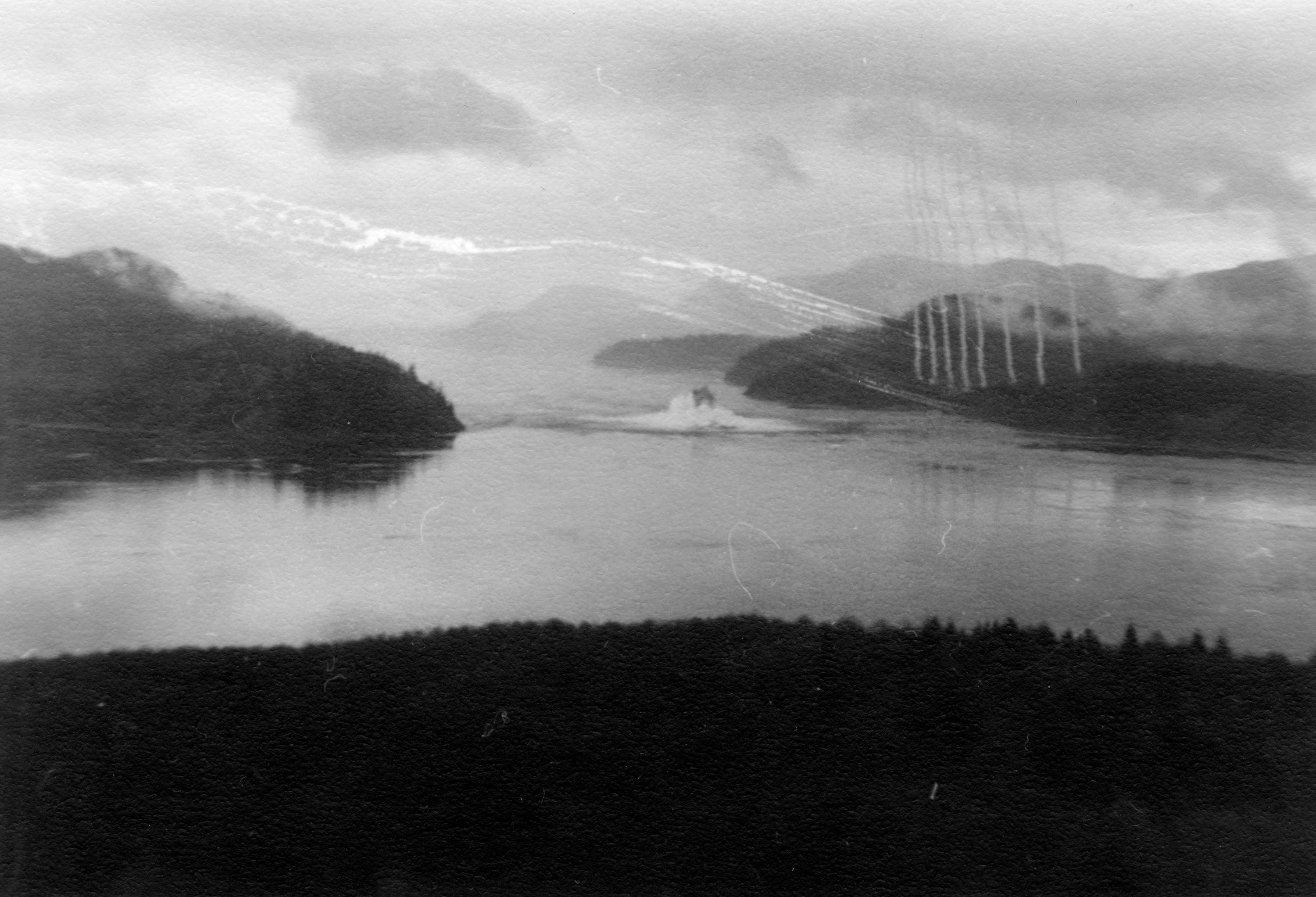
At 9:31:02 on the morning of April 5, 1958, the twin peaks of Ripple Rock ceased to exist. One thousand two hundred and seventy metric tonnes of Nitramex 2H explosive, packed into shafts tunneled up from beneath the seabed, detonated in a single coordinated blast. Six hundred and thirty-five thousand tonnes of rock and water erupted 300 metres into the air, raining debris on both shores of Seymour Narrows. Canadians watched it happen live on television -- one of the first coast-to-coast broadcasts of a real-time event in the country's history. The underwater mountain that had terrorized mariners for more than a century was gone.
One of the Vilest Stretches of Water
Explorer George Vancouver noted Ripple Rock as early as 1791, describing the surrounding waters as "one of the vilest stretches of water in the world." The twin-peaked seamount sat in Seymour Narrows, the tightest section of Discovery Passage, where the channel narrows to 750 metres and tidal currents can reach 15 knots. At low tide, the rock's two summits lurked just 2.74 metres and 6.4 metres below the surface, producing massive eddies and standing waves that could spin a ship sideways. The first major victim was the sidewheel steamer USS Saranac in 1875, heading north to Alaska. Over the next 83 years, at least 20 large vessels and 100 smaller ones were damaged or destroyed. At least 110 people drowned. Captains who knew the narrows timed their transits to slack tide. Those who didn't paid for the mistake.
Decades of Failed Attempts
As early as 1931, a marine commission recommended removing Ripple Rock, but the idea had powerful opponents. In the 1860s, planners had proposed using the rock as a mid-support for a bridge linking Vancouver Island to the mainland at Bute Inlet, and this vision persisted for decades, generating political resistance to demolition. It was not until 1942 that the government authorized the first attempt. Floating drilling barges were anchored over the rock with the goal of blasting it apart from above. The first attempt, in 1943, used six steel cables and anchors weighing a combined 998 metric tons, but the savage currents ripped the barge free. A second attempt in 1945 used overhead steel lines and managed only 93 of a planned 1,500 controlled explosions before it too was abandoned. The rock, it seemed, could not be attacked from the surface.
Tunneling from Below
In 1953, the National Research Council of Canada commissioned a feasibility study for a radically different approach: tunneling from nearby Maud Island, drilling horizontally beneath the seabed to reach the base of Ripple Rock, then drilling upward into the twin peaks to plant explosives. The study endorsed the plan, and three firms -- Northern Construction Company, J.W. Stewart Limited, and Boyles Brothers Drilling Company -- won the contract for more than three million dollars. Between November 1955 and April 1958, an average of 75 men worked three shifts to build 500 feet of vertical shaft, 2,370 feet of horizontal drift, and two main vertical shafts up into the peaks. From these, smaller "coyote" shafts branched outward to hold the charges. The quantity of explosive packed into the shafts -- 1,270 metric tonnes -- was estimated at ten times what would be needed for an equivalent blast above water.
The Blast Heard Across Canada
The Royal Canadian Mounted Police cleared everyone within three miles. Engineers and the television crew were sheltered in a bunker. At 9:31 in the morning, the charges fired. The explosion displaced 635,000 metric tonnes of rock and water. Debris arced 300 metres skyward and fell on land on both sides of the narrows. When the water settled, the twin peaks that had been less than nine feet below the surface now sat at least 45 feet under -- deep enough that ships could pass safely at any tide. The event was designated a National Historic Event of Canada. It drew the attention of nuclear weapons scientists at Britain's Atomic Weapons Research Establishment at Aldermaston, who sent a delegation to monitor the blast with specialized instruments. The explosion remains one of the largest non-nuclear planned detonations in history.
After the Blast
Seymour Narrows is still no place for the careless. Even without Ripple Rock's peaks, the currents remain fierce, and vessels continue to time their transits carefully. In March 1981, the freighter Star Philippine ran aground in the narrows, a reminder that the water itself is the true hazard. But the scale of the danger changed fundamentally on that April morning in 1958. Campbell River celebrated the 50th anniversary of the blast in 2008, with a commemorative explosion staged by a Vancouver special effects company at precisely 9:31:02 AM. A punk rock band, the Evaporators, named their 2004 album after the rock. And the footage of the original explosion still plays regularly at the Campbell River Museum -- the moment a country decided to move a mountain.
From the Air
Ripple Rock's former location is at approximately 50.137N, 125.353W, in the center of Seymour Narrows within Discovery Passage. From the air, Seymour Narrows is identifiable as the tightest constriction of the waterway between Vancouver Island and Quadra Island. Maud Island, the starting point for the tunnel, is on the eastern shore. The rock itself is now submerged at least 45 feet below the surface and not visible from altitude. Campbell River Airport (YBL/CYBL) lies approximately 12 nm to the south-southeast. Best viewed at 2,000-4,000 feet AGL. Expect marine traffic in the narrows below.