Robert Sibley Volcanic Regional Preserve
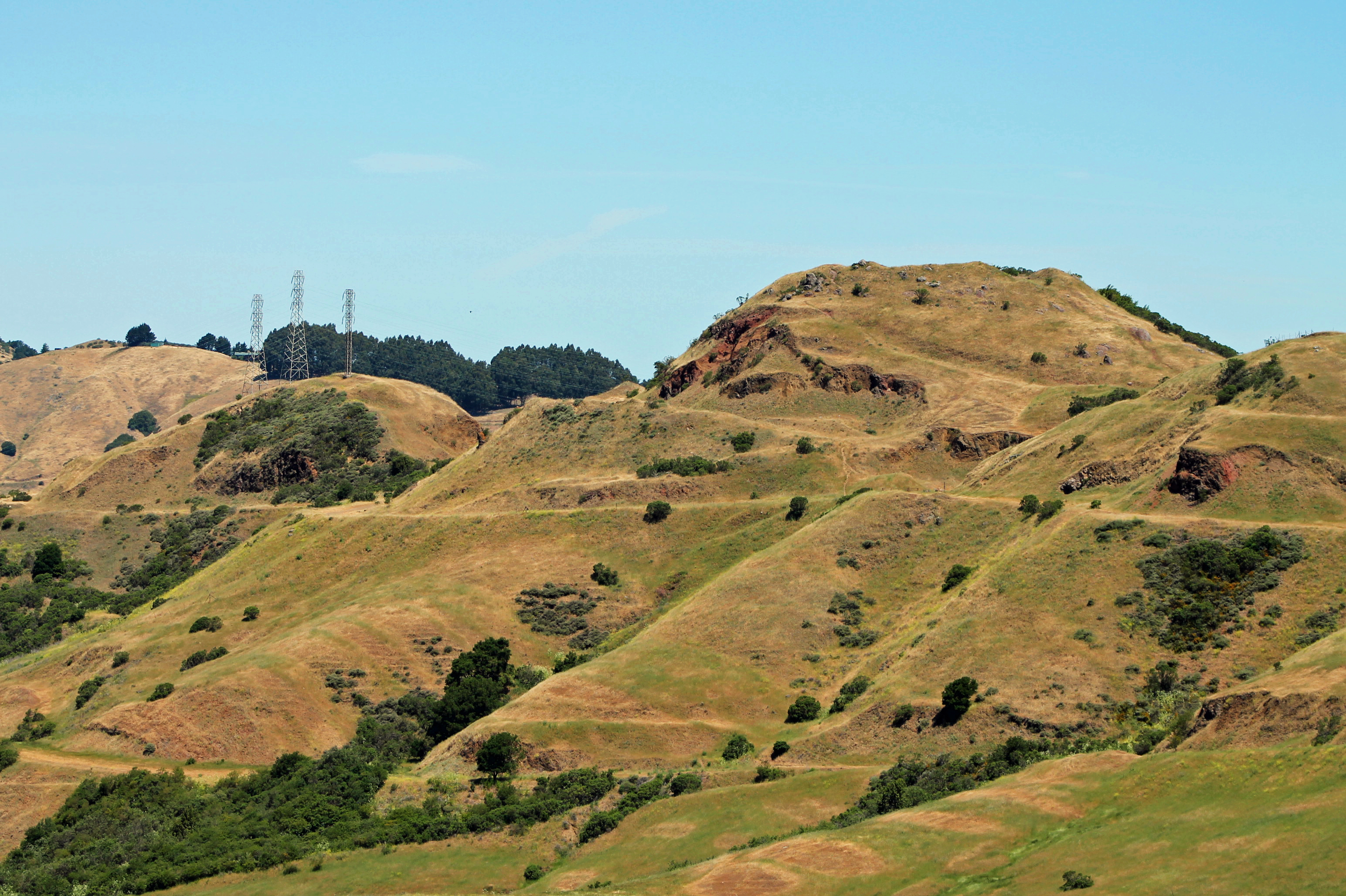
Ten million years ago, a volcano stood upright in what is now the East Bay hills above Oakland. It erupted, producing the basaltic lavas that today underlie the ridgelines from Tilden Regional Park south to Moraga. Then the earth moved on -- not metaphorically, but literally. The Hayward and Moraga faults, grinding along over millions of years, tilted the entire volcanic complex onto its side. What was once a vertical throat of magma is now a horizontal cross-section exposed at the surface, readable like a geological textbook left open to the right page. Round Top, the preserve's 1,763-foot summit, is not the volcano's peak. It is its flank, rotated skyward by forces that make human timescales irrelevant.
Reading the Tilted Earth
The Volcanic Trail at Sibley loops through what geologists call the Moraga Volcanics -- a Pliocene-epoch formation of basaltic lava, volcanic debris, and ash deposits. Because the entire formation has been tilted roughly 90 degrees by tectonic activity, hikers walk across features that would normally be stacked vertically underground. Lava flows that once pooled on the surface now stand as vertical walls. The old volcanic vent, which once channeled magma upward, lies exposed at trail level. Interpretive markers along the Round Top Loop Trail guide visitors through this rotated landscape, explaining how each outcrop relates to the original eruption sequence. It is one of the most accessible volcanic geology sites in the Bay Area -- a place where the deep earth has been, quite literally, turned inside out for inspection.
Mazzariello's Gift
At a clearing along the trail, hikers encounter something unexpected: a large stone labyrinth laid into the ground. This is the Mazzariello Labyrinth, constructed in 1990 by East Bay resident Helena Mazzariello and donated, in her words, as a "gift to the world." It is not a maze -- there are no dead ends, no tricks. A single path spirals inward to a center point and back out again. Mazzariello used to walk her goats through it, saying, "I can enter with a question, and inevitably, I will emerge with some insight. It is a powerful spot." Visitors have taken the invitation seriously. Talismans, small stones, flowers, and handwritten notes accumulate at the center, left by hikers who come to pray, meditate, or simply pause. The Friends of the Labyrinth reports that the site has visitors 24 hours a day, seven days a week. A smaller, heart-shaped labyrinth sits nearby at Post No. 4, less elaborate but no less intentional.
From Round Top to Sibley
The preserve opened in 1936 as Round Top Park, one of the earliest acquisitions of the newly formed East Bay Regional Park District. For decades it was simply a hilltop park with good views. Then, in 1972, the park was renamed in honor of Robert W. Sibley, a founding member and longtime director of the park district who had served ten years on its board before his death. The "Volcanic" in the name came later, as geologists more fully documented the significance of the Moraga Volcanics exposure. Today the 928-acre preserve straddles the Alameda-Contra Costa county line, its trails threading through grassland, eucalyptus groves, and the volcanic outcrops that give the park its identity. The Kaiser Sand and Gravel company once quarried here, and the old quarry pit remains visible -- another layer of human use pressed into a landscape already rich with geologic history.
Walking the Crater's Edge
The Round Top Loop Trail is the preserve's main draw, a moderate hike that circles the summit and drops through the volcanic geology on the eastern side. From the top, views stretch west to San Francisco Bay and east across the rolling hills of Contra Costa County. The park is open year-round, with no parking or dog fees -- a rarity among Bay Area parks that makes Sibley a default destination for dog walkers and casual hikers. Claims of older, hidden labyrinths elsewhere in the preserve surface periodically, but the Friends of the Labyrinth has analyzed high-resolution aerial photographs and found no evidence to support them. The real mystery at Sibley is not hidden in any human construction. It is in the rocks themselves -- in the fact that an entire volcano was rotated onto its side over ten million years, and that you can walk across its exposed interior on a Sunday afternoon, dog leash in one hand, trail map in the other.
From the Air
Located at 37.85°N, 122.20°W along the ridgeline of the Berkeley Hills. Round Top peak rises to 1,763 feet, making it one of the area's highest points and a useful visual landmark. The preserve sits along Skyline Boulevard between Oakland and Orinda. Nearest airports: KOAK (Oakland International, 12nm southwest), KCCR (Buchanan Field, 8nm northeast). Best viewed at 2,500-4,000 ft AGL. The old quarry pit on the eastern slope and the open grassland summit are visible from the air. The volcanic geology is not distinguishable from altitude, but the Round Top summit and ridgeline trail are clear landmarks along the Skyline corridor.