Rocky Mountain National Park
Enos Mills was fourteen when he moved to the mountains surrounding Longs Peak in 1884. Over the next three decades, he climbed that 14,259-foot summit more than 40 times by himself, wrote books about the region's ecology and beauty, and lobbied Congress until President Woodrow Wilson signed the legislation creating Rocky Mountain National Park in 1915. Today, over four million visitors annually experience what Mills fought to protect: 415 square miles of alpine wilderness where the Continental Divide runs through the center, elk herds migrate through glacier-carved valleys, and Trail Ridge Road - the highest continuous paved road in America - crosses tundra that looks more like the Arctic than Colorado. One-third of the park lies above treeline, a world of rock and sky accessible to anyone willing to drive or hike into thin air.
The Highest Road
Trail Ridge Road climbs to 12,183 feet as it crosses the park between Estes Park and Grand Lake, spending eleven miles above treeline. The views stretch across cirques and moraines carved by glaciers, past peaks that exceed 13,000 feet, to horizons that seem to belong to a larger planet. Pull-offs and short trails offer access to the alpine tundra - a fragile ecosystem where plants grow only a few inches tall, taking decades to recover from a single footprint. The Alpine Visitor Center, at nearly 11,800 feet, provides context and respite. Snow typically closes the road from mid-October through Memorial Day, though exact dates depend on the year's snowpack. When open, the drive takes two to three hours in good conditions, longer when elk or bighorn sheep create 'wildlife jams' that stop traffic.
Wildlife Crossroads
Rocky Mountain elk migrate through the park in numbers that can exceed 3,000, their bugling echoing through the valleys during fall rut. Moose favor the willowy wetlands on the western side of the park. Bighorn sheep - the park's symbol - traverse seemingly impossible terrain above treeline, occasionally visible from Trail Ridge Road viewpoints. Marmots whistle warnings from boulder fields. Pikas, the small relatives of rabbits that live only in high-altitude rock piles, gather hay against the coming winter. Black bears roam the forests, and mountain lions hunt unseen. The park's wildlife abundance reflects its position as a corridor between the Great Plains and the Rockies' interior - a crossroads where species from multiple ecosystems meet.
Climbing Longs Peak
Longs Peak dominates the park's southeastern skyline, the only 'fourteener' in Rocky Mountain National Park and the most climbed 14,000-foot peak in Colorado. The Keyhole Route offers a non-technical path to the summit - meaning no ropes required - but the 15-mile round trip with 5,100 feet of elevation gain demands excellent fitness and an alpine start. Most successful summits begin before 3 AM to avoid the afternoon thunderstorms that threaten anyone caught above treeline. The final approach crosses the Narrows, a ledge traverse with thousand-foot exposure, and the Homestretch, a steep slab requiring hands-on scrambling. Several people die on the mountain each year, usually from lightning, falls, or altitude-related emergencies. Those who reach the top earn one of the most spectacular summit views in Colorado.
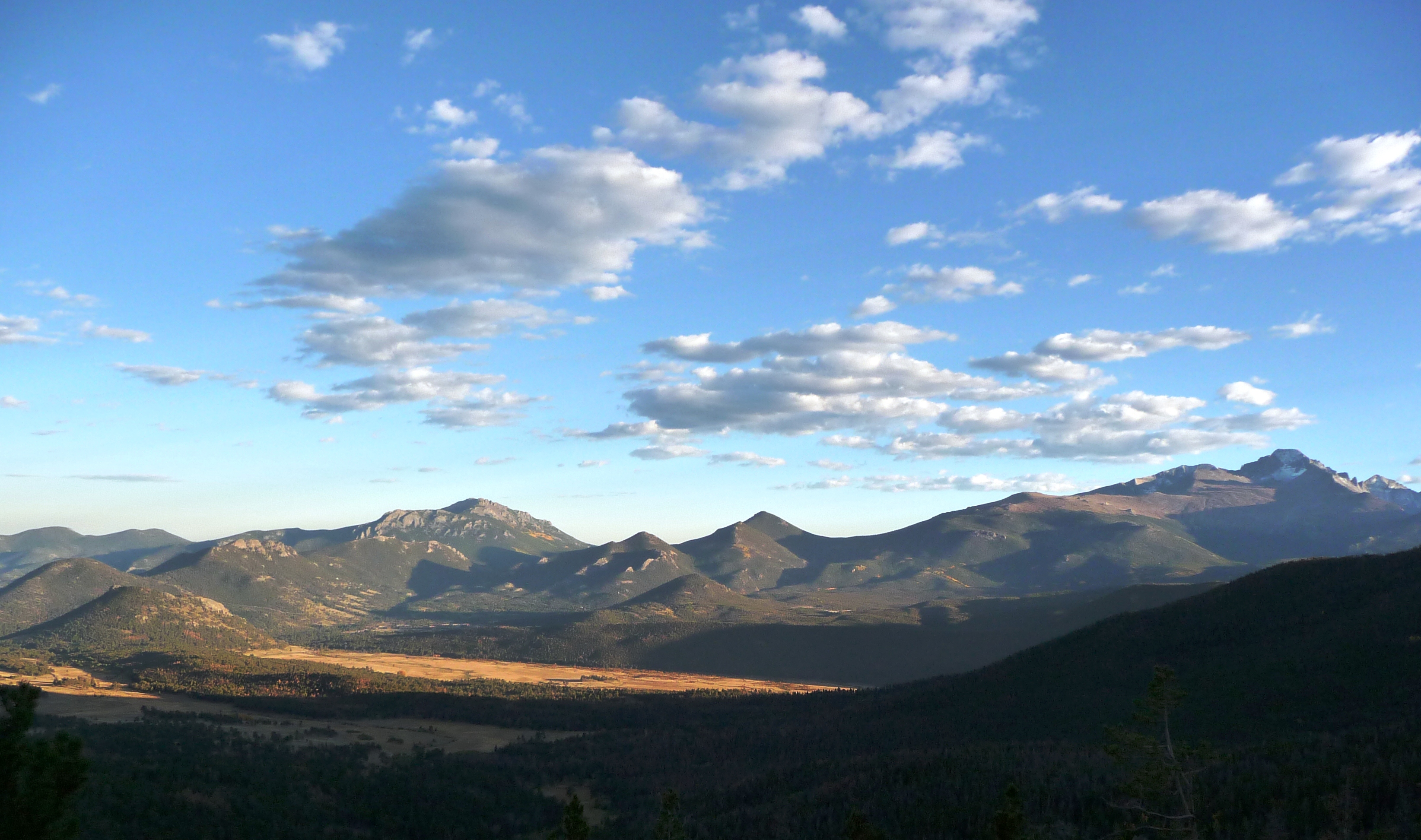
Two Sides of the Divide
The Continental Divide creates two distinct worlds within the park. The eastern slope, facing the Front Range cities, receives less precipitation and features the dramatic glacially-carved valleys that draw most visitors. Bear Lake, Sprague Lake, and Dream Lake offer easy access to alpine scenery; the Glacier Gorge area provides more challenging trails into the high country. The western slope, accessible from Grand Lake, receives more snow and supports denser forests of subalpine fir and Engelmann spruce. Fewer visitors explore this side, creating opportunities for solitude that the eastern approaches rarely offer. Connecting them, Trail Ridge Road offers a two-hour journey between ecosystems, from montane forest through subalpine to alpine tundra and back down again.
Altitude's Price
Every year, visitors underestimate the effects of altitude. The entire park sits above 7,500 feet; the highest trails exceed 14,000 feet. At these elevations, the air contains significantly less oxygen than at sea level. Headaches, nausea, fatigue, and shortness of breath affect even fit individuals who haven't acclimated. Heart attacks and altitude sickness cause multiple medical evacuations each summer. Lightning strikes the high country almost daily during afternoon thunderstorms from July through early September - the park recommends descending below treeline by noon during storm season. Despite these challenges, Rocky Mountain remains remarkably accessible. Paved roads reach viewpoints above 12,000 feet. Easy trails circle lakes reflecting jagged peaks. The park offers genuine wilderness within ninety minutes of Denver's airport, demanding only that visitors respect the thin air and volatile weather that come with such height.
From the Air
Located at 40.33°N, 105.71°W in northern Colorado's Front Range. The park spans 415 square miles with the Continental Divide running north-south through its center. Longs Peak (14,259 feet) dominates the southeastern quadrant. Trail Ridge Road is visible crossing the alpine zone. Denver International Airport (DEN) is 75nm southeast. Rocky Mountain Metropolitan Airport (BJC) near Boulder is closer for general aviation. The Never Summer Range and Mummy Range form the western and northern boundaries. Snow-capped peaks are visible most of the year; the park's high elevation (7,500-14,259 feet) creates dramatic relief visible from cruising altitude.