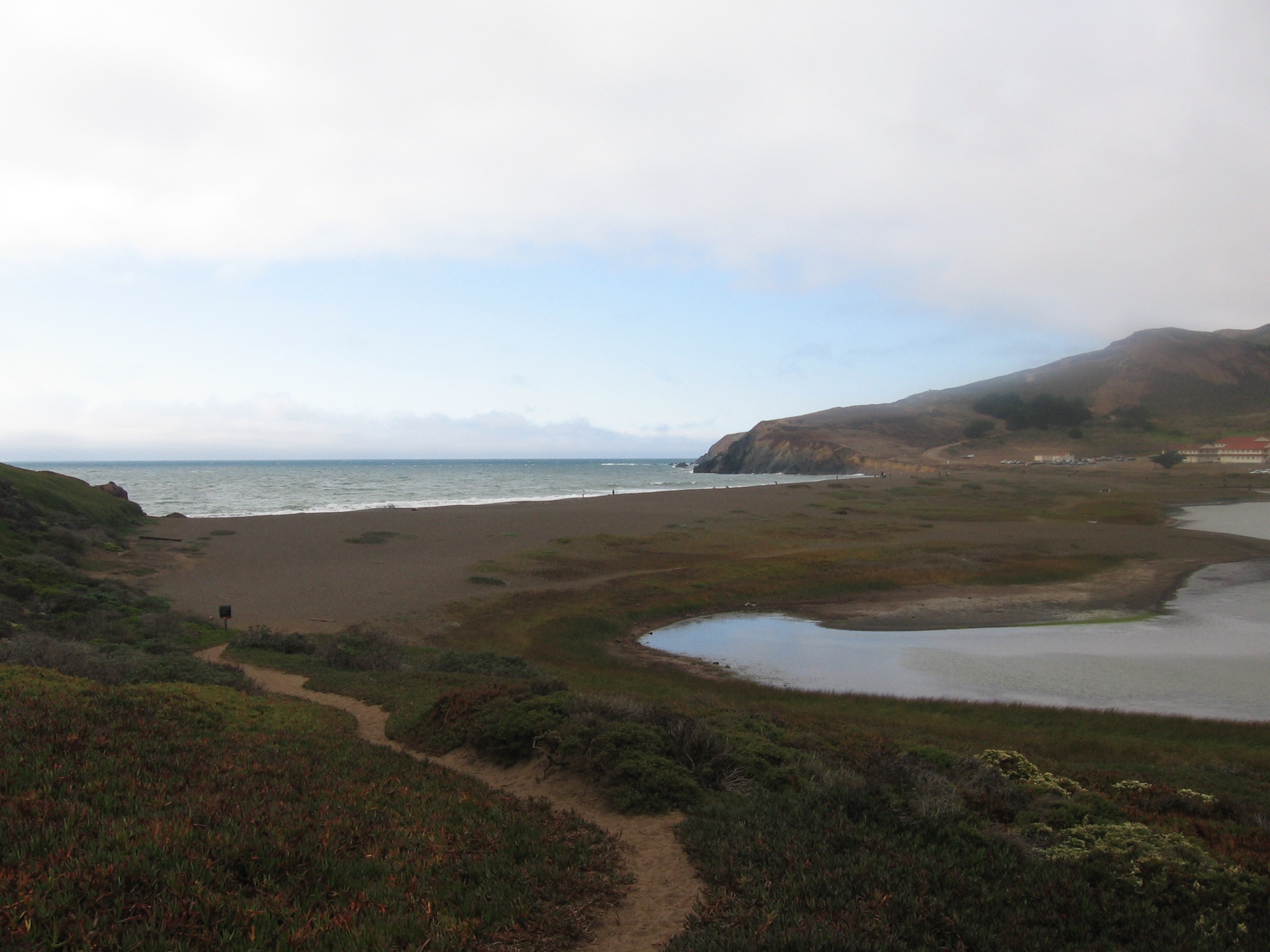
Rodeo Beach
The sand is dark, almost black in places, and mixed with it are pebbles of chert, jasper, and agate in reds, greens, and translucent whites that catch the light when wet. Rodeo Beach sits in the Marin Headlands, two miles west of the Golden Gate Bridge, within the Golden Gate National Recreation Area. It is one of the few beaches in the Bay Area where the geology puts on a show at your feet. The beach forms a narrow spit roughly 50 meters wide at the mouth of a long embayment, separating the Pacific Ocean from Rodeo Lagoon behind it.
Headlands Geography
Rodeo Beach occupies a sheltered cove carved into the Marin Headlands, the dramatic coastal ridges that guard the northern entrance to the Golden Gate. The beach is composed of sand and gravel eroded from the surrounding cliffs, which are rich in Franciscan Complex rocks -- a geological assemblage of chert, basalt, and serpentinite that gives the beach its distinctive multicolored pebbles. The surf can be powerful and the currents unpredictable; swimming is not recommended. But the beachcombing is extraordinary, and the setting -- steep headlands rising on three sides, the Pacific pounding in from the west -- is among the most dramatic on the Northern California coast.
Between Ocean and Lagoon
Behind the beach, Rodeo Lagoon stretches inland, a brackish body of water that supports a distinct ecosystem of shorebirds, waterfowl, and aquatic vegetation. The sand spit that separates the lagoon from the ocean shifts with the seasons, sometimes breaching during winter storms and reconnecting the lagoon to the Pacific. The interaction between fresh water from the surrounding hillsides and salt water from the ocean creates the brackish conditions that support species adapted to neither fully fresh nor fully salt environments.
Two Miles from the Bridge
The proximity to the Golden Gate Bridge gives Rodeo Beach an unusual juxtaposition. From the beach, the bridge is invisible, hidden behind the headlands. But a short hike up the Coastal Trail reveals it in full, with the San Francisco skyline beyond. The Marin Headlands themselves are a former military installation, dotted with abandoned batteries and bunkers from the harbor defense era. The transition from military reservation to national recreation area has given the public access to coastal terrain that was restricted for decades. Rodeo Beach is the headlands' most accessible destination, reachable by car via Bunker Road or on foot from multiple trailheads.
From the Air
Located at 37.83°N, 122.54°W in the Marin Headlands, 2 nm west of the Golden Gate Bridge. The beach is visible as a dark sand crescent at the mouth of Rodeo Lagoon. KSFO is approximately 14 nm south.