Rotterdam Kralingen-Crooswijk
In the last week of June 1970, more than one hundred thousand young people poured into a park on the east side of Rotterdam to hear Pink Floyd, Santana, The Byrds, Jefferson Airplane and Family play across three humid days. The Dutch papers called it the European answer to Woodstock. The park was the Kralingse Bos, two hundred hectares of mature forest wrapped around a lake. What no one mentioned in the festival programs was where the park had come from: the lake was a flooded peat-cutting pit that had been swallowing the village edge of Kralingen since the seventeenth century, and the wooded islands at the south end were heaped from the broken concrete of Rotterdam's city centre after the May 1940 bombing. The kids who slept on the grass that summer were sleeping on their grandparents' rebuilt city.
The Peat That Sank Below the Sea
To understand Kralingen, start with the peat. Through the seventeenth century, this corner of South Holland was so thoroughly stripped of fuel turf that pits opened below sea level and filled with water, leaving a constellation of veenplassen - peat lakes - across what had been firm farmland. The Kralingse Plas is the survivor of that constellation, the others reclaimed in the nineteenth century to become the Prins Alexanderpolder. Note the name: this Alexander was the heir apparent who died in 1884 at age thirty-three, not the king who reigns today. Locals still occasionally have to correct visitors who assume otherwise. The polder sits up to six meters below sea level. Pumps keep it dry. The lake, by contrast, stays a lake. Some scars the Dutch decide to keep.
Honingen and the Castle That Lost
Kralingen the village grew not around the lake but around a castle - Honingen Castle, the seat of a minor noble line east of medieval Rotterdam. The castle fell during the Eighty Years' War, the Dutch revolt against Spanish Habsburg rule that lasted from 1568 to 1648. Honingen was burned and not rebuilt, but the road it had anchored continued to organize the village: a single thread running east to west, with the reclaimed peatfield stretching away to the north. Centuries later, when planners chose a route for the Rotterdam Metro east from Rotterdam Centraal, they laid the line straight through what had been the medieval main street. The metro reached the former town in 1982. The castle has been gone for four hundred years; the road it built remains an artery.
The Hongerwinter's Trees
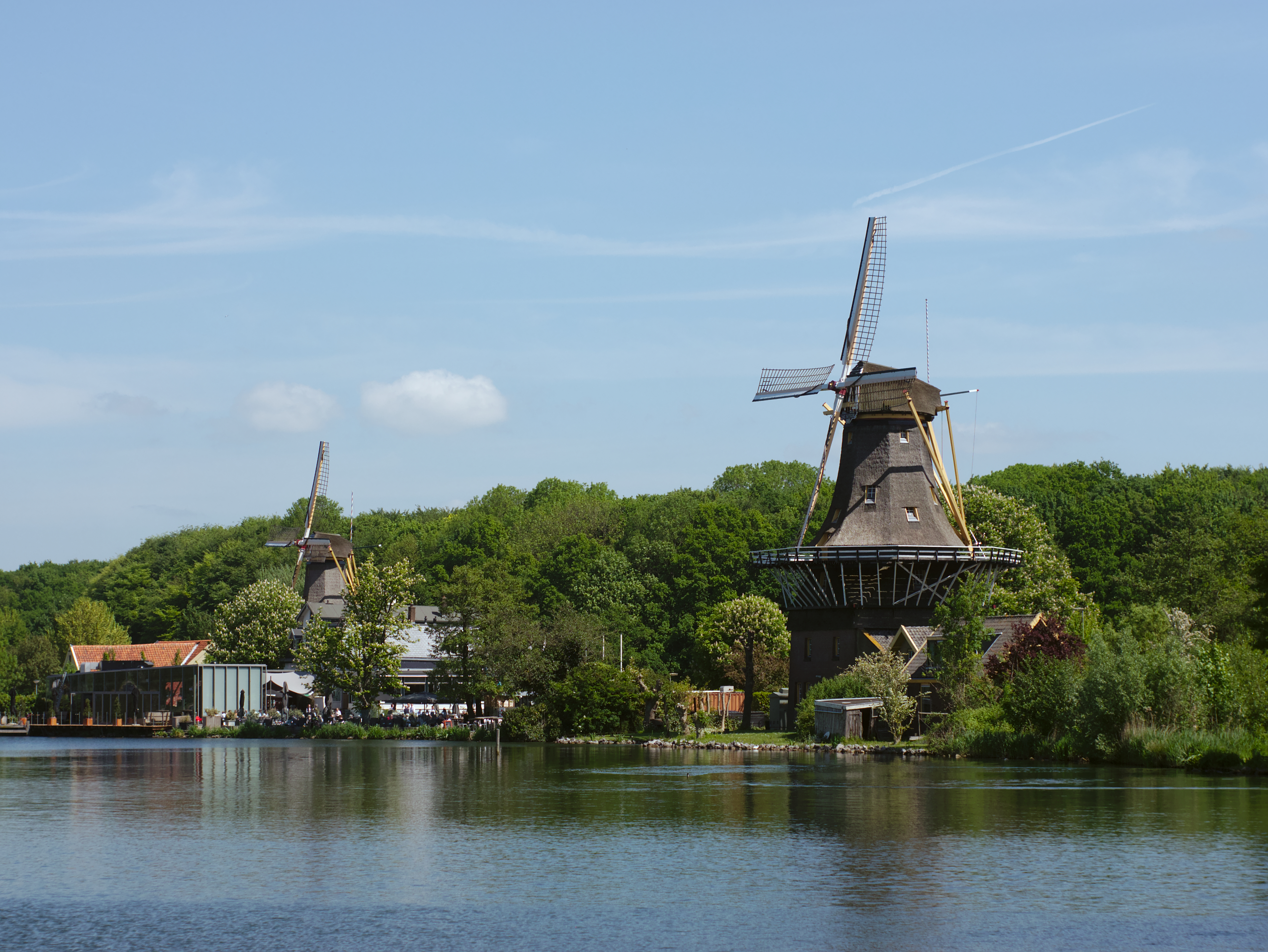
The Kralingse Bos park was a depression-era make-work project, planned for two decades before the 1930s economic crisis finally pushed the city to start digging. The trees were purpose-bred oaks, selected to anchor a forest that would still be young in a hundred years. Then came the German occupation, and then the Hongerwinter - the Hunger Winter of 1944-45, when food and fuel supplies to the western Netherlands collapsed and Rotterdammers cut down everything that would burn. Many of the young Kralingse Bos oaks went into stoves that winter. Other Dutch parks lost the same way. The park was finally completed in 1953, with the bomb rubble of the city centre dumped into the lake's south end to form a chain of wooded islands. By 1970 the trees were tall enough to throw shade for a hundred thousand festivalgoers. The forest you walk through today is, in a literal sense, the seedlings that survived the war.
The University on the East Edge
East of the park, where Kralingen runs into the De Esch neighborhood, sits Erasmus University Rotterdam, named for Desiderius Erasmus of Rotterdam, the sixteenth-century humanist whose Latin essays needled popes and reformers alike. The modern university traces its roots to the Netherlands School of Commerce, founded in 1913 to train merchants for the world's busiest port. It is still, more than a century later, the most quantitative university in the Netherlands - heavy on economics, business, medicine, public health. Tram line 7 from Rotterdam Centraal terminates at Burgemeester Oudlaan, depositing thousands of students at the campus gates each morning. The De Esch water tower - a slender brick column from 1939 - watches over the whole arrangement from the river dike, the closest thing the campus has to a bell tower.
Noord and the Vintage Hunt
West of Crooswijk, on the north side of the railway, lies the Noord district. A generation ago this was working-class housing, modest and unfashionable. Today the streets around Zwaanshals and Noordplein have become what local writers like to call a design Valhalla - a strip of vintage furniture boutiques, mid-century lighting dealers, ceramics studios and lunchrooms run by people who could not afford the Witte de Withstraat across the railway. The gentrification is uneven and unfinished. On a single block you can find a thousand-euro Danish teak sideboard in one window and a Turkish bakery selling lahmacun in the next. The whole district sits between the river Rotte - which gave Rotterdam its name - and the canal called the Boezem. It is the kind of place a city becomes when it has run out of obvious places to put its design class.
From the Air
Kralingen-Crooswijk centers at 51.93 N, 4.51 E, immediately east and northeast of Rotterdam Centrum. The Kralingse Plas - a circular freshwater lake roughly 1 km across - is the unmistakable landmark from above, with the wooded park wrapping its eastern and southern shores. The De Esch water tower (1939) marks the southeast corner near the Nieuwe Maas. Rotterdam The Hague Airport (EHRD) sits about 7 km west-northwest. The A16 motorway forms a clean visual border along the east. Expect coastal stratus and persistent westerly winds at low altitudes year-round.