Round Valley Reservoir
Somewhere beneath 180 feet of cold, clear water, the walls of a schoolhouse and a church still stand. When the New Jersey Water Authority constructed two massive dams in 1960 and flooded the circular valley inside Cushetunk Mountain, they submerged an entire farming community -- homes, roads, foundations, and all. What rose in its place was Round Valley Reservoir, the largest reservoir in New Jersey, holding 55 billion gallons of water for central New Jersey. From the surface, it is strikingly beautiful. But the valley's history, and what has happened on its waters since, give it a reputation that beauty alone cannot explain.
A Valley Shaped by Fire and Water
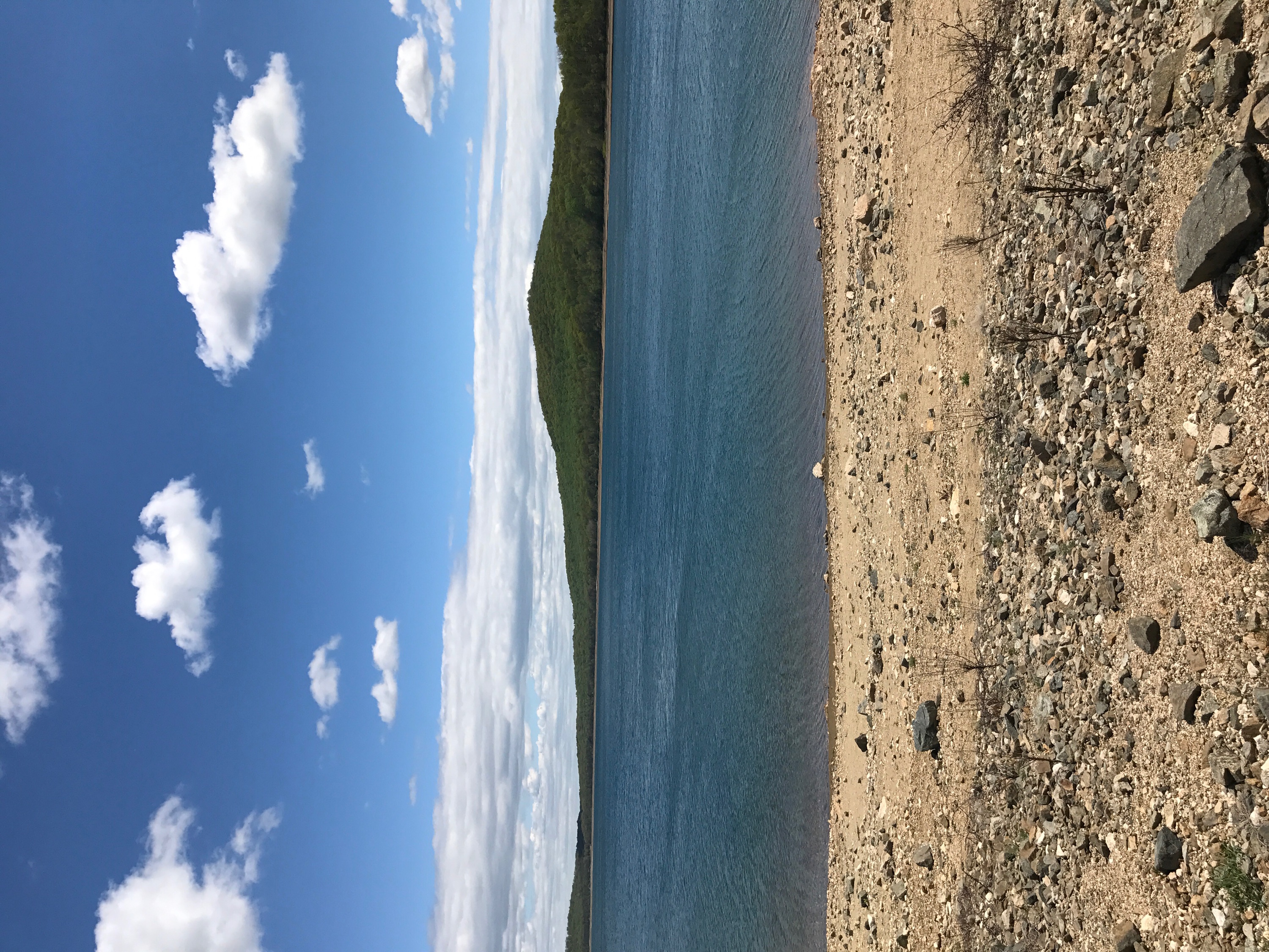
The circular shape that gives Round Valley its name is not accidental. Cushetunk Mountain, the ridgeline that encircles the valley, is made of diabase -- dense volcanic rock that cooled slowly beneath the earth's surface and now resists erosion. The softer sedimentary rock at the valley's center did not resist. Over millennia, water carved it away, leaving a natural bowl ringed by hard volcanic ridges. When engineers looked for a site to build a reservoir in the 1950s, the geology could not have been more inviting: a deep, contained basin that needed only two dams to seal. The resulting reservoir covers 2,350 acres in Clinton Township, Hunterdon County, and reaches depths of 180 feet -- extraordinarily deep for a New Jersey lake. The water is fed not by rivers but by pumping from the South Branch of the Raritan River, drawn in during wet periods and held for drought relief.
The Town Below
Before the reservoir, Round Valley was farmland. Families worked the fields in the basin, their children attended the local school, and the community's social life revolved around a small church. When the state decided to flood the valley, the community was displaced. The buildings were not demolished -- many were simply left in place as the water rose. Scuba divers who explore the reservoir's depths today can still find the foundations and walls of these structures, ghostly remnants of a way of life that was sacrificed for the water needs of a growing state. The story is not unique -- reservoir construction displaced communities across the American Northeast in the mid-20th century -- but at Round Valley, the submerged village remains unusually intact, a time capsule preserved by the very water that destroyed it.
The Bermuda Triangle of New Jersey
The nickname is not playful. Since 1971, more than 26 people have drowned in Round Valley Reservoir. Six of their bodies have never been recovered. The reservoir's extreme depth, cold water temperatures, and sudden wind shifts create conditions that are genuinely dangerous, especially for boaters and swimmers who underestimate a body of water that looks placid from shore. The steep underwater terrain drops off sharply, and hypothermia can set in quickly in the deeper layers. Law enforcement and rescue teams have struggled with recoveries in water that, below the surface, is dark and disorienting. The "Bermuda Triangle" label, coined by local media, has stuck -- and for the families of those who were lost, it is not a metaphor but a description of a place that took someone and did not give them back.
Trout, Trails, and Clear Blue
For all its dark history, Round Valley is also a place of genuine natural beauty and ecological significance. The New Jersey Division of Wildlife identifies it as the southernmost body of water in the United States that supports naturally reproducing lake trout -- one of only two lakes in New Jersey with this cold-water species, the other being Merrill Creek Reservoir in Warren County. The fishery also includes bass, pickerel, catfish, American eel, yellow perch, brown trout, and rainbow trout, making it one of the most diverse fishing destinations in the state. Round Valley Recreation Area surrounds the reservoir with hiking and biking trails, a wilderness camping area, swimming beaches, and a boat ramp. The water clarity is remarkable -- on still days the blue surface reflects the encircling ridgeline of Cushetunk Mountain with a sharpness that feels out of place in densely developed New Jersey. It is a landscape of contradictions: beautiful and dangerous, man-made and ancient, a source of drinking water built on top of a drowned community.
From the Air
Located at 40.614°N, 74.823°W in Clinton Township, Hunterdon County, New Jersey. The reservoir's distinctive circular shape is unmistakable from the air, ringed by the ridgeline of Cushetunk Mountain. Best viewed from 3,000-5,000 feet AGL where the full oval basin and its two dams are visible. Spruce Run Reservoir is visible to the north. Nearest airports: Solberg-Hunterdon (N51) approximately 8 nm east, Central Jersey Regional Airport (47N) approximately 10 nm south. The blue water and surrounding green ridgeline create a striking visual contrast against the surrounding farmland.