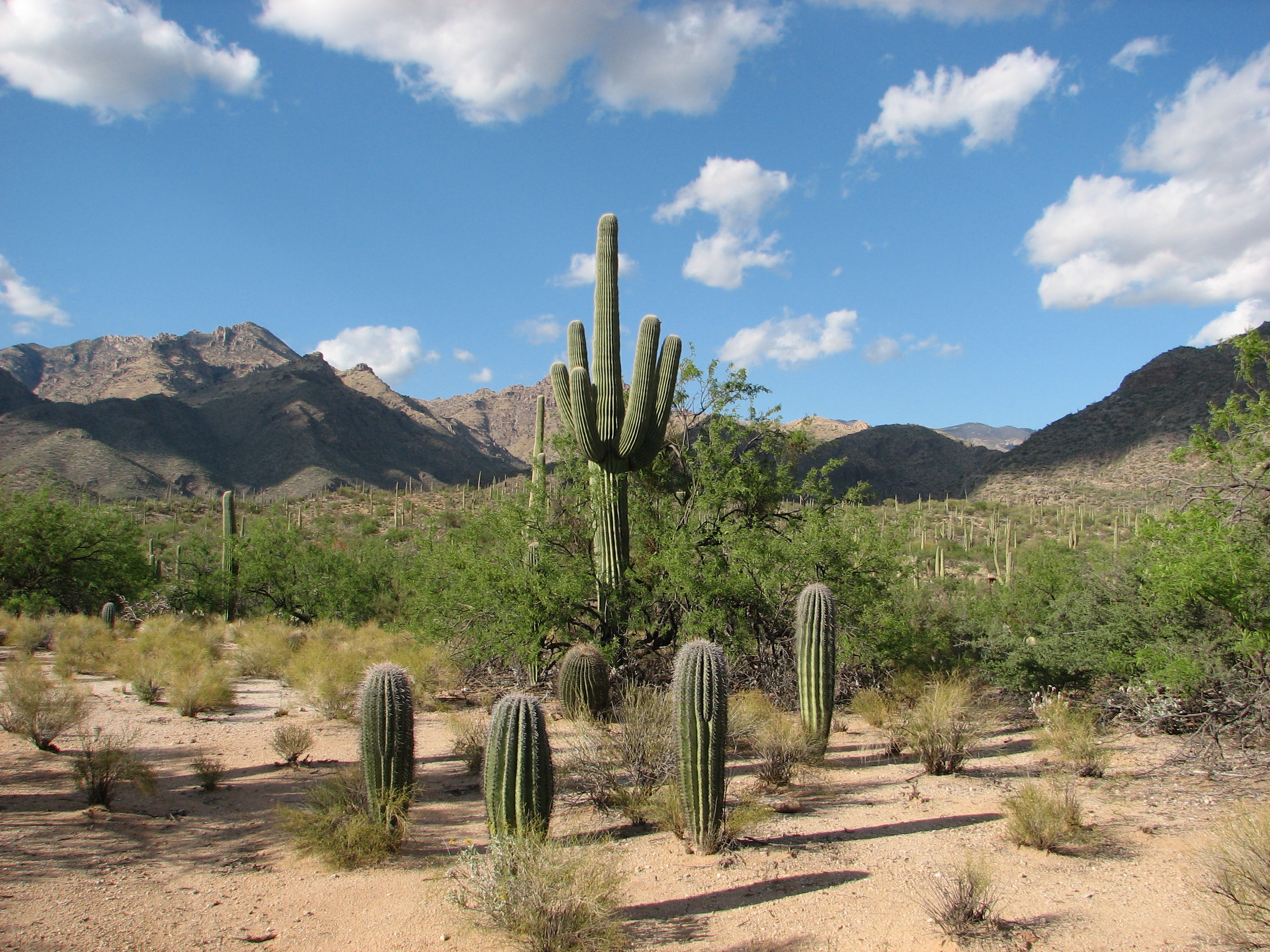
Sabino Canyon
The 1887 Sonora earthquake shook boulders loose from the canyon walls, sending them tumbling into the valley below where they still rest today. Those massive stones joined a landscape that had been forming for 12 million years, ever since the Santa Catalina Mountains began rising from the desert floor. The Hohokam people knew this canyon between 6,000 and 8,000 years ago, drawn to the same water that now pulls over a million visitors annually into the Coronado National Forest. Just minutes from the Tucson heat, waterfalls cascade over striated rock formations, javelina root through desert scrub, and mountain lions prowl terrain that would seem impossible for a major American city to possess.
Water in the Desert
Sabino Creek does what water rarely does in southern Arizona: it flows year-round. The creek carves through metamorphic rock, creating pools and small waterfalls that have shaped recreation here for over a century. Depression-era workers built nine bridges over the creek during the 1930s as part of an ambitious Works Progress Administration project to construct a road to the top of Mount Lemmon. The road travels several miles into the canyon before the terrain defeated even New Deal determination. Those stone bridges remain, monuments to both the craftsmanship of the era and the canyon's stubborn geology. When monsoon storms sweep through in summer, the creek transforms from gentle stream to roaring torrent, a reminder that the desert stores its violence for rare occasions.
Wild Neighbors
The wildlife inventory reads like a Sonoran Desert field guide: mule deer browsing at dawn, javelina traveling in family groups, desert tortoises carrying ancient patience on their backs. Rattlesnakes coil in the shade of canyon walls while mountain lions stake out territories that occasionally overlap with hiking trails. Great horned owls hunt the night sky, and scorpions glow under ultraviolet light on summer evenings. The canyon creates a vertical ecosystem, with saguaros and prickly pear at lower elevations giving way to oak woodlands as the trail climbs. Researchers have documented bat colonies, amphibian populations that depend on the creek's permanence, and reptile species that find refuge in this protected watershed within the Coronado National Forest.
Shuttles and Floods
The first shuttle began operating in October 1978, ending the era of private vehicles in Upper Sabino Canyon. The decision preserved the canyon's character while creating a unique transportation experience. Visitors board electric shuttles that wind through the canyon, stopping at nine points where hikers can disembark for trail access. On July 31, 2006, a monsoon thunderstorm demonstrated why the shuttle replaced cars: flooding washed out the bridge at Rattlesnake Creek, scattered debris across the roadway, and proved that this landscape remains untamed despite its proximity to a metropolitan area of a million people. The shuttle service was cancelled in 2018 but reopened in 2019 with electric vehicles, continuing a tradition of motorized access that respects the canyon's limits.
Guardians of the Canyon
Federal funding has not kept pace with the pressure that urbanization places on Sabino Canyon. Friends of Sabino Canyon, founded in 1993, has raised nearly half a million dollars to fill the gap. Their contributions funded trail rehabilitation after the devastating Aspen Fire, restored the historic Lowell House Ranger Station, preserved the Depression-era stonework, and supported research into the canyon's bats and reptiles. Each year, Music in the Canyon brings an outdoor holiday concert to the desert, raising funds while celebrating the landscape. Major donors find their names on hand-painted tiles at the canyon entrance, each tile reflecting southwestern themes. The tiles represent a community that refuses to let federal budget constraints diminish a place the Hohokam valued millennia ago.
From the Air
Located at 32.32N, 110.81W in the Santa Catalina Mountains, approximately 12nm northeast of downtown Tucson. The canyon cuts dramatically into the southern face of the range, visible as a deep notch in the mountain wall. Best viewed from 4,000-6,000 feet AGL approaching from the south. Nearby airports: KTUS (Tucson International, 18nm southwest). Be aware of mountain-induced turbulence and rapidly changing weather. The canyon terrain rises steeply from desert floor to over 9,000 feet at Mount Lemmon.