Sacramento Mountains: Sky Islands of the Desert
The Sacramento Mountains rise abruptly from the Chihuahuan Desert floor like a green wall dropped from the sky. From Alamogordo, looking east, the escarpment climbs over 5,000 feet in just a few miles, transforming parched desert scrub into cool pine forests. The mountains run roughly 80 miles north to south through south-central New Mexico, but it is their western face that commands attention -- a series of dramatic cliffs that mark the eastern edge of the Tularosa Basin. What happens on these slopes shapes the entire region. Gypsum eroded from the Sacramento limestone washes down into the basin below, where it becomes the blinding white dunes of White Sands National Park.
A Landscape Split in Two
The Sacramentos divide neatly into two distinct sections. The main northern section holds all the terrain above 8,000 feet, including the highest named point, Cathey Peak at 9,645 feet. Two unnamed summits near Sunspot and on Benson Ridge actually reach slightly higher, approximately 9,695 feet. From this high western ridge, the mountains slope gently eastward, gradually merging into the Pecos River valley near Artesia. The southeastern section connects to the Guadalupe Mountains, which extend into Texas and hold Carlsbad Caverns at their foothills. The Rio Tularosa and Rio Ruidoso carve boundaries between the Sacramentos and their neighboring ranges -- Sierra Blanca to the northwest and the Capitan Mountains to the northeast.
Fault Block and Gypsum Source
The Sacramento Mountains are a fault block range, tilted eastward like a book with its spine lifted. Nearly the entire range consists of limestone, which makes it both a water tower and a gypsum factory. Multiple perched aquifers sit above a deeper regional aquifer, and winter precipitation on the high peaks provides most of the groundwater recharge for the Roswell Artesian Basin to the east. But it is the gypsum story that connects these mountains to one of America's most striking landscapes. Calcium sulfate dissolves from the Sacramento limestone, washes down into the Tularosa Basin, and evaporates in the desert heat. The residue becomes the pure white gypsum sand that forms the dunes at White Sands -- a direct gift from these mountains to the desert below.
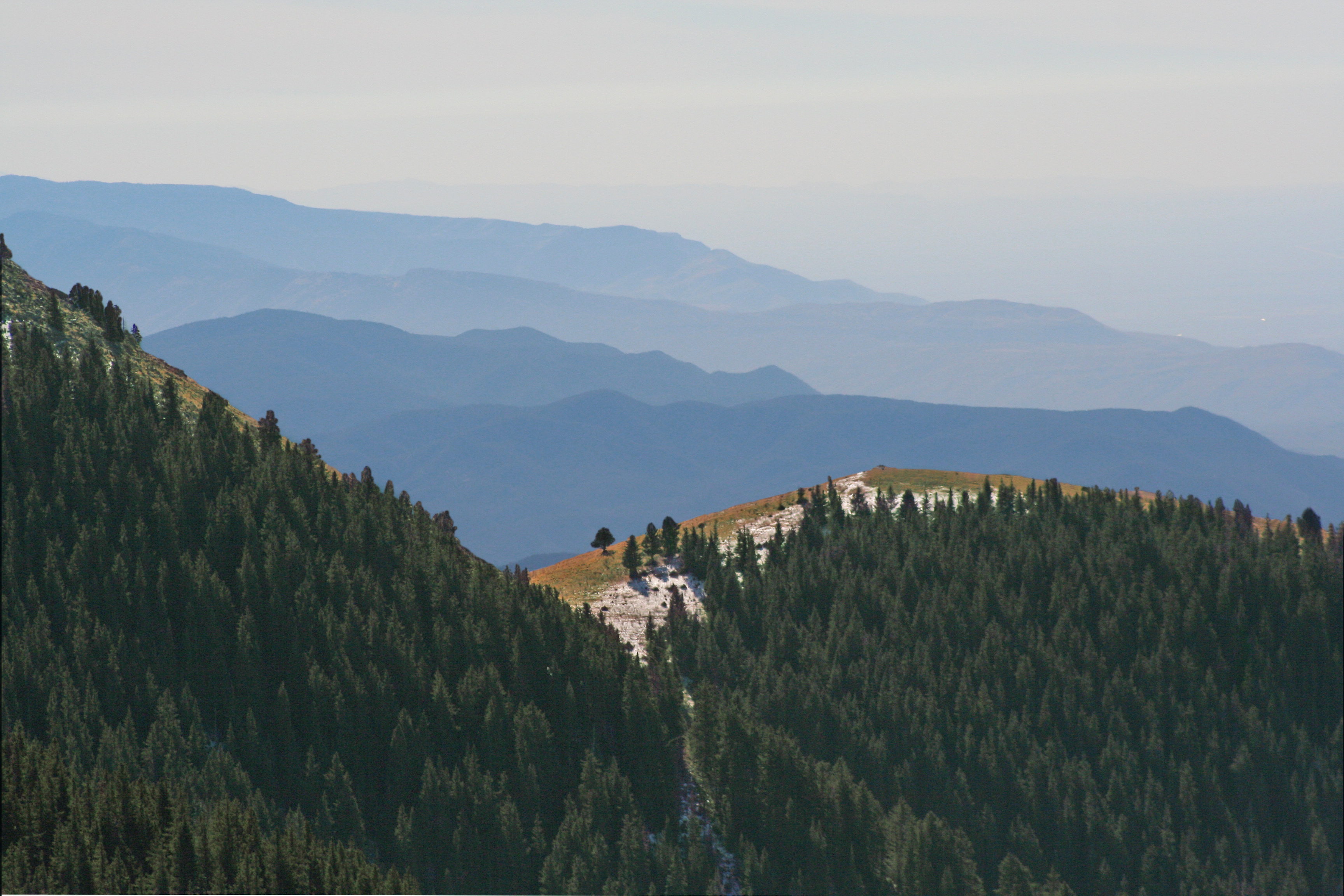
Mountain Towns and Forest Retreats
The resort town of Cloudcroft sits on the western escarpment, offering escape from summer heat for residents of the lowland cities. Ruidoso perches on the northern edge, drawing visitors year-round for skiing, horse racing, and mountain recreation. Timberon anchors the southern end. The Lincoln National Forest covers much of the range, with designated wilderness areas and numerous hiking trails threading through ponderosa pine and mixed conifer forests. The National Solar Observatory occupies Sacramento Peak, taking advantage of the clear mountain air and high elevation for solar research. These mountains are the only home of two endemic plants: the Sacramento prickly poppy and the Sacramento Mountains thistle, both protected under federal endangered species laws.
Rift Valley Origins
The Sacramento Mountains mark the easternmost expression of the Rio Grande Rift system that defines New Mexico's geography. The Tularosa Basin dropped down between the Sacramentos and the San Andres Mountains to the west, separating rock layers that were once continuous. The San Andres and Sacramento ranges are geological twins, split apart by the same tectonic forces that created the Rio Grande valley. Unlike the Sacramentos, the neighboring Sierra Blanca is volcanic in origin -- an igneous intrusion that punched through the surrounding sedimentary rock. The contrast between the limestone Sacramentos and volcanic Sierra Blanca illustrates the geological complexity packed into this corner of New Mexico.
From the Air
Located at 32.81N, 105.80W in south-central New Mexico. The Sacramento Mountains form a prominent north-south escarpment rising sharply east of the Tularosa Basin and White Sands. Visible from cruising altitude as a forested ridge contrasting with the desert floor. Cloudcroft sits on the western escarpment at approximately 8,600 feet. Sierra Blanca Peak (12,000+ feet) rises prominently to the northwest. Alamogordo-White Sands Regional Airport (KALM) lies at the base of the escarpment. Expect mountain wave turbulence along the western slopes with strong westerly winds. Summer afternoon thunderstorms are common over the peaks.