Saikazaki
They called themselves the Saiga Ikki, and they were the finest sharpshooters in sixteenth-century Japan. From this rocky cape jutting into the Kii Channel, a confederation of warriors armed with matchlock arquebuses held off the armies of Oda Nobunaga himself -- the warlord who was conquering the rest of the country. Today Saikazaki is a drowsy fishing village on the southwestern edge of Wakayama City, its narrow alleys threading between houses stacked on steep hillsides, earning it the nickname "Japan's Amalfi." But climb to the old lighthouse on the bluff the locals call the Hawk's Nest, look out across the channel toward Awaji Island and the distant coast of Shikoku, and you begin to understand why anyone who controlled this headland controlled the trade routes of the Inland Sea.
The Gunners of Kii
The Saiga Ikki were part of the Ikko-ikki movement, communities of warrior-monks, farmers, and merchants who rejected feudal rule and governed themselves. What made the Saiga forces exceptional was their early and enthusiastic adoption of firearms. Shortly after Portuguese traders introduced matchlock guns to Japan in 1543, gunsmiths in Kii Province began manufacturing their own. Under the leadership of Suzuki Magoichi -- known as Saiga Magoichi -- the confederation amassed thousands of arquebuses, an arsenal that made them disproportionately dangerous for their numbers. Saikazaki served as their headquarters, a natural fortress where steep bluffs and open sea lanes gave them both defensive advantage and access to maritime trade. When Nobunaga invaded Kii Province in 1577, the Saiga Ikki's guerrilla tactics and withering gunfire stopped him cold. It took his successor, Toyotomi Hideyoshi, and a massive army to finally break the confederation in 1585.
The Last Natural Shore
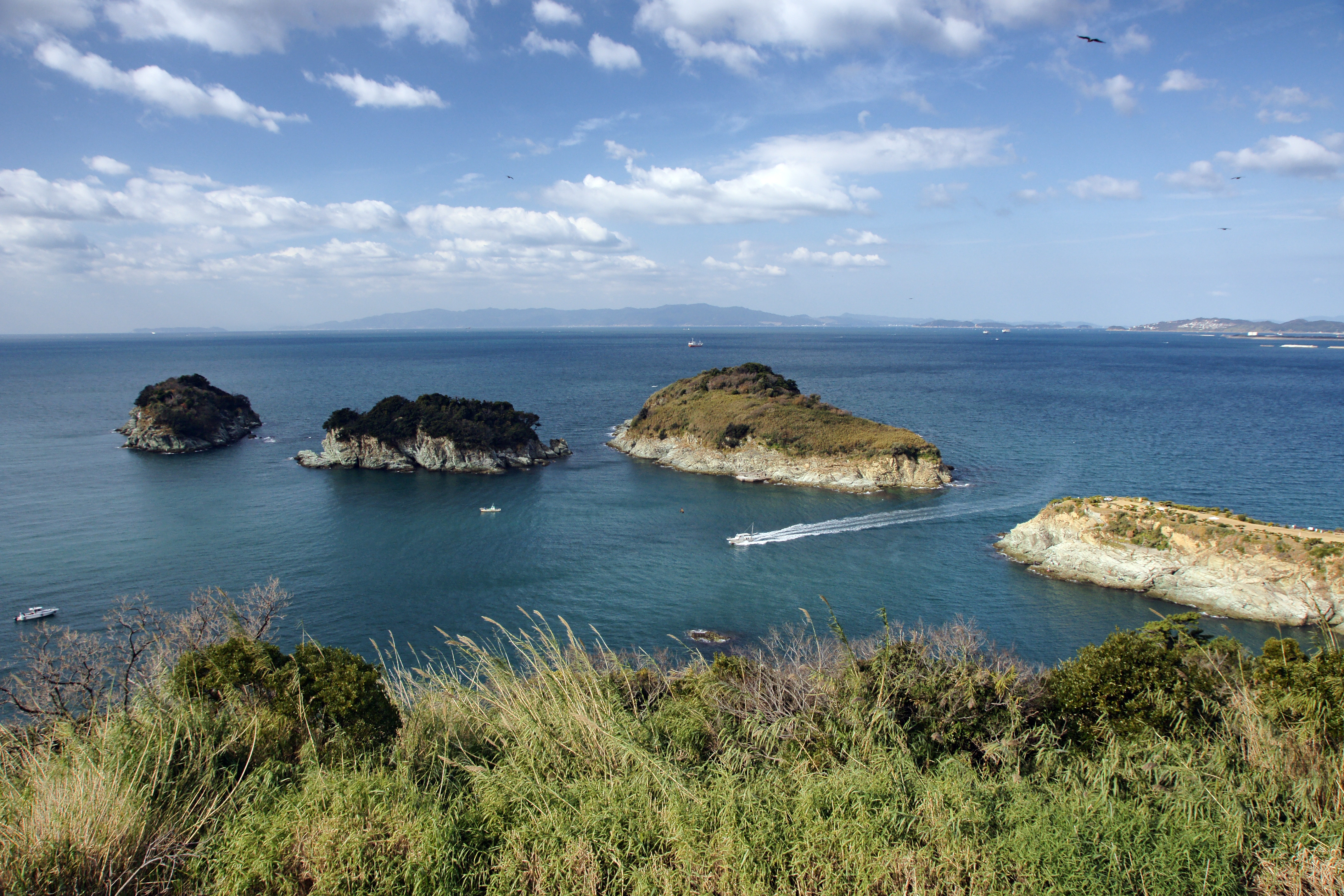
The Wakaura coastline surrounding Saikazaki was once considered among the most beautiful in Japan. In 1950, it ranked first in a national poll of scenic destinations. Then the development boom of the 1970s arrived, and concrete seawalls and resort construction consumed nearly every stretch of natural shore. Saikazaki alone survived. Protected as part of Setonaikai National Park, this cape preserves the only natural coastline remaining in the Wakaura region. The bluffs drop sharply to the water, and from the promontory you can see the scattered islands of the channel -- Tomogashima, Oojima, Nakanoshima, and the twin Futagojima Islands -- strung across the blue water like stepping stones.
Sentinel on the Hawk's Nest
A lighthouse stands on the highest point of the cape, a bluff called Takansu -- the Hawk's Nest. Established by Wakayama City on March 31, 1960, with an upper section housing a beacon installed by the Japan Coast Guard, the Saikazaki Lighthouse commands views in every direction. To the west, the Kii Channel stretches toward Shikoku. Below, the small peninsula of Bandoko no Hana extends into the water. During the Edo period, this finger of land served the Kishu Domain as a lookout post, its sentries watching for unauthorized ships in a nation sealed shut under the policy of sakoku. The Bandoko Garden, a traditional Japanese garden, still graces the peninsula today, a remnant of the domain's cultivated presence at this strategic point.
A Maze of Alleyways
The fishing village that grew up around the cape is as old as the Muromachi period, when net fishermen established the first permanent settlement. Today, Saikazaki's houses climb the hillsides in tight, stacked rows connected by narrow lanes and steep stone stairways that wind like a maze. The resemblance to the cliffside villages of Italy's Amalfi Coast is striking enough to have earned Saikazaki the title of "Japan's Amalfi." Down at the harbor, the tradition of hata uri continues -- fishermen selling their catch directly from stalls lined up in front of their boats, the morning's haul from the Kii Channel laid out for buyers who arrive before dawn. Professional chefs and ordinary families crowd the same docks, competing for the freshest fish at the water's edge.
From the Air
Located at 34.19N, 135.14E on the southwestern coast of Wakayama City. The cape is identifiable from the air by its position at the end of a hilly peninsula jutting into the Kii Channel, with the Saikazaki Lighthouse visible on the bluff. The fishing harbor sits on the eastern side of the promontory. Tomogashima Islands are visible to the southwest. Nearest major airport: Kansai International Airport (RJBB), approximately 40nm north. Nanki-Shirahama Airport (RJBD) lies approximately 50nm south. Best viewed at 2,000-3,000 feet for coastline detail. The Kii Channel provides a clear visual reference running north-south between Honshu and Shikoku.