Saint Croix State Park
One hundred and sixty-four structures built by young men of the Civilian Conservation Corps and the Works Progress Administration still stand in Saint Croix State Park, making it the largest collection of New Deal projects in Minnesota. That number alone would justify the park's 1997 designation as a National Historic Landmark. But the structures are only part of the story. At 33,895 acres, Saint Croix State Park is the largest in Minnesota's state park system, following the St. Croix River for 21 miles and encompassing the final 7 miles of the Kettle River before it joins the St. Croix. The scale is not decorative -- it reflects the ambition of a Depression-era program that took exhausted farmland and logged-over pine forest and remade it into something meant to endure.
Ice, Water, and Thirty Types of Soil
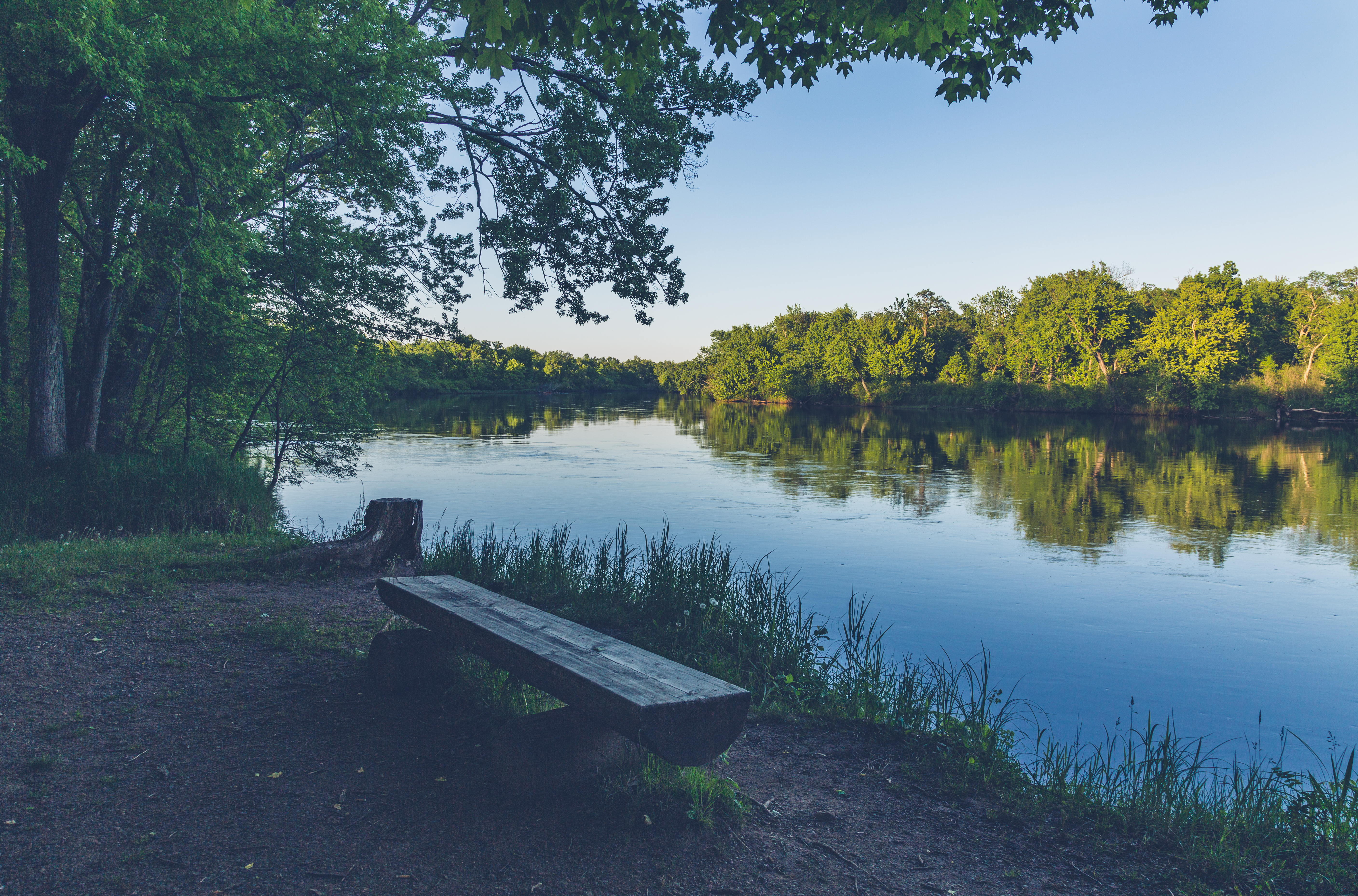
The St. Croix River Valley owes its shape to the last glacial period. Around 10,000 BC, meltwater from retreating ice sheets carved the valley and deposited a remarkable variety of sediments -- over thirty different soil types exist within the park's boundaries, ranging from very sandy compositions to deposits of red and yellow clay. The park sits on the eastern edge of the Mille Lacs Uplands, a landscape originally dominated by towering red and white pines. Logging stripped those forests in the nineteenth century, and farming further altered the vegetation. But the combination of river corridors, upland forests, and varied soils has allowed a diverse ecosystem to reassemble. The Kettle River, designated a State Wild and Scenic River, cuts through the park's western section before emptying into the St. Croix, itself a National Scenic Riverway. Two nationally recognized wild rivers converging in a single park is a rare distinction.
From Fur Posts to Federal Ambition
Before European settlement, the Dakota people inhabited this stretch of the St. Croix Valley, though they were eventually displaced by the Ojibwe. French fur traders established a trading post within what is now the park, part of the extensive commercial network that followed the river system through the northern woods. By the early twentieth century, logging and farming had exhausted much of the land's productivity. The federal government saw an opportunity. In the 1930s, an initial 18,000 acres were transferred to the U.S. Department of the Interior, and Saint Croix became one of the nation's Recreational Demonstration Areas -- experimental projects where the National Park Service directed CCC and WPA crews in transforming marginal land into public recreation spaces. It was, in its own quiet way, a radical idea: that worn-out land could be given back to the people who had worn it out.
Camp Yellowbanks and the Builders
The CCC camp at Yellowbanks became the base of operations. Company 2762 arrived first, followed by Company 2706, and together these crews built the infrastructure that defines the park to this day. Using sandstone quarried from within the park and lumber from its recovering forests, they constructed roads, bridges, picnic shelters, cabins, and a fire tower that still stands as one of the park's signature landmarks. That tower rises high enough above the canopy that visitors today can climb its 134 steps to the cab, where interpretive signs describe the layers of forest habitat visible below and the features of the surrounding countryside. The tower was staffed during fire season until 1981, when aerial surveys replaced human lookouts. The 164 surviving structures represent not just functional architecture but a philosophy of design -- the National Park Service rustic style that used natural materials to make human construction feel like an extension of the landscape rather than an imposition upon it.
Trails, Rivers, and a Storm's Reminder
The park's trail network opens the landscape to hikers, horseback riders, mountain bikers, cross-country skiers, and snowmobilers, with the Willard Munger State Trail passing through the full length of the park. Lake Clayton, formed where Hay Creek widens, provides a swimming beach and picnic area, and a paved trail connects it to the drive-in campground with its 211 sites across three loops. Eight group campsites, five cabins, two guest houses, and remote sites for backpackers and canoeists round out the accommodations. The park is bordered by Chengwatana State Forest to the southwest, Saint Croix State Forest to the northeast, and Governor Knowles State Forest across the river in Wisconsin -- creating a vast, nearly continuous corridor of protected land. In July 2011, a severe storm cut a swath through the park, damaging many of the historic structures. By a stroke of fate, the park was closed at the time due to the Minnesota state government shutdown, and no one was injured. The repairs that followed were a reminder that these New Deal buildings, like the forests around them, require ongoing care to survive.
From the Air
Located at 45.97°N, 92.58°W in Pine County, Minnesota, along the St. Croix River at the Minnesota-Wisconsin border. At 33,895 acres, the park appears as a large, densely forested area with the St. Croix River forming its eastern boundary. The Kettle River is visible cutting through the western portion before joining the St. Croix. Lake Clayton is a small but visible water feature within the park. The fire tower may be spotted in clear conditions. Nearest airports include St. Cloud Regional (KSTC) approximately 69 miles west, Duluth International (KDLH) approximately 76 miles north, and Minneapolis-Saint Paul International (KMSP) approximately 86 miles south. The town of Hinckley, Minnesota lies to the west. Best viewed at 3,000-6,000 feet AGL to appreciate the river corridors and the scale of the forested park against surrounding agricultural land.