Salalah
Every July, while the rest of the Arabian Peninsula wilts under temperatures that can exceed fifty degrees Celsius, something improbable happens in Salalah. The khareef monsoon arrives from the Indian Ocean, wrapping the city in mist and drizzle, dropping temperatures into the low twenties, and turning the surrounding mountains the color of wet emeralds. Hotels fill to capacity. Families from Dubai, Muscat, and Riyadh pour in by the thousands. Streets flood occasionally, the ocean churns too violently for swimming, and everyone is happy about it, because this is the coolest, greenest place on the peninsula. Long before the monsoon became a tourist attraction, though, Salalah drew the ancient world for a different reason. This was where the frankincense road began.
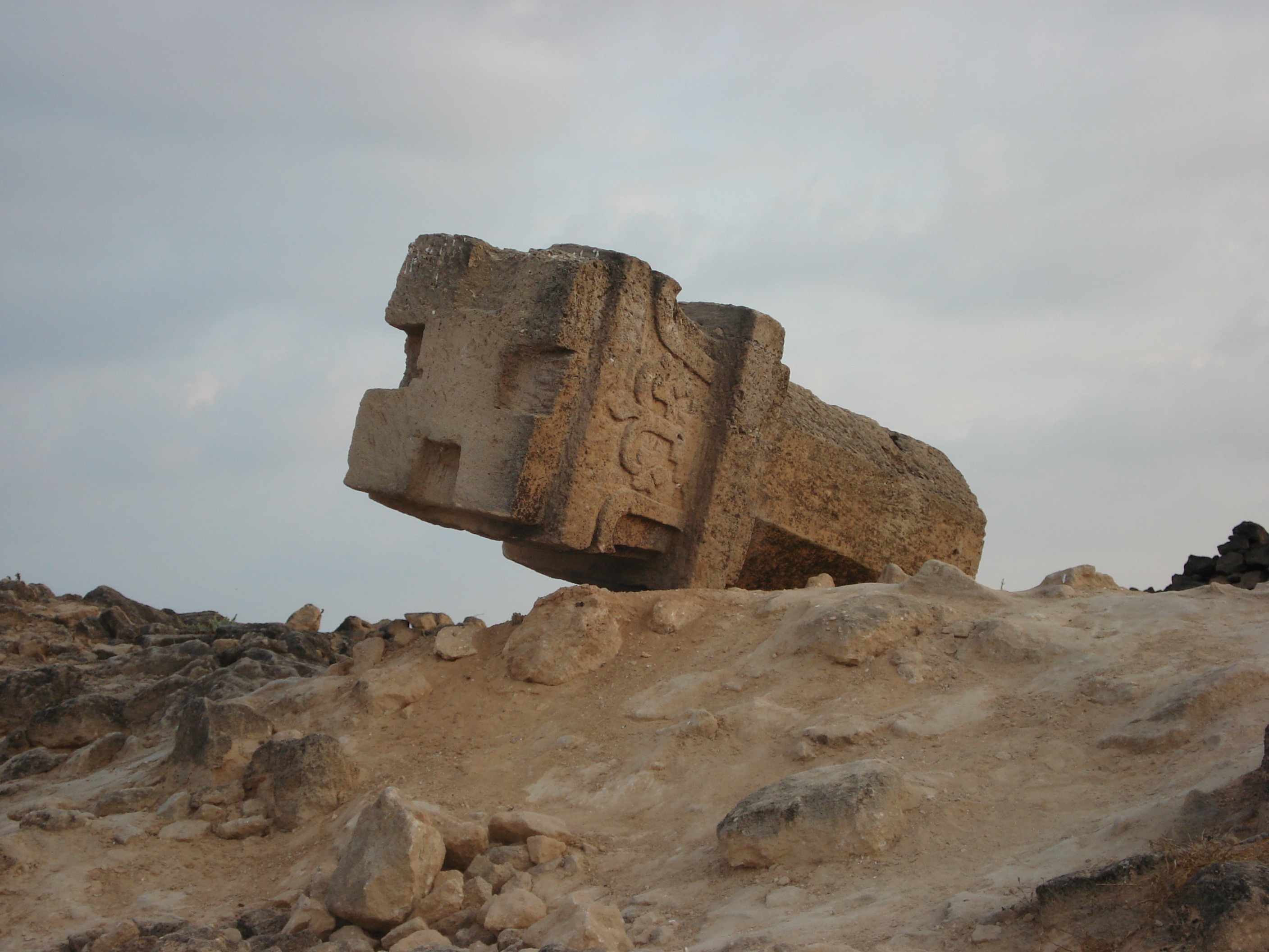
Two Thousand Years of Resin and Smoke
Salalah's history stretches back two millennia, anchored by its position on the frankincense and silk trading routes. The Boswellia sacra trees that produce the world's finest frankincense grow in the mountains above the city, and for centuries Salalah's ports served as the point where Arabian resin met ships and caravans bound for Rome, Persia, India, and China. Today the old city occupies Al Haffa, pressed against the seafront, where the Haffa Souq still sells frankincense in several grades sorted by color. The lightest pieces, nearly translucent white, are the most prized. Incense burners of local Dhofari clay sit alongside heaps of myrrh, Omani perfumes, and the khanjar, the traditional curved dagger. In the nineteenth century, the Sultanate of Muscat and Oman absorbed the region, and Salalah served as the national capital from 1932 until 1970, when Sultan Qaboos, born here in 1940, moved the seat of government north to Muscat.
The Sultan's Birthplace
Sultan Qaboos bin Said came to power in 1970, deposing his father in a palace coup that had British support and Salalah as its stage. The elder Sultan, Said bin Taimur, had kept Oman isolated and undeveloped, ruling from Salalah while the Dhofar Rebellion raged in the mountains. Qaboos reversed course dramatically, modernizing the country with oil revenues and ending the rebellion by 1976 through military force and social reform. His mother was from a prominent Jebali mountain tribe, and Qaboos maintained close ties to Salalah throughout his fifty-year reign. The city grew under his patronage, gaining an international airport with flights to Muscat, Dubai, Sharjah, Jeddah, and Doha. The drive from Muscat still takes roughly twelve hours through desert and oil fields, a journey some travelers make at night so they arrive when the city lights are visible from the high-altitude approach, glittering against the dark coastline.
Monsoon City
The khareef defines Salalah's calendar. From late June through September, the southwest monsoon brings cool temperatures, persistent drizzle, and fog that drapes the Dhofar Mountains in shifting veils. Wadis fill with water. Waterfalls appear where dry rock faces stood weeks earlier. The annual Salalah Festival runs through the monsoon months, drawing visitors from across the Gulf who come to escape heat that makes outdoor life elsewhere punishing. Hotel prices spike, rental cars vanish from agency lots, and the population swells. Ocean currents turn dangerous, closing diving and swimming until October, when the rains retreat and a different season takes hold. The dry months from October through May are optimal for diving and birdwatching. Dhofar is an important stopover for migratory birds, and the coastline east toward Mirbat offers dive sites with coral reefs and shipwrecks. May and June, before the monsoon's arrival, are brutally hot, the city holding its breath for the relief that the rains will bring.
Coconuts, Cobras, and the Coast Road
Outside the monsoon season, Salalah settles into a quieter rhythm. Roadside vendors sell fresh coconuts, lopping the tops off green husks with a machete for a few hundred baizas. The corniche along Al Haffa stretches beside the sea, and Al Baleed Archaeological Park preserves the ruins of a medieval trading port. West of the city, Highway 47 leads to Mughsayl, where blowholes shoot seawater through cavern openings during high tide and a five-kilometer beach stretches below shaded picnic shelters. East on Highway 49, the coastal road runs through Taqah to Mirbat, passing archaeological sites and fishing villages where baobab trees grow in the wadis. Salalah serves as the base for all this exploration because lodging outside the city is scarce. The city itself is compact enough to walk in cooler months, though taxis are plentiful and unmetered, requiring the usual Omani skill of negotiating a fare before climbing in.
Gateway to the Empty Quarter
Salalah faces the Indian Ocean, but it backs up against one of the most forbidding landscapes on Earth. The Rub al Khali, the Empty Quarter, begins just north of the Dhofar Mountains and stretches into Saudi Arabia, a vast sand sea that Wilfred Thesiger crossed in the late 1940s with Bedu guides from this region. The contrast defines the place. Stand on the coast and you smell salt air. Drive an hour north and there is nothing but sand and silence. Salalah exists at this boundary, a city defined by what lies on either side: the ocean that carried its frankincense to the world, and the desert that isolated it from northern Oman for centuries. That isolation shaped a distinct culture, with Jebali mountain languages unrelated to Arabic and ethnic ties reaching across the Indian Ocean to Zanzibar and East Africa. Salalah is Omani, but it is its own kind of Omani, and the monsoon that sets it apart from the rest of the peninsula is only the most visible sign of a deeper distinctiveness.
From the Air
Salalah is located at 17.02N, 54.09E on the southern coast of Oman. The city is visible as a coastal settlement backed by the Dhofar Mountains, with the Arabian Sea to the south. Salalah Airport (OOSA) is the primary gateway, located northwest of the city center. During the khareef (June-September), expect low cloud cover and reduced visibility over the coastal mountains. The contrast between green coastal slopes and tan desert interior is striking from altitude. Thumrait Air Base (OOTH) is approximately 80 km to the north. Best viewed at 3,000-5,000 feet AGL to see the city's relationship to coast, mountains, and desert.