Salar de Atacama
From 2,300 meters elevation, the Salar de Atacama stretches toward a wall of volcanoes that look close enough to touch but stand 50 kilometers away. Licancabur's perfect cone, Lascar's active crater, Acamarachi's broad shoulders — they line the eastern horizon like sentries guarding a basin that has no outlet, no river flowing to the sea, no escape for the water that trickles in from snowmelt and springs. Everything that enters stays, and over millions of years that patient accumulation has produced Chile's largest salt flat and one of the richest lithium deposits on the planet. What looks from the air like a white void is, in geological and economic terms, anything but empty.
A Basin That Keeps Its Secrets
Salar de Atacama occupies an endorheic basin — a closed depression with no drainage to the ocean. The Andes wall it in from the east, while the Cordillera de Domeyko seals the west. The volcanoes along the eastern rim — Licancabur, Acamarachi, Aguas Calientes, and Lascar, one of Chile's most active — form a north-south line that separates the salar from smaller basins beyond. Water enters through snowmelt, groundwater seepage, and streams that lose themselves in the salt before reaching any center. The geology beneath the surface tells a story measured in hundreds of millions of years: ancient plutonic rocks of Cambrian and Ordovician age crop out to the south, remnants of the Famatinian orogeny. Volcanic and sedimentary layers from the Late Cretaceous through the Late Eocene record a time when volcanism occurred west of the basin rather than east, making it a back-arc basin before tectonic forces rearranged the Andes into their current configuration.
White Gold Beneath the Crust
Lithium has transformed the Salar de Atacama from a geographical curiosity into a strategic resource. The brines beneath the salt crust contain some of the highest concentrations of lithium found anywhere, and as of 2017 the salar provided roughly 36 percent of the world's lithium carbonate supply. Two companies dominate production: Sociedad Quimica y Minera (SQM) and Albemarle, both among the largest lithium producers globally. Their process begins with pumping salty brine from beneath the surface into vast evaporation ponds, where the Atacama sun does most of the work. Over 12 to 18 months, water evaporates and lithium concentration rises to approximately 6 percent. The enriched brine is then trucked to processing plants near Antofagasta on the coast — Planta Salar del Carmen and Planta La Negra — where it becomes lithium carbonate, lithium hydroxide, and lithium chloride destined for batteries, ceramics, and pharmaceuticals worldwide.
The People Who Were Here First
Long before lithium had a name, the Likan Antay — the Atacama people — inhabited the margins of this basin. The town of San Pedro de Atacama, 55 kilometers north of the salar, has been a human settlement for thousands of years, and the indigenous communities maintain a complex and evolving relationship with the mining that now defines their homeland. The Likan Antay have a history of both opposing lithium extraction and negotiating for shared benefits with the companies that profit from it. Water is at the heart of the tension. In a landscape where every drop matters, the pumping of brines and the drawdown of aquifers raise questions that economics alone cannot answer. Boron is also extracted from the brines as boric acid, adding another layer of industrial activity to a basin that was already under pressure.
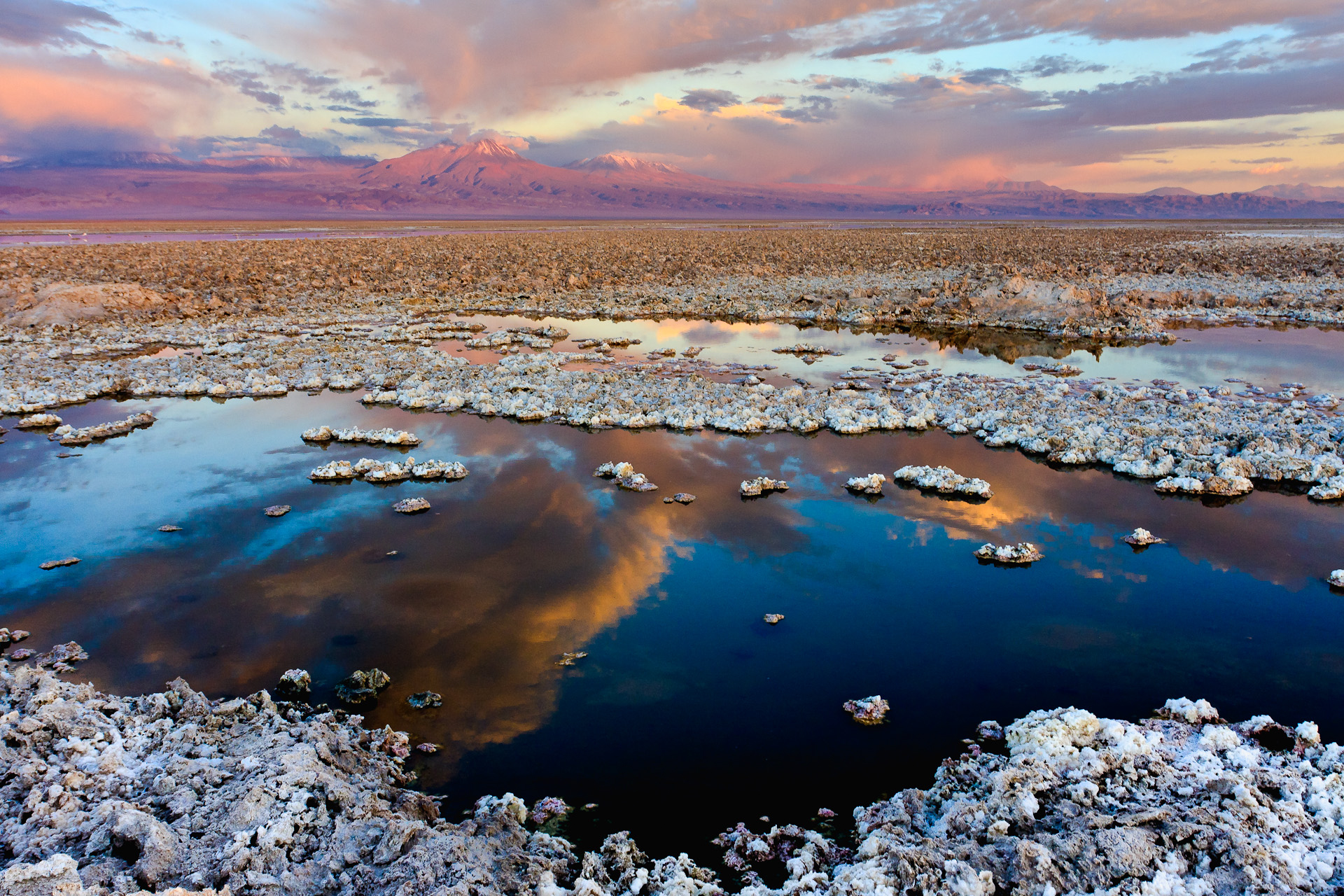
Flamingos and Deep Time
Despite its harshness, the Salar de Atacama supports life. Andean flamingos wade through the shallow lagoons that form along the salar's edges, their pink plumage incongruous against the white and brown landscape. Laguna Cejar, near the salar's margin, is so saline that swimmers float effortlessly on its surface. The salt flat sits within a larger depression that Chilean geographer Reinaldo Borgel called "La gran fosa" — the great pit — bounded by north-south geological structures that have controlled the basin's shape for tens of millions of years. This is a landscape where geological time is visible: thrust faults have pushed Late Paleozoic rocks over younger formations, and the volcanic line to the east continues to reshape the terrain with each eruption from Lascar, which last produced a significant explosion in 1993.
The View from Overhead
From altitude, the Salar de Atacama reads as a vast white patch set between two mountain ranges, its edges irregular where alluvial fans push sediment inward from the surrounding slopes. The evaporation ponds of the lithium operations stand out as geometric rectangles of varying color — turquoise, green, amber — their hues shifting as brine concentration changes. The volcanic skyline to the east is dramatic even from above: Licancabur's 5,916-meter cone, Lascar's faint plume on active days, and the chain of peaks stretching south toward Ojos del Salado. The dry air at this latitude and altitude provides visibility that extends for hundreds of kilometers, making the salar one of the most recognizable features in all of northern Chile.
From the Air
Salar de Atacama is centered at approximately 23.42°S, 68.27°W at an average elevation of 2,300 meters (7,550 feet) in Chile's Antofagasta Region. From cruising altitude, the salt flat is unmistakable as a large white expanse between the Andes to the east and the Cordillera de Domeyko to the west. Lithium evaporation ponds are visible as colored rectangles on the salar's surface. The volcanic chain along the eastern rim, including Licancabur and Lascar, provides dramatic landmarks. The nearest airport with services is El Loa (SCCF) at Calama, approximately 100 km to the north. San Pedro de Atacama lies 55 km north of the salar. Visibility is typically excellent due to extreme aridity.