Salvador Metro
The contract said the trains would run in 2003. They ran in 2014 - eleven years late, two weeks before Brazil hosted the opening of the FIFA World Cup. For a city of 2.4 million people, Salvador's metro is startlingly modest: 38 kilometers of track, 22 stations, two lines that meet at a single junction on the high ridge above the Bay of All Saints. It is easily the most useful train in Bahia, and one of the more honest monuments in Brazil to what happens when urban infrastructure meets political turnover, land tenure disputes, and a terrain that rises a hundred meters straight out of the harbor.
Eleven Years Late
The World Bank had been working with Salvador and the state of Bahia on an urban transportation strategy since 1992. The first line, running 11.9 kilometers from Pirajá in the north down to the underground Lapa station in the commercial center, was scheduled to open in 2003. It did not. Construction stalled, restarted, stalled again. A consortium of Siemens, Camargo Corrêa, and Andrade Gutierrez had done the work. The Spanish firms CAF, Dimetronic, and ICF took over the concession under a Build-Operate-Transfer contract - 25 years of operation in exchange for supplying the rolling stock and signaling. Line 1 finally opened, partially, in June 2014. The rest of the system followed in stages through 2018, with an extension to Águas Claras arriving only in 2023. For two decades, buses carried almost all of Salvador's commuters - an average commute of 94 minutes one way, according to transit data, with a third of riders spending more than two hours a day on buses.
Geography Makes You Pay
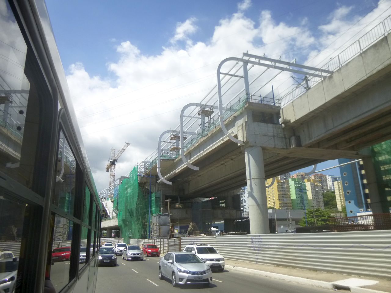
Salvador is built on a peninsula that rises a hundred meters out of its harbor. The old colonial city sits on top of the cliff; the port and the modern commercial downtown sit below. That vertical geography is why the Lacerda Elevator, inaugurated in 1873, is still one of the city's primary pieces of infrastructure - it moves people between the upper and lower cities in 22 seconds. It is also part of why a subway here is hard. The initial 1.4 kilometers out of Lapa station is in tunnels; then the line emerges onto elevated viaducts (Brotas station, which serves the Fonte Nova stadium, is elevated) and finally drops to at-grade tracks at Acesso Norte and Retiro. Line 2 branches east at Acesso Norte and runs to Lauro de Freitas, passing through Salvador Bahia International Airport - the one metro-to-airport link in northeastern Brazil.
Who the Train Serves
The official language of the project, from the World Bank documents onward, is about "connecting currently excluded low-income neighborhoods." That is not rhetoric. Pirajá, at the northern end of Line 1, sits amid some of the lowest-income parts of Salvador - the same neighborhoods that Pelourinho's 1990s gentrification displaced people into. A 25-year concession on a metro is a promise, however imperfect, that people in those neighborhoods can get to Lapa and Campo da Pólvora (the stop 900 meters from Pelourinho) and to the airport for the R$3.70 fare, with two bus transfers included on a single card. The suburban line from Calçada to Paripe, a 14-kilometer railway that has never connected with the Metro, is being converted into a 36.4-kilometer light rail - 34 stations, scheduled for 2028 - that will finally knit the coastal suburbs into the system. Each four-car train on the Metro holds 1,250 passengers. On a weekday, they run full.
From the Air
The Salvador Metro runs through the city of Salvador at roughly 12.98°S, 38.49°W, primarily above ground once it exits the short tunnel out of Lapa station. Line 2's terminus at Salvador Bahia International Airport (SBSV) is visible from the northeast approach. The elevated Brotas station runs alongside the white shell of the Itaipava Arena Fonte Nova, a useful landmark for VFR arrivals tracking inland toward the historic center. Weather is tropical year-round, with afternoon rain showers common during the April-June wet season.