Samuraizuka Kofun
In 1692, a powerful feudal lord named Tokugawa Mitsukuni ordered his men to dig into two enormous earthen mounds on the right bank of the Naka River. Mitsukuni was the grandson of Tokugawa Ieyasu, founder of the shogunate that ruled Japan, and he was obsessed with compiling a definitive history of the nation. He had reason to believe these mounds held the answer to a local mystery: a stone stele dated 689 AD, discovered in a shrine in nearby Otawara, listed the names of ancient rulers of the Nasu district stretching back to the fifth century. One name in particular caught his attention -- Ataiide, a Kuni no miyatsuko, or provincial governor, from the Kofun period. Mitsukuni suspected the mounds were his tomb. What his excavators found inside -- bronze mirrors, fragments of iron armor, cylindrical beads, and iron balls -- confirmed that whoever lay buried here had wielded real power. It was arguably the first systematic archaeological dig in Japanese history, three centuries before the discipline formally existed.
Shapes on the Plain
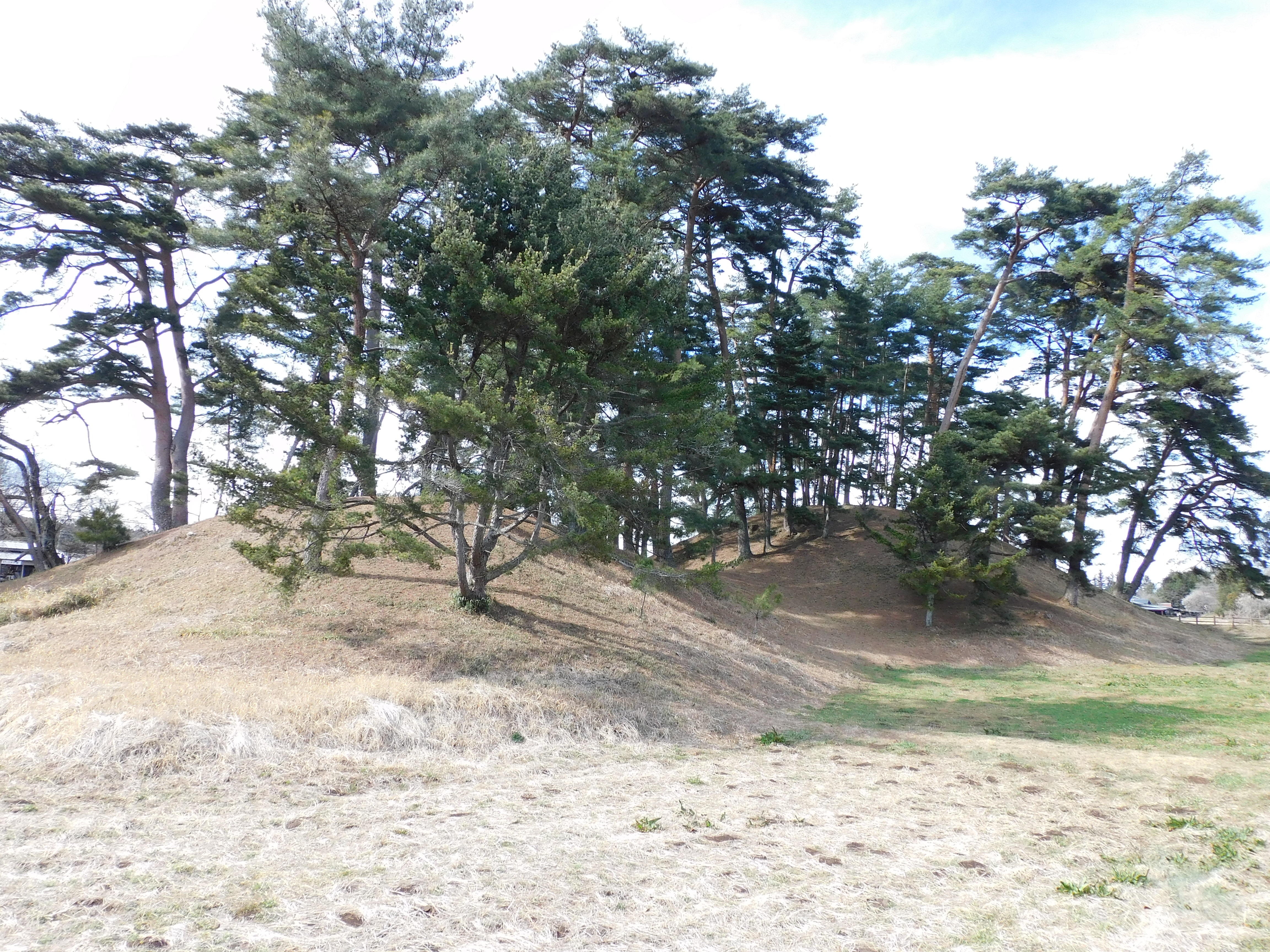
The Samuraizuka Kofun sit on the northern edge of the Kanto Plain, Japan's largest flatland, where the Naka River bends through rice paddies and low hills in Tochigi Prefecture. From the air, their form is unmistakable: the distinctive shape of zenpō-kōhō-fun, the front-square-rear-square burial mounds that define the Kofun period. The larger of the pair, Kamisamuraizuka, stretches 114 meters in total length, its rear mound rising 12 meters high and spanning 60 meters wide. The smaller Shimosamuraizuka, 700 meters to the north, measures 84 meters long and was once encircled by a moat now filled with silt and grass. Archaeologists believe Shimosamuraizuka is the older of the two, both dating to the early fifth century AD. The neighborhood of Yuzukami contains still more kofun -- a cluster of smaller mounds including seven circular tumuli and one square-shaped tomb -- suggesting this stretch of river was a burial ground for generations of local elites.
The Lord Who Dug Into History
Tokugawa Mitsukuni was not a typical feudal lord. As daimyo of Mito Domain, he devoted decades to compiling the Dai Nihon-shi, a monumental history of Japan that would eventually run to 397 volumes. His excavation of the Samuraizuka mounds in 1692 was driven by that same scholarly impulse. His team kept detailed illustrated records of every artifact recovered -- an extraordinary act of documentation for the era. After cataloging the finds, Mitsukuni had the artifacts placed in boxes crafted from Japanese red pine, returned them to the burial chambers, and ordered the mounds backfilled and left undisturbed. He attributed the tombs to the ancient rulers listed on the Nasu Kuni no miyatsuko stele. Whether or not he was right about the specific identity of the occupants, the scale and care of the burial goods -- bronze mirrors of a type reserved for powerful chieftains, iron weaponry, ornamental beads -- leave no doubt that these were people of considerable status in fifth-century Japan.
Artifacts and Echoes
The two mounds yielded different collections. Kamisamuraizuka, the larger southern tomb, contained bronze mirrors, armor fragments, cylindrical beads, and iron balls -- a burial assemblage suggesting a warrior-leader connected to trade networks that stretched across the Japanese archipelago and into the Korean Peninsula, where similar mirror types originated. Shimosamuraizuka, the older northern tomb, held bronze mirrors and iron swords alongside Haji ware pottery, the distinctive unglazed reddish ceramics that served as everyday vessels during the Kofun period. In 1975, a trench excavation tied to a land improvement project uncovered additional Haji ware shards around Shimosamuraizuka, confirming that the site had been used not just for burial but for the ritual activities that surrounded death in ancient Japan. Together, the artifacts paint a picture of a local dynasty maintaining power along the Naka River during a period when Japan itself was coalescing from a patchwork of regional chieftains into something approaching a unified state.
Guardians of the Mounds
Both Samuraizuka Kofun were designated National Historic Sites in 1951, placing them under formal government protection. The mounds remain covered in grass and trees, rising from the flat farmland like green hills that seem too symmetrical to be natural -- because they are not. The surrounding Yuzukami neighborhood, with its cluster of additional tumuli, is protected as an Otawara City Historic Site. The site is accessible by a short walk from the Sajizuka Parking Lot bus stop, served by municipal buses from Nasushiobara Station on the Tohoku Shinkansen. For all their archaeological significance, the mounds remain quiet, rarely crowded, a place where the rice paddies stretch to the horizon and the only sound is wind moving through the grass that has grown over fifteen centuries of buried history.
From the Air
Located at 36.81N, 140.12E on the northern Kanto Plain along the Naka River in Tochigi Prefecture. The zenpō-kōhō-fun mounds (front-square-rear-square) are visible from lower altitudes in clear conditions, appearing as distinctly symmetrical green hills amid surrounding farmland. Nearest airports: Utsunomiya (RJTU) approximately 50nm southwest, Ibaraki Airport (RJAH) approximately 60nm south. The Tohoku Shinkansen line runs nearby. Flat terrain with rice paddies provides clear visual reference. Expect good visibility except during summer haze or winter overcast.