San Antonio River Walk
In the late 1920s, San Antonio's plan for the prominent bend of the San Antonio River was straightforward: pave it over and turn it into a storm sewer. A disastrous 1921 flood had killed 51 people and left 23 missing, and city officials wanted the river tamed, not beautified. But a local architect named Robert Hugman had a different idea. He proposed flood gates, a small dam, and commercial development along the bend -- an outdoor marketplace he called 'The Shops of Aragon and Romula.' Officials dismissed him. The area was so dangerous it had been declared off-limits to military personnel. People warned that anyone near the river would be 'drowned like a rat.' Hugman waited. It took a decade, but in 1938, his persistence and a WPA grant finally turned a condemned river bend into what is now the most visited attraction in Texas.
A City Built Below the Street
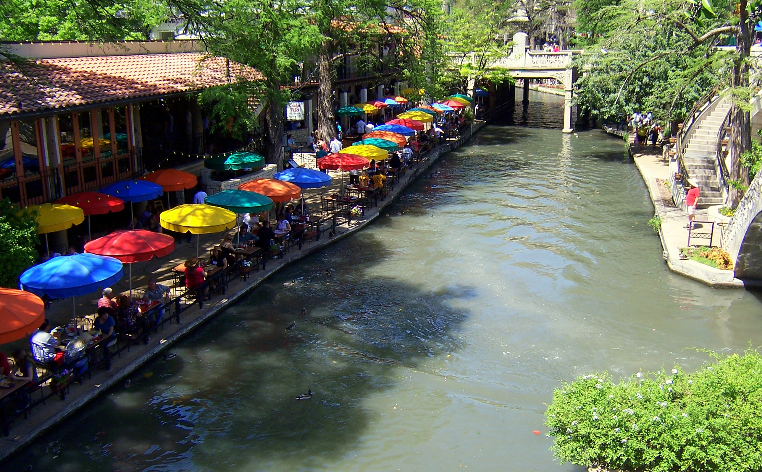
The River Walk sits one full level below the automobile streets of downtown San Antonio, creating a parallel city that most visitors experience as a sudden reveal -- one moment you are walking a standard Texas sidewalk, the next you descend a staircase into a canopied world of bald cypress trees, stone bridges, and restaurant patios hovering just above the waterline. The area within the River Walk's loop is the heart of the original 1700s Villa de Bejar outpost, the Spanish settlement that would become San Antonio. Many downtown buildings have two entrances: a street-level door for cars and deliveries, and a river-level entrance below for pedestrians. This separation of automotive and foot traffic through an intricate network of bridges, walkways, and old staircases is what gives the River Walk its peculiar intimacy -- a place where you can forget you are surrounded by a modern city.
The Flood That Started Everything
The September 1921 flood was catastrophic enough to force action. The city built Olmos Dam upstream and a bypass channel around the downtown river bend. The San Antonio Conservation Society successfully fought the plan to pave over the bend entirely, preserving the waterway that Hugman would later transform. Critical WPA funding arrived in 1939, enabling the construction of walkways, about twenty bridges, and extensive plantings. Some of the bald cypress trees planted then -- and others already several hundred years old -- now stretch their branches up to ten stories, visible from street level above. Hugman was named project architect. His engineering was tested seven years later when a major flood in 1946 threatened downtown, but the dam and bypass channel held. That same year, Casa Rio became the first restaurant to open on the water, right next door to Hugman's own office along the bend he had fought so hard to save.
Stretching the River
The River Walk expanded in bursts tied to San Antonio's ambitions. The first major extension came for HemisFair '68, when contractors excavated much of a city block to connect the original horseshoe bend to a new convention center and the Tower of the Americas. That year also saw the Hilton Palacio del Rio, the first hotel to brand itself as 'riverfront' property. A 1988 expansion created a lagoon at the Rivercenter Mall. In 2009, the $72 million Museum Reach extended the walk northward past the San Antonio Museum of Art to the Pearl Brewery complex. Two years later, the Mission Reach pushed it several miles south to Mission Espada, linking the walk to the city's five Spanish colonial missions -- all UNESCO World Heritage Sites, including the Alamo. By 2016, the River Walk connected for the first time with the San Pedro Creek Greenway, creating a network of linear urban parks that other cities have tried to replicate, from Charlotte's Little Sugar Creek Greenway to the Santa Lucia Riverwalk in Monterrey, Mexico.
Barges, Parades, and a Winter Storm
Each spring during Fiesta San Antonio, flowery floats drift down the river in the River Parade, and the San Antonio Spurs have celebrated all five of their NBA Championship victories with parades along the water. The River Walk has served as a film backdrop, too: Steve McQueen shot scenes for The Getaway here in 1972, and the so-called Selena Bridge between Navarro and North St. Mary's streets provided the romantic setting for a scene in the 1997 Selena biopic starring Jennifer Lopez. The river bottom gets an annual cleaning during the Mud Festival, when the water is drained and locals celebrate in the muck. But the River Walk's most unexpected moment came in February 2021, when a devastating winter storm crippled Texas infrastructure and San Antonio residents, desperate for water, were photographed collecting it directly from the River Walk -- the same waterway the city once tried to bury under concrete.
From the Air
Located at 29.425°N, 98.492°W in downtown San Antonio. The River Walk follows the San Antonio River's distinctive horseshoe bend, visible from the air as a green, tree-lined corridor cutting through the urban grid. The winding water path and dense tree canopy contrast sharply with surrounding streets and rooftops. Best viewed from 2,000-5,000 ft AGL. Nearest airports: KSAT (San Antonio International Airport, 8 nm N), KSSF (Stinson Municipal Airport, 7 nm S). The Tower of the Americas (750 ft) at HemisFair Park serves as a useful visual landmark at the River Walk's eastern extension.