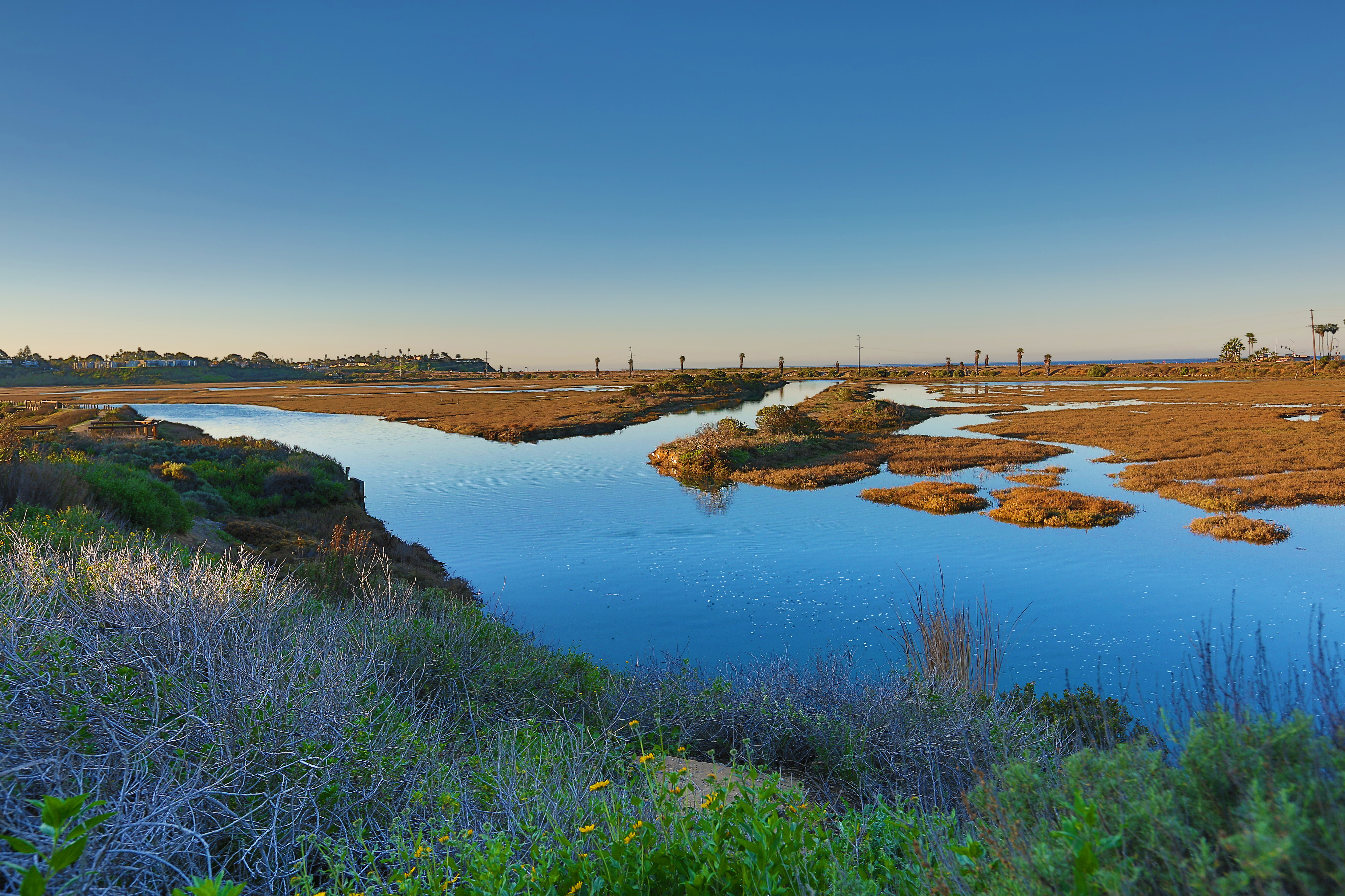
San Elijo Lagoon
Gaspar de Portolá named it 'San Alejo' in 1769 when his expedition passed through on the way north from San Diego, and the name has shifted slightly over the centuries to become San Elijo. But the Kumeyaay people who were already hunting and gathering along the lagoon's shores when Portolá arrived had their own name for this place, and had been using it for at least 8,500 years before the Spanish expedition gave the wetland a Christian saint's name. San Elijo Lagoon is one of the largest remaining coastal wetlands in San Diego County — an estuarine system that has survived railroad, highway, and freeway construction to remain a functioning habitat for more than 300 plant species and 300 bird species.
Eight Thousand Years of Use
The earliest evidence of human presence at San Elijo Lagoon dates to approximately 8,500 years before the present — Kumeyaay ancestors who recognized what a coastal marsh offers. The lagoon is a zone of transition between freshwater and saltwater, between terrestrial and aquatic habitat, between the plants and animals of the upland chaparral and those of the open ocean. This ecological edge effect creates conditions of unusual biological productivity: invertebrates, fish, and birds all concentrate here in numbers that reward the effort of hunting and gathering.
For the Kumeyaay, the lagoon was a source of shellfish, waterfowl, fish, and plant materials across the seasonal cycle. The evidence of their sustained use survives in shell middens — accumulations of discarded shells, burned bone, and other food waste — that tell archaeologists something about what was eaten and when. Eight-and-a-half millennia of continuous use represent a relationship with a place so deep that the distinction between ecology and culture becomes difficult to maintain: the Kumeyaay did not merely use the lagoon, they were part of its ecological history.
The Portolá expedition's passage in 1769 began the disruption of that relationship. The mission system that followed, the rancho system that came after, and the American development era that succeeded all progressively restricted the Kumeyaay's access to lands and resources they had used for countless generations. The lagoon itself survived because no one found it profitable to fill it completely.
Three Corridors That Changed the Water
Transportation infrastructure arrived at San Elijo Lagoon in three successive waves, each one constraining the tidal circulation that defines an estuary's ecological function. The Santa Fe Railroad's Surf Line was built across the lagoon in 1887 — the first major fixed crossing. The Pacific Coast Highway followed in 1891. Interstate 5 came in 1965.
Each crossing constricted the tidal channel connecting the lagoon to the ocean. A healthy estuary requires robust tidal exchange — ocean water flooding in at high tide, mixing with freshwater from the upland watershed, and ebbing out at low tide in a cycle that flushes accumulated organic material, maintains salinity gradients, and renews the oxygen levels that fish and invertebrates require. When transportation corridors interrupt this exchange with bridge pilings, embankments, and reduced channel cross-sections, the estuary becomes less functional.
San Elijo Lagoon, bisected by three corridors in less than eighty years, has been maintained as a functioning wetland through a combination of protective designation, active management, and the ecological resilience of estuaries that have been degraded but not destroyed. The lagoon's mouth at Cardiff State Beach is mechanically dredged each spring to prevent closure by sand deposition — a managed intervention that substitutes for the natural scouring that adequate tidal flow would provide.
The Living Wetland
Despite a century of infrastructure crossings and the development pressure of one of California's fastest-growing metropolitan areas, San Elijo Lagoon functions. The numbers are not abstractions: 300 plant species find habitat here, from the pickleweed and cordgrass of the salt marsh to the lemonade berry and sage scrub of the upland transition zone. More than 300 bird species have been recorded at the lagoon — a figure that represents approximately forty percent of all North American bird species ever documented on the continent. The sheer variety reflects the lagoon's role as a coastal stopover on the Pacific Flyway, the migratory route that channels millions of birds along the California coast each spring and fall.
A LEED Platinum nature center opened at the lagoon in spring 2009, providing educational infrastructure for visitors and research facilities for the scientists who monitor the lagoon's ecological health. The combination of a working nature center, active restoration efforts, and protective designation has given San Elijo Lagoon a degree of institutional attention that most coastal wetlands lack.
The lagoon today is neither pristine nor lost. It is what remains when an ancient wetland survives the collision with modernity — smaller than it was, more carefully managed, dependent on human decisions to maintain functions that once maintained themselves. The Kumeyaay who used it for 8,500 years would not recognize the Interstate 5 bridge that shadows part of its shoreline. But they would recognize the birds.
From the Air
San Elijo Lagoon sits at approximately 33.01°N, 117.26°W on the coast between Encinitas and Solana Beach, at Cardiff-by-the-Sea. From altitude heading south along the coast, the lagoon is visible as a distinct wetland feature immediately south of San Elijo State Beach campground, with Cardiff State Beach at its ocean entrance. The I-5 bridge over the lagoon is a prominent landmark. Nearest airports: KCRQ (McClellan-Palomar, Carlsbad, 7 miles north) and KMYF (Montgomery-Gibbs Executive, 15 miles southeast). The lagoon's wetland color contrasts visibly with the surrounding development on clear days at 2,000–4,000 feet MSL.