San Juan Expedition
A journey planned for six weeks took six months. Nobody died, and three babies were born along the way. The San Juan Expedition of 1879-1880, also known as the Hole-in-the-Rock Expedition, remains one of the most audacious overland crossings in American frontier history: more than 200 Mormon settlers, 83 wagons, and over a thousand head of livestock threading through some of the most impassable terrain on the continent, including a narrow crack in a cliff face that they blasted and chiseled into a wagon road descending to the Colorado River.
The Shortcut That Wasn't
After arriving in the Salt Lake Valley in 1847, the Mormons steadily expanded their settlements through central and southeastern Utah. In 1878, church leaders decided to establish a colony east of the Colorado River in the Four Corners area, appointing Silas S. Smith and Jens Nielson to lead the effort. Scouts identified the fertile valley of Montezuma Creek near the San Juan River as the destination. Two established routes existed: the Old Spanish Trail and a long path around the southern rim of the Grand Canyon. Both were hundreds of miles longer than a direct line through the desert. The expedition chose the direct route, reasoning they could cross the relatively gentle terrain near the Escalante River, find a way across the Colorado, and negotiate whatever lay on the other side. They had no idea what lay on the other side.
Blasting a Road Through Stone
In the fall of 1879, the expedition assembled at a spring at the head of Fortymile Gulch, between the deep canyons of the Escalante River Basin and the cliffs of the Kaiparowits Plateau. An advance party scouted ahead for a river crossing and found it at a place where a narrow crevice in the cliff face offered a potential descent to Glen Canyon and the Colorado River. They named it Hole-in-the-Rock. The crevice was far too narrow for wagons, barely wide enough for a person to squeeze through. For several months, working with hand tools and black powder, the settlers widened the slot, carved anchor points into the rock, and built wooden tracks along the steepest sections. It was brutal, precise work in freezing winter conditions, transforming a geological crack into something just barely passable.
The Descent Nobody Forgot
On January 26, 1880, the main expedition began lowering itself through the Hole-in-the-Rock. People and livestock climbed down the crevice on foot. Wagons descended with brakes locked while 10 to 20 men gripped ropes to control the speed. A wooden trackway at the bottom provided passage around a boulder-choked gulch. Expedition member Kumen Jones later wrote that he hitched his well-broken team to B. Perkins' wagon and drove it down through the hole, with long ropes and men holding fast to prevent any accident. By January 28, most wagons had crossed the river on a wooden ferry built by Charles Hall. A third of the expedition had made the descent on the very first day. The perilous route claimed not a single life.
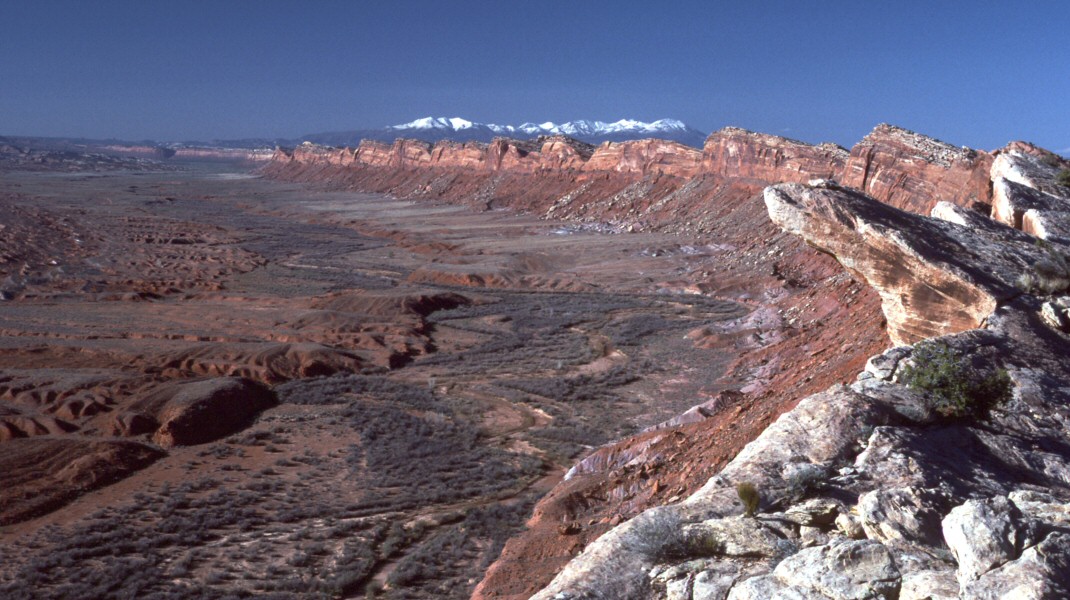
The Maze on the Other Side
The real hardship began east of the Colorado. A labyrinth of canyons, mesas, and cliffs extending between the Colorado and San Juan Rivers made the terrain nearly impassable. The deep slot canyons of Grand Gulch forced the expedition far to the north, adding weeks to the journey. Finally they reached Salvation Knoll atop Cedar Mesa, near present-day Natural Bridges National Monument, and could see an easier slope leading down into Comb Wash. From there they traveled south toward the San Juan River. Exhausted and just twenty miles short of their original destination at Montezuma Creek, the expedition halted in April 1880 and founded the community of Bluff, Utah. The settlement endured.
A Road Used Once and a Legacy That Lasted
The Hole-in-the-Rock route served as a supply road for just one year before Charles Hall moved his ferry to an easier crossing further north, at what became known as Halls Crossing. The route was simply too difficult for regular use. But the expedition's story endured far longer than its road. John Ford loosely based his 1950 film Wagon Master on the journey. Gerald N. Lund's historical novel The Undaunted brought the expedition to a new generation of readers. Today the Hole-in-the-Rock Trail is managed by the Bureau of Land Management, and the original slot in the cliff face, now overlooking Lake Powell rather than the free-flowing Colorado, remains one of the most dramatic historical sites in the American West. The crack in the rock still tells the story of people who chose the hard way through and made it.
From the Air
The Hole-in-the-Rock site is located at approximately 37.26N, 110.90W on the western shore of Lake Powell in southeastern Utah. From altitude, the expedition's route traces a line from the Escalante River area southeast through Glen Canyon to Cedar Mesa and Comb Wash. The Hole-in-the-Rock slot is visible as a narrow notch in the cliff face above Lake Powell. Nearby landmarks include Natural Bridges National Monument and the town of Bluff. Nearest airports include Blanding Municipal (BDG) and Page Municipal (PGA) approximately 50 nm to the southwest.