San Luis National Wildlife Refuge
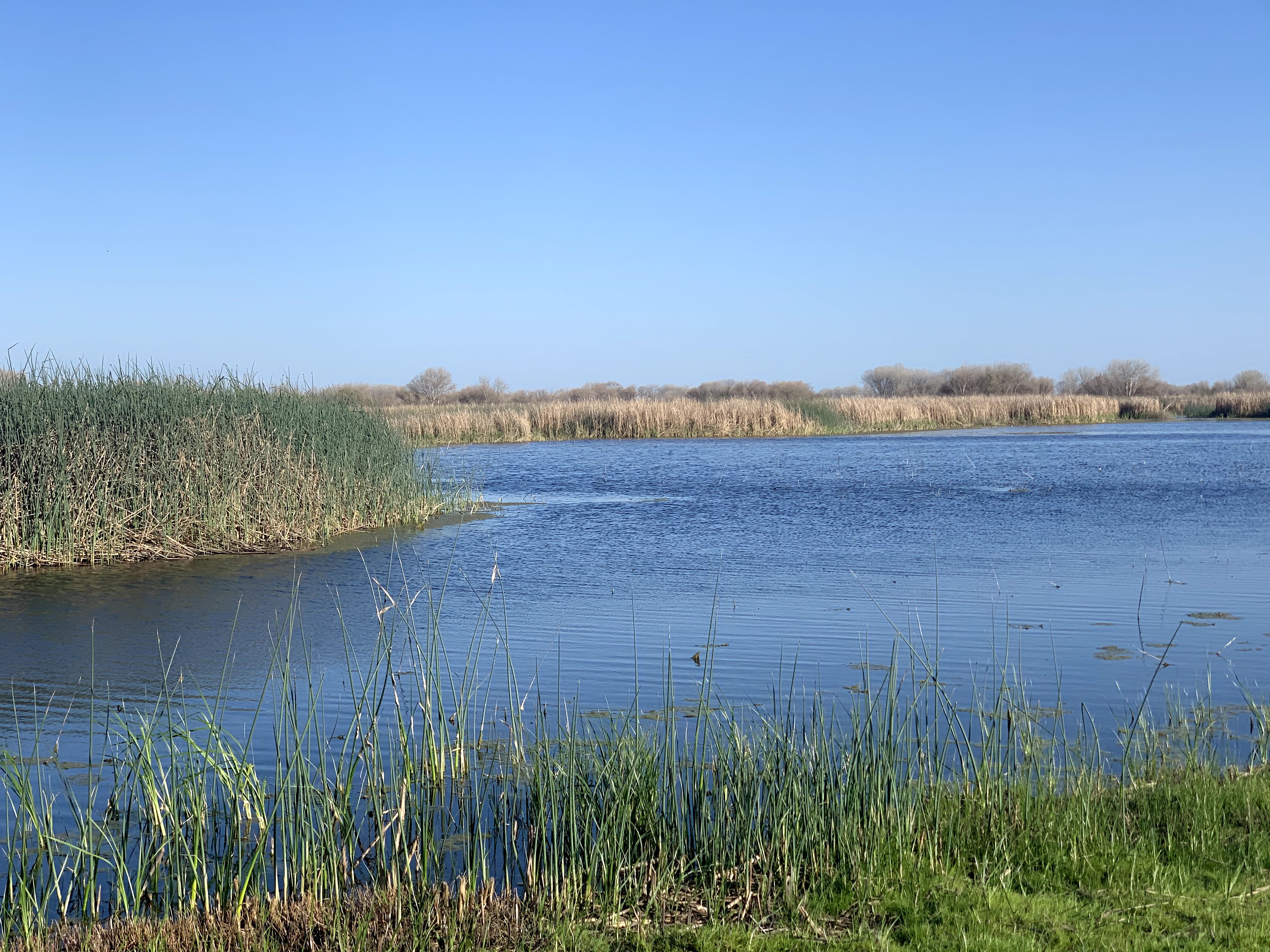
Before irrigation transformed California's Central Valley into the most productive farmland on earth, the San Joaquin River sprawled across its floodplain in a tangle of channels, oxbow lakes, and seasonal marshes that stretched for miles. Almost all of that is gone now. But in the Bear Creek and Salt Slough floodplain of Merced County, a remnant survives. The San Luis National Wildlife Refuge preserves thousands of acres of wetlands, native grasslands, and vernal pools that look remarkably like the valley did before the canals arrived, and it hosts a cast of wildlife that suggests just how much the rest of California has lost.
Last of the Valley's Wild Grasslands
What makes San Luis exceptional is not just its wetlands but its grasslands. The refuge contains the most extensive network of pristine native grasslands, shrubs, and vernal pools still remaining anywhere in the Central Valley. This matters because the valley's original grassland ecosystem has been almost entirely erased. More than 95 percent of the Central Valley's native habitat has been converted to agriculture, cities, or pastureland. The grasslands at San Luis are a living reference for what once covered thousands of square miles, from the Sacramento Valley in the north to the Tehachapi foothills in the south. Vernal pools dot the higher ground, filling with winter rain and supporting communities of plants and invertebrates found nowhere else. In spring, the pools dry in sequence, each one surrounded by rings of wildflowers that mark the receding waterline like bathtub rings of color.
Wings Over the Floodplain
When the managed wetlands flood each autumn, the refuge becomes one of the Pacific Flyway's most important staging areas. Thousands upon thousands of mallards, northern pintails, green-winged teal, and ring-necked ducks pour into the marshes from breeding grounds across western North America. Wood ducks live year-round in the tree-lined slough channels, the males unmistakable with their iridescent green and chestnut plumage. Great blue herons and snowy egrets nest in mature valley oaks and willows along the waterways, stalking frogs and crayfish in the shallows below. Hawks patrol the grasslands. Burrowing owls stand sentry at the mouths of ground squirrel burrows. Songbirds fill the riparian corridors with sound. The diversity is a direct result of the refuge's mosaic of habitats: open water, emergent marsh, riparian woodland, grassland, and seasonal pools, each attracting species the others cannot support.
The Elk That Almost Disappeared
Among the refuge's most remarkable residents is a herd of tule elk, the smallest subspecies of American elk and a species once thought to be extinct. Tule elk are native to the Central Valley and the coastal marshes of California. Before European settlement, herds numbering in the hundreds of thousands grazed the same grasslands and tule marshes that the refuge now protects. By 1870, market hunting and habitat loss had reduced the entire species to a small remnant herd of fewer than thirty animals, discovered on a cattle ranch in the southern San Joaquin Valley. From that pair, and from careful management over the following century, tule elk have been reintroduced to scattered sites across their former range. The herd at San Luis represents one of these recovery populations, grazing the native grasslands where their ancestors once roamed in numbers that darkened the valley floor. Watching them move through the late-afternoon light, their antlers catching the sun, it is easy to forget how close the species came to vanishing entirely.
Kesterson's Shadow
Not far from San Luis lies the Kesterson National Wildlife Refuge, or what remains of it. In the 1980s, Kesterson became a national scandal when selenium-contaminated agricultural drainage water poisoned the wetlands, causing grotesque deformities in nesting birds and killing fish by the thousands. The reservoir was closed to wildlife use and eventually sealed. Today, the Kesterson Reservoir sits within the boundaries of San Luis National Wildlife Refuge, a sobering reminder of how quickly managed landscapes can turn toxic when the water that feeds them carries the wrong chemistry. San Luis itself has avoided Kesterson's fate through careful water management, drawing from different sources and monitoring contaminant levels. But the proximity of the two refuges tells a larger story about the Central Valley: in a landscape where every drop of water has been engineered, the difference between sanctuary and disaster can come down to which canal feeds which marsh.
From the Air
San Luis National Wildlife Refuge lies at 37.1999N, 120.801W in the San Joaquin Valley floodplain. From the air, the refuge's wetlands and tree-lined slough channels are clearly visible as dark green corridors winding through the agricultural grid, particularly when surrounding fields are bare in winter. Best viewed at 2,000-4,000 feet AGL. The nearest airports are Castle Airport (KMER) approximately 15 nautical miles northeast and Los Banos Municipal Airport (KLSN) about 12 nautical miles southwest. The adjacent Merced National Wildlife Refuge lies roughly 10 miles to the east. In autumn and winter, large concentrations of waterfowl may be visible as dense flocks on the managed wetlands.