San Salvador de Jujuy
On May 25, 1813, in the covered galleries of the Cabildo on the corner of Belgrano and Sarmiento streets, the new Argentine flag was presented to the public for the first time. The moment is commemorated in a painting hanging inside the cathedral across the street, and the actual flag General Manuel Belgrano carried after his victory at the Battle of Salta is preserved in the Casa de Gobierno's Flag Room a few steps away. In most Argentine cities, independence history is something you read about. In San Salvador de Jujuy, it is something you walk through, condensed into a few blocks where nearly every building tells a piece of the story.
Where the Flag First Flew
The walking tour called Belgrano's Exodus traces the general's footsteps through a remarkably compact circuit. Start at Belgrano Square, where the Cabildo stands on the corner -- the same town hall whose galleries held the crowd for that first flag unveiling. Cross the street to the cathedral, where the altar painting depicts the North Army swearing their oath to the flag. Continue along the square to San Martin Street and the Casa de Gobierno, where the Flag Room holds the banner Belgrano himself presented. Then walk down Belgrano Street to the corner of Senador Perez, where his house once stood. The original building was demolished, but the site is marked. The entire circuit takes less than an hour, and yet it covers one of the foundational moments of Argentine nationhood.
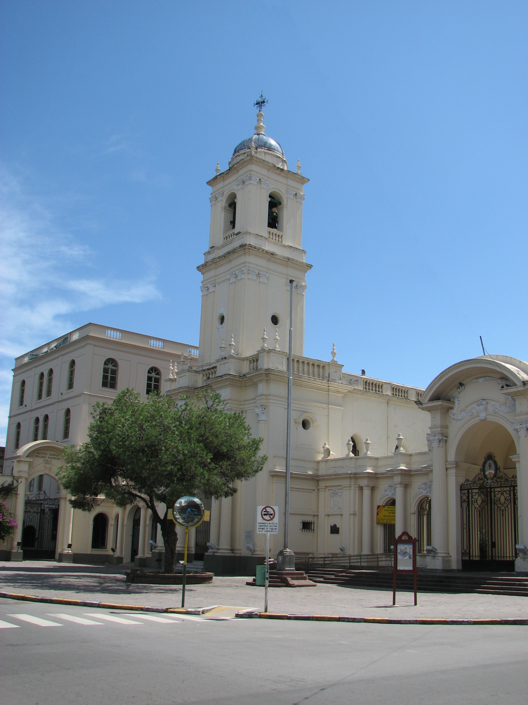
The Cathedral's Cedar Pulpit
The Catedral Basilica anchors the city center with a presence that goes beyond its role as a church. Its pulpit, carved in cedar and nandubay wood in 1761, is considered one of the most important works of colonial religious art in the country. The carvings depict biblical scenes with a level of detail and craftsmanship that reflects the skilled artisan traditions of the region -- traditions that blended Spanish technique with indigenous sensibility. The cathedral is not the only church worth visiting; the Capilla Santa Barbara and the Iglesia San Francisco round out a collection of colonial sacred architecture that gives the city center a sense of continuity stretching back centuries.
Artisans and Empanadas
The Paseo de los Artesanos near the old railway station is where the cultural circuit begins, and it sets the tone for the city's relationship to craft. Stalls display work in wood, alpaca silver, leather, reed, and clay -- materials that connect directly to the Andean highland traditions surrounding the province. Nearby, the RECREAR Foundation sells calendars featuring drawings by Guaman Poma, the Peruvian artist whose 18th-century illustrations documented colonial life with unflinching detail. But the most democratic art form in Jujuy is food. The empanadas sold across from the bus station are legendary among travelers, and the street food near the terminal is both excellent and cheap. Traditional dishes like tamales and asado fill restaurant menus, but the empanada -- meat-stuffed, baked or fried, eaten standing up or walking -- is the city's edible signature.
Gateway to the North
Jujuy functions as a gateway city. Tilcara, the Quebrada de Humahuaca, the salt flats, and the thermal baths at Reyes are all within reach, and residents will eagerly talk about these natural wonders when given the chance. The people of Jujuy may seem reserved at first, but that initial shyness dissolves quickly once you engage them. A 2.5-hour bus ride connects the city to Salta, and other services run north to La Quiaca at the Bolivian border. The main commercial artery is Belgrano Street -- cross the bridge from the bus station, keep walking, and you are in the heart of a city that has been welcoming travelers along this north-south corridor for centuries.
From the Air
Located at 24.19S, 65.30W in the Andean northwest of Argentina, at approximately 1,260 meters elevation. The city sits in a valley flanked by green hills, visible from altitude as a compact urban center at the junction of several rivers. The nearest airport is Gobernador Horacio Guzman International Airport (SASJ), located about 30 km southeast. The Quebrada de Humahuaca, a UNESCO World Heritage Site, extends north from the city. The surrounding terrain is mountainous with rapid elevation changes, requiring caution during approach.