Sanandaj
In 2019, UNESCO named Sanandaj a Creative City of Music, but the Kurds who live here could have told you that centuries ago. This city in the western Zagros Mountains has long been the cultural heartbeat of Iranian Kurdistan, a place where music is not performance but atmosphere -- woven into weddings, mourning, the rhythms of daily work. Known locally as Senna, Sanandaj sits at roughly 1,480 meters above sea level in a green valley that feels improbable against the surrounding rock and ridge. The Ardalan dynasty chose this spot around 1636 to establish their capital, and the Kurdish identity they cultivated here has never loosened its hold.
A Dynasty's Chosen Valley
Sanandaj owes its existence to Soleyman Khan Ardalan, who founded the city around 1636 as the seat of what would become the longest-lasting Kurdish local government in history. The Ardalan rulers shaped Senna into a center of Kurdish poetry, scholarship, and governance for roughly two centuries. Their legacy survives most tangibly in the Sanandaj Museum, housed in a 19th-century royal palace. Inside, the Arusi Room -- the Wedding Room -- stops visitors mid-step. Its walls and ceiling are covered in handcrafted woodwork of extraordinary intricacy, carved and fitted without nails, a masterwork of Qajar-era craftsmanship. Nearby, the ruins of an 11th- and 12th-century fortress remind visitors that this valley was strategically valuable long before the Ardalans arrived.
Sound and Thread
Sanandaj's reputation rests on two things you can carry with you: music and carpets. The Senneh knot, named for the city's traditional name, is among the finest weaving techniques in Persian carpet-making, producing rugs of exceptional density and detail. In the old bazaar, Kurdish handicrafts fill the stalls -- textiles, metalwork, pottery, woodcraft -- but it is the carpets that draw serious collectors. The music runs deeper. Kurdish musical traditions here span devotional Sufi singing, wedding celebration, and regional folk forms that vary from village to village. The tanbur, a long-necked lute central to Kurdish spiritual music, carries sounds that have echoed through these valleys for generations. Walk through Sanandaj's neighborhoods in the evening and you are likely to hear it.
Where Rock Meets Water
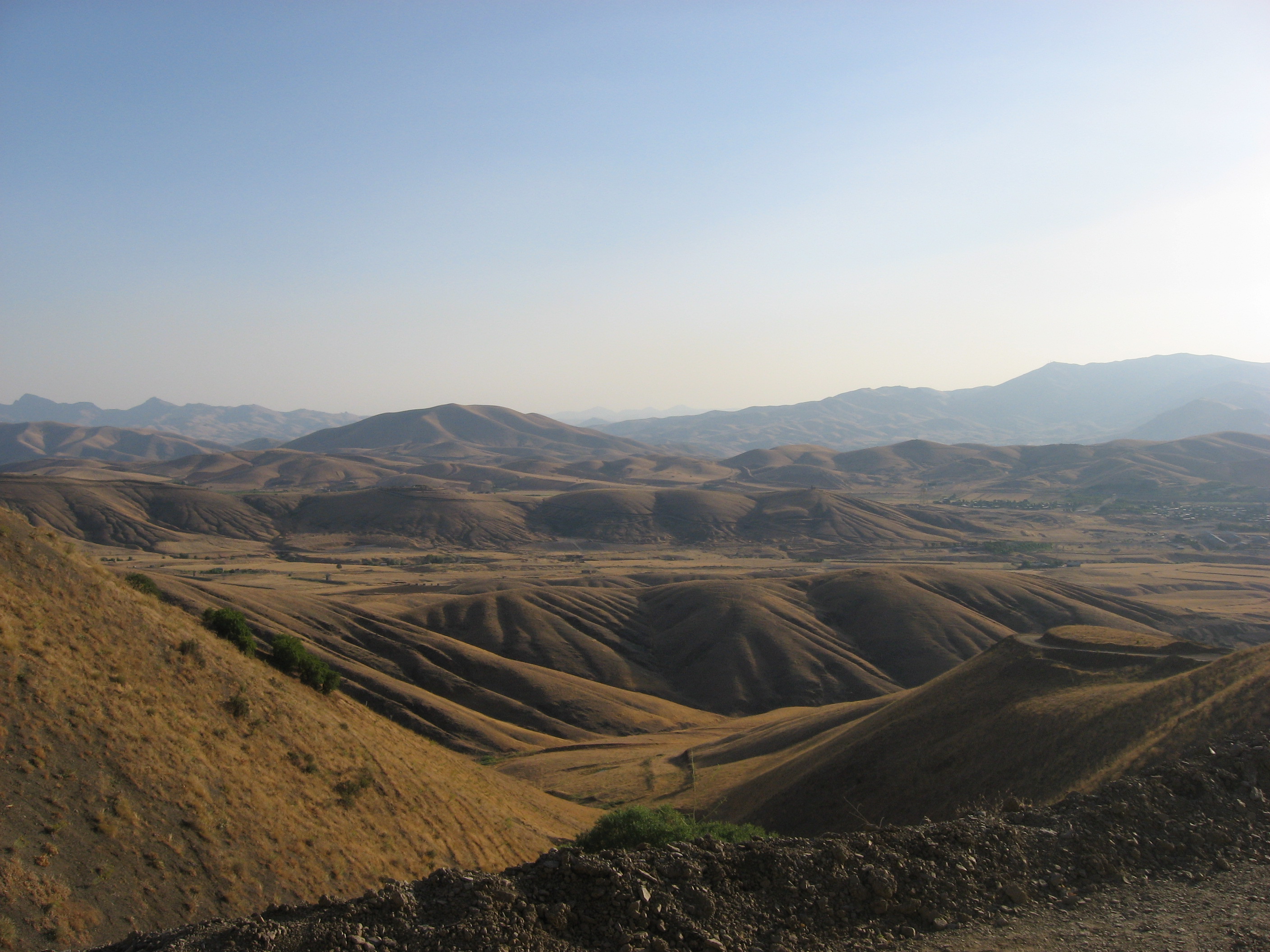
The landscape surrounding Sanandaj is riddled with surprises. Abidar Mountain rises at the city's western edge, and residents treat it as a communal backyard -- hiking its trails, gathering in parks like the Amirieh Jungle Park that spreads beneath its slopes. But the real geological drama lies underground. Quri Qaleh, roughly 92 kilometers away toward Paveh, is one of Iran's most spectacular water caves, stretching 12 kilometers with an underground river flowing at 111 liters per second. Hot springs dot the surrounding countryside. Lake Zarivar, a freshwater lake near Marivan, sits in a mountain basin that feels almost alpine. The Zagros here are not merely scenic backdrop; they are a labyrinth of hidden valleys, caves, and thermal springs that reward anyone willing to leave the city behind.
Kurdish Life at the Crossroads
Sanandaj is a manufacturing city as much as a cultural one. Cotton textiles, leather goods, cutlery, milled rice, refined sugar, and processed foods all pass through its workshops and markets. Kurdistan University, which traces its origins to 1974 and gained full university status in 1991, anchors the city's intellectual life. But what defines Sanandaj most is its position as a crossroads -- geographically between Tehran and the Iraqi Kurdish cities of Sulaymaniyah and Erbil, and culturally between the Persian state and Kurdish identity. The Dar al-Ehsan Mosque stands in the old city center. The bazaars bustle with a mix of Kurdish and Persian. Buses arrive daily from Tehran, Kermanshah, Tabriz, and Hamedan, while routes also connect to Turkey and Iraqi Kurdistan. Sanandaj is not isolated; it is a meeting point, and it has always known it.
From the Air
Located at 35.31°N, 47.00°E at approximately 1,480 meters elevation in the Zagros Mountains of western Iran. The city occupies a visible green valley amid rugged terrain. Sanandaj Airport (OICS) serves domestic flights. Kermanshah Airport (OICC) lies to the south. The Zagros ridgelines running northwest-to-southeast provide strong visual navigation references. Best viewed in clear conditions when the contrast between the fertile valley and surrounding mountains is most striking.