Santa Bàrbara Castle
From Postiguet Beach, the profile of Mount Benacantil looks like a face in repose -- a forehead, nose, and chin carved by erosion into the limestone. Locals call it la cara del moro, the face of the Moor, and it is one of the most recognizable silhouettes on the Spanish Mediterranean coast. At 166 meters above the sea, crowning this uncanny geological formation, Santa Bàrbara Castle has watched over the bay of Alicante since the 9th century, its strategic position offering commanding views that made it coveted by every power that ever contested this coastline.
Older Than Its Name
Bronze Age tools, Iberian pottery, and Roman artifacts have been found on the slopes of Mount Benacantil, but the fortress itself dates to the 9th century, when Muslim rulers controlled the Iberian Peninsula. The Arab geographer Al-Idrisi referred to the mountain as Banu-lQatil, a name that may derive from the Arabic pinna, meaning peak, combined with laqanti, an adjectival form of Laqant -- the Arabic name for Alicante. The castle received its current name on December 4, 1248, when Castilian forces under the future Alfonso X captured it from the Moors. The date coincided with the feast of Saint Barbara, and the castle was named in her honor. Half a century later, in 1296, James II of Aragon took the fortress and ordered its reconstruction, beginning a cycle of conquests and rebuildings that would continue under Peter IV of Aragon, Charles I of Spain, and Philip II.
Bombarded, Occupied, Bombarded Again
The castle's military history reads like a catalog of European conflicts. In 1691, a French squadron bombarded it from the sea. During the War of the Spanish Succession, British forces held the castle for three years. In 1873, cantonalistas -- radical federalists during Spain's tumultuous First Republic -- bombarded both the castle and the city from the frigate Numancia. Through all of this, the fortress was rebuilt, adapted, and strengthened, its walls absorbing the evolving technologies of warfare from medieval siege engines to 19th-century naval artillery. By the 18th century, however, the castle's military relevance had waned, and it was repurposed as a prison -- a common fate for obsolete European fortifications that retained their most useful quality: the difficulty of getting out.
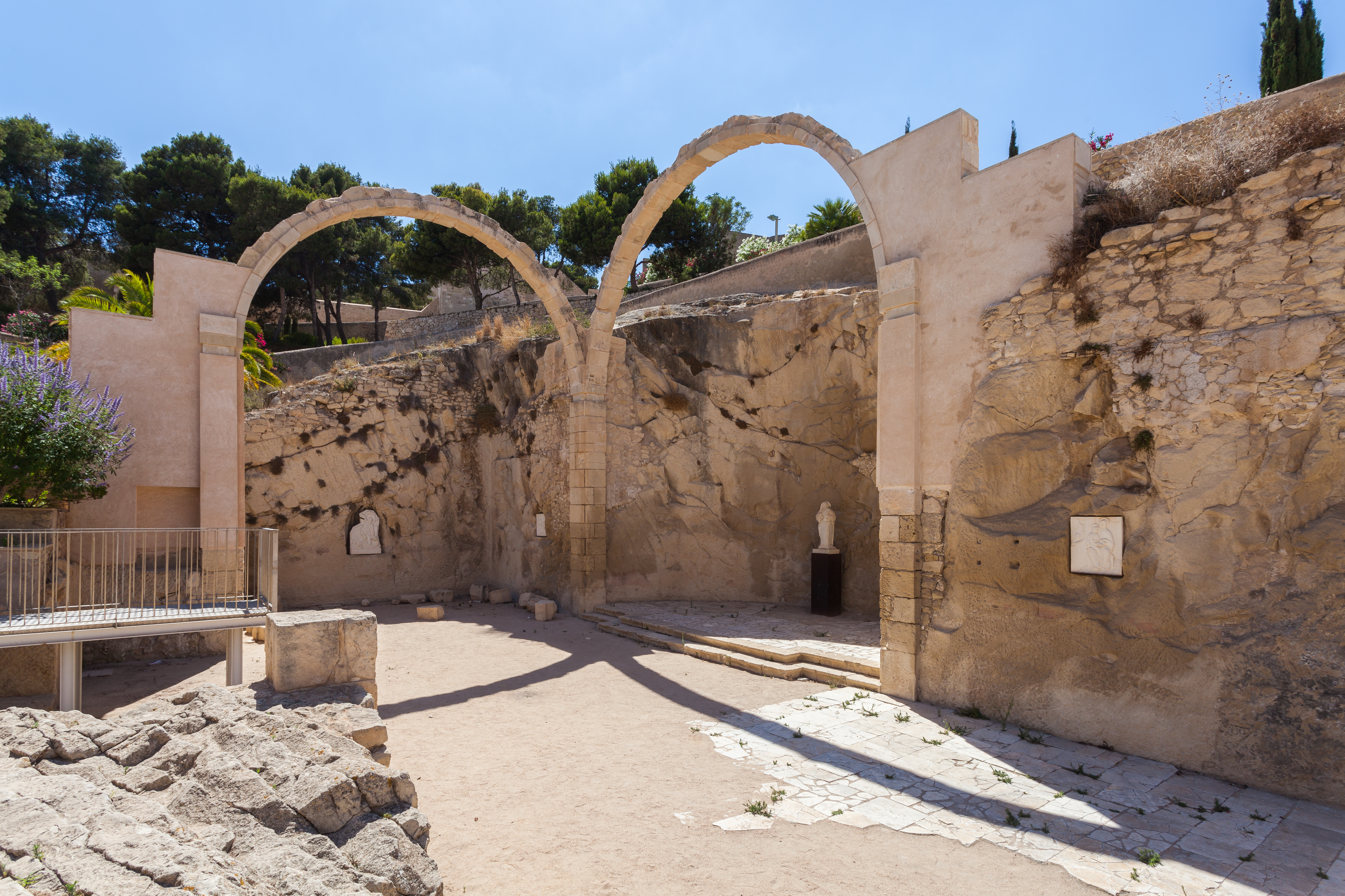
Three Levels of History
The castle is divided into three distinct zones, each corresponding to a different era of construction. The highest section, known as La Torreta, contains the oldest remains: foundations from the 11th to 13th centuries, including the old Torre del Homenatge and the so-called Bastion of the English. This upper citadel also houses the Governor's House and the Noble Room, which served as a hospital. The intermediate enclosure, completed around 1580, contains the most substantial rooms: the Felipe II Hall, the large Patio de Armas, the Guard Corps, the Baluarte de la Reina, and the ruins of the hermitage of Santa Bàrbara. The lowest section dates to the 18th century and includes the Ravellí del Bon Repós, now a parking lot, and a monument to Félix Berenguer de Marquina, an Alicante-born soldier who became captain general of the Philippines and viceroy of New Spain.
The Mountain Opens
After decades of abandonment, the castle was opened to the public in 1963. The most dramatic improvement came with the installation of lifts inside the mountain itself, tunneling through the rock to carry visitors from the base to the summit without the steep climb. Inside the walls, the Museum of the City of Alicante occupies five rooms complemented by a Renaissance-era cistern, tracing the city's history from its Iberian origins through the present. A large white marble shield from the 18th century, originally mounted on the Royal Consulate of the Sea before that building was destroyed by an explosion, now hangs above the access door to the second enclosure. Ongoing restoration work continues to reveal and consolidate elements from the castle's many construction phases. From the highest esplanade, the Macho del Castillo, the panorama encompasses the entire bay, the Serra Grossa headland, and the grid of Alicante's modern streets spreading outward from the mountain's base -- a view that explains, in a single glance, why every ruler of this coastline wanted this hilltop.
From the Air
Located at 38.35°N, 0.48°W atop Mount Benacantil (166m) in central Alicante on the Mediterranean coast. The castle and the mountain's distinctive 'face of the Moor' profile are highly visible from the air. Nearest airport: LEAL (Alicante-Elche Airport), approximately 11 km southwest. Best viewed at 1,500-4,000 ft AGL, where the castle, the beach below, and the bay are all visible. The mountain's face profile is most apparent when approaching from the east.