Santa Fe Trail
Before the Mexican-American War, before the railroads, before the territories became states, there was the Santa Fe Trail - a commercial highway stretching 900 miles from Franklin, Missouri to Santa Fe, New Mexico. Beginning in 1821 when Mexico's independence from Spain opened the border to American trade, the Trail carried goods worth millions of dollars annually: manufactured goods heading southwest, silver and gold and furs heading northeast. For nearly sixty years, until the railroad arrived in 1880, this dusty track across prairie, desert, and mountain passes was the economic lifeline of the Southwest. The Trail was not one road but many: the Mountain Route climbed over Raton Pass, the Cimarron Cutoff risked waterless desert crossings, and dozens of variants wound through the grasslands. Traders died of thirst, Native Americans raided caravans, and fortunes were made and lost. Today the ruts remain visible in places, shallow depressions in the earth that carried a nation's commerce west.
Opening the Trade
William Becknell receives credit as the 'Father of the Santa Fe Trail' for his 1821 expedition that established the route as a commercial highway. When he arrived in Santa Fe with trade goods, Spanish colonial restrictions had just ended with Mexican independence. Suddenly American manufactures - cloth, tools, hardware - were desperately wanted, and Mexican silver was ready to pay. Becknell's profit on that first trip was enormous, and the news spread. The following year he returned with wagons - the first to cross the prairie - establishing the trade pattern that would continue for decades. By the 1840s, caravans of up to a hundred wagons traveled together for protection against both bandits and weather. The traders developed systems for crossing rivers, organizing night watches, and selecting campsites. Their commercial success created political pressure: the valuable trade with New Mexico made American annexation of the Southwest economically logical.
The Routes
West of Dodge City, the Trail split into two main branches. The Mountain Route followed the Arkansas River into Colorado, passed Bent's Fort, and crossed Raton Pass into New Mexico - longer but with reliable water sources. The Cimarron Cutoff headed directly southwest across the shortgrass prairie and into the waterless Jornada, a fifty-mile stretch without water that killed mules, men, and occasionally entire parties when they missed the Cimarron River crossing. Traders chose their routes based on season, cargo weight, and appetite for risk. The Cutoff was shorter by nearly 100 miles but the Mountain Route was safer. Landmarks became legendary: Pawnee Rock, where travelers carved their names into the soft sandstone; the Rabbit Ears, twin peaks visible for miles across the prairie; Glorieta Pass, the final climb before descending to Santa Fe. These names persisted in local geography long after the Trail's purpose ended.
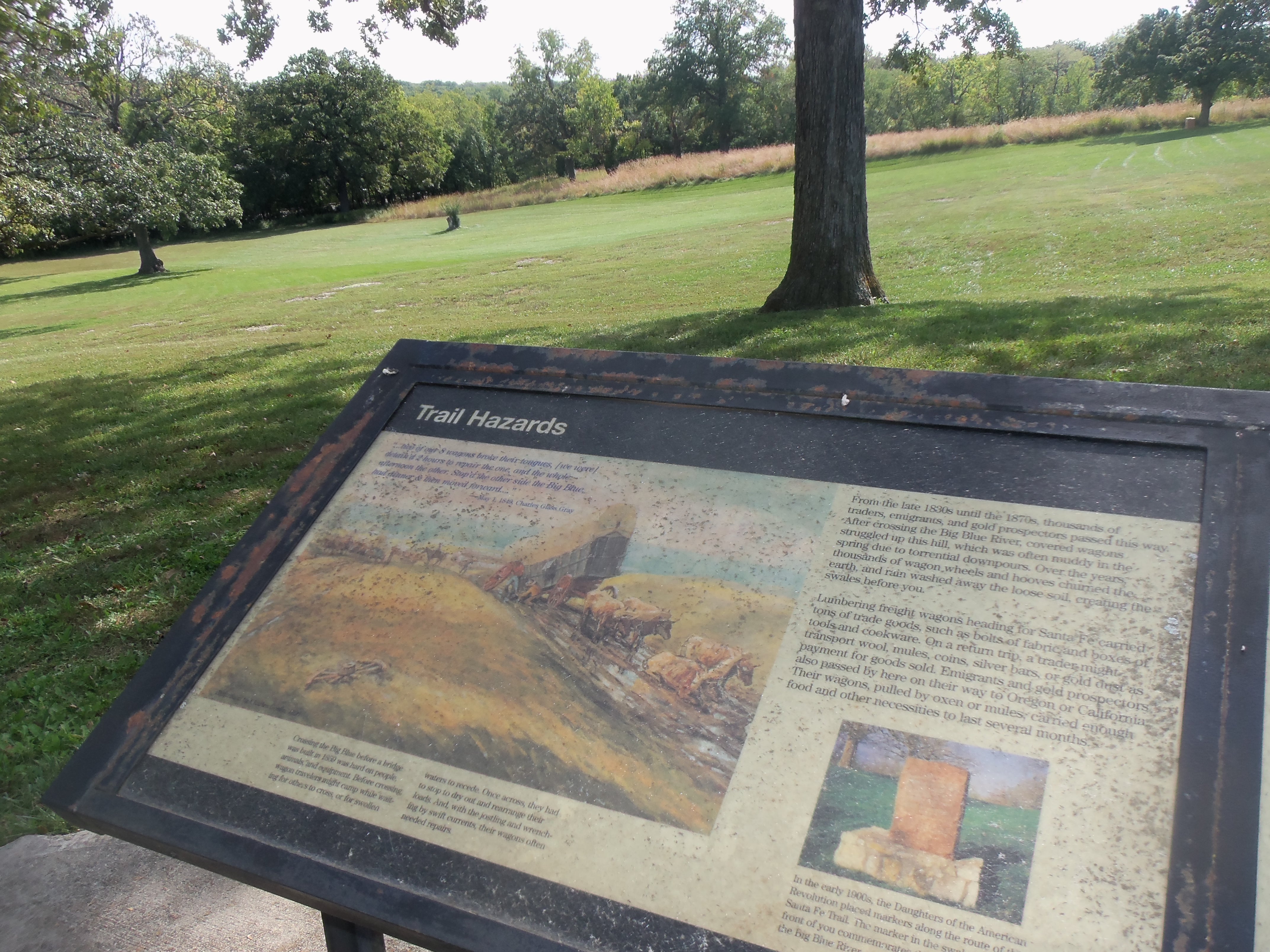
Conflict and Conquest
The Trail was never peaceful. Comanche, Kiowa, Apache, and other nations recognized that these caravans carried wealth through their territories. Raids were common; travelers were killed, and goods and animals were taken. The U.S. Army established forts along the route - Larned, Dodge, Union - to protect the commerce that was increasingly vital to national expansion. During the Mexican-American War, Colonel Stephen Kearny marched his Army of the West along the Trail to capture Santa Fe without firing a shot in 1846 - the commercial relationships built by Trail traders had already created American sympathies among New Mexico's elites. During the Civil War, the Battle of Glorieta Pass in 1862 destroyed Confederate hopes of capturing the Southwest and its gold shipments. The Trail was not just a trade route but a corridor of conquest, its wagon ruts smoothing the path for American expansion.
Life on the Trail
A journey on the Santa Fe Trail typically took two to three months. Traders departed from Independence or Westport (now Kansas City) in late spring when the prairie grass was tall enough to feed the animals. Wagons were loaded with up to 5,000 pounds of goods - cloth, tools, whiskey, books, anything that would sell in Santa Fe's markets. Teams of ten to twelve mules or oxen pulled the heavy Conestoga wagons at perhaps fifteen miles a day. Life was monotonous punctuated by terror: endless prairie crossings broken by river crossings, storms, Indian encounters, and the ever-present fear of getting lost. Water determined everything. At river crossings, wagons sometimes waited days for floods to subside. In the Jornada, men and animals died if they missed the route to the Cimarron. Traders who survived and prospered became prominent citizens; those who failed became anonymous bones scattered across the prairie.
The Trail Today
The Atchison, Topeka and Santa Fe Railway reached Santa Fe in 1880, ending the Trail's commercial purpose overnight. Wagons couldn't compete with trains. Within a decade, the Trail had become a memory and a historical curiosity. Today the Santa Fe National Historic Trail, administered by the National Park Service, commemorates the route through five states. Original ruts remain visible in places - at Fort Larned, at Fort Union, and in remote sections of Kansas grassland where the earth still holds the impression of thousands of wagon wheels. Markers guide modern travelers along roads that roughly parallel the historic route. Independence has a museum; Santa Fe has the end-of-trail plaza. But the Trail's true monument is the Southwest itself: the trade that flowed over this route for sixty years created the economic and political connections that made the American Southwest possible.
From the Air
Located along a route from 39.1°N, 94.4°W (Independence, Missouri) to 35.7°N, 105.9°W (Santa Fe, New Mexico). The trail crossed Kansas, Colorado, Oklahoma and New Mexico. Fort Larned and Dodge City mark key Kansas waypoints. Bent's Old Fort in Colorado marks the mountain route. The terrain transitions from rolling Missouri hills through Kansas prairie to Colorado mountains to New Mexico desert. Kansas City International (MCI) and Santa Fe Regional (SAF) bookend the route.