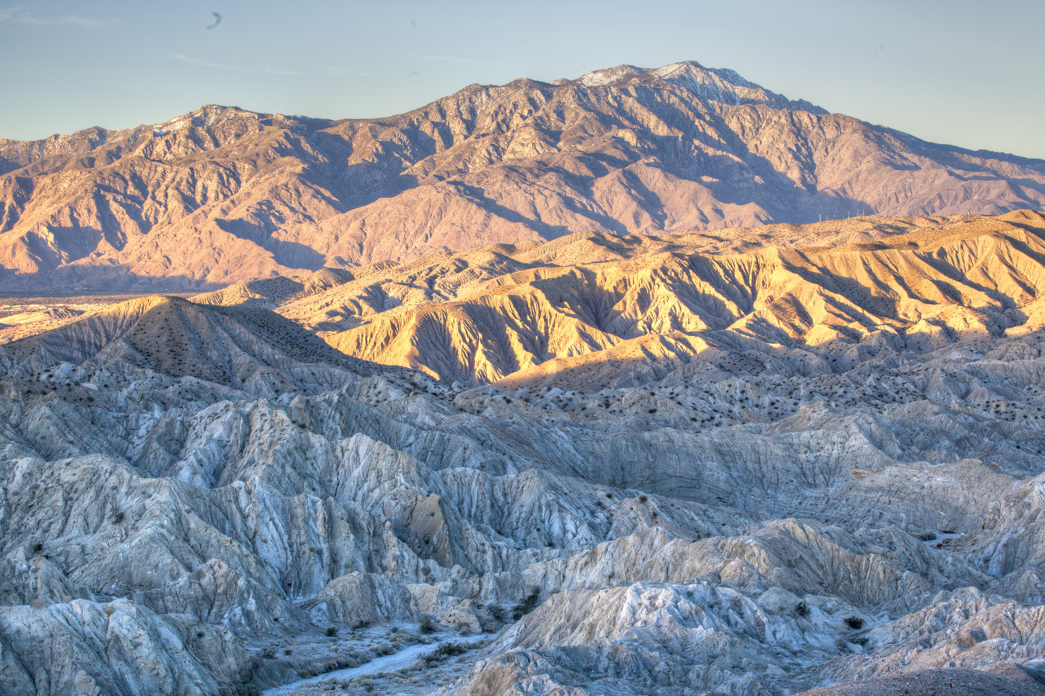
Santa Rosa and San Jacinto Mountains National Monument
The Peninsular Bighorn Sheep did not choose its home for convenience. The sheep — one of the monument's nineteen endemic species, animals found nowhere else on earth in quite this form — move through terrain that would challenge most hikers: rocky slopes, exposed ridgelines, the kind of landscape where footing is never entirely certain and the margin for error is calibrated in inches. The Santa Rosa and San Jacinto Mountains National Monument, established in October 2000, protects the ecosystems these sheep and eighteen other endemic species require. It covers 280,071 acres of mountain wilderness between the Coachella Valley and the Salton Sea, an expanse of terrain that most Coachella Valley visitors see only as a dramatic backdrop.
The Long Road to Protection
The legislation establishing the monument was introduced by Congresswoman Mary Bono, who had assumed the congressional seat of her late husband Sonny Bono after his death in January 1998. Its passage in October 2000 was the product of years of advocacy by conservation organizations, local governments, and tribal governments who argued that the mountains' extraordinary biodiversity and cultural significance required federal protection beyond what state and county mechanisms provided. The monument's designation brought together land already in various federal and state ownership and added the layer of national monument protection, which restricts certain development and use activities while preserving access for hiking, research, and traditional cultural practices.
Nineteen Species Found Nowhere Else
The monument's nineteen endemic species represent the product of geographic isolation: populations that evolved in the specific conditions of the Santa Rosa and San Jacinto Mountains over thousands of years, becoming distinct enough from related species elsewhere that they are recognized as unique. The Peninsular Bighorn Sheep is the best-known of these, a subspecies whose habitat requirements — the rocky, steep terrain of the monument's mountain faces — have made it vulnerable to development that encroaches on its movement corridors. Casey's June beetle, found only in a small area of the monument, represents the smaller and less visible end of the endemic spectrum: insects whose ecological specificity makes them equally important indicators of ecosystem health.
Cahuilla Land Within the Monument
Approximately 19,800 acres within the monument's boundaries are owned by the Agua Caliente Band of Cahuilla Indians, who are designated as a co-managing agency for the monument. This arrangement reflects the Cahuilla people's historical and contemporary connection to the mountain landscape: the Santa Rosa and San Jacinto ranges are not merely scenic resources to the Cahuilla but living cultural landscapes embedded with place names, stories, and traditions that extend back thousands of years before federal land management existed as a concept. The co-management structure acknowledges this relationship in institutional form, giving the tribe a formal role in decisions about a landscape they have never stopped regarding as their own.
The Pacific Crest Trail and Desert Wilderness
The Pacific Crest Trail, the 2,650-mile route that runs from Mexico to Canada along the spine of the western mountains, traverses the western portion of the monument. Through-hikers following the PCT from the desert sections near Palm Springs into the San Jacinto Mountains experience one of the route's most dramatic elevation gains: the trail climbs from desert floor to alpine forest in a distance that takes most hikers a single day. The monument's terrain ranges from the low desert edges, where creosote and ocotillo give way to the bajada slopes below the mountain face, to the high mountain peaks, where granite and subalpine vegetation create conditions more reminiscent of the Sierra Nevada than of the Coachella Valley visible far below.
From the Air
Located at 33.80°N, 116.71°W, the monument encompasses the mountain wilderness immediately west and south of Palm Springs. The Santa Rosa and San Jacinto ranges are prominent from cruising altitude, with the dramatic escarpment rising steeply from the Coachella Valley floor. Palm Springs International Airport (ICAO: KPSP) is at the monument's northeastern edge.