Santa Rosa National Park
On certain new moon nights in late summer, the beach at Playa Nancite becomes something difficult to believe even when you are watching it happen. Thousands of olive ridley sea turtles emerge from the Pacific surf simultaneously, dragging themselves across the sand to dig nests and deposit eggs in a synchronized mass arrival called an arribada. The turtles have been doing this for millennia, long before the surrounding dry tropical forest was designated as Santa Rosa National Park in 1970 -- Costa Rica's first national park, and a place where military history, ecological preservation, and raw natural spectacle converge in 49,515 hectares of Guanacaste coastland.
Where Jaguars Still Roam
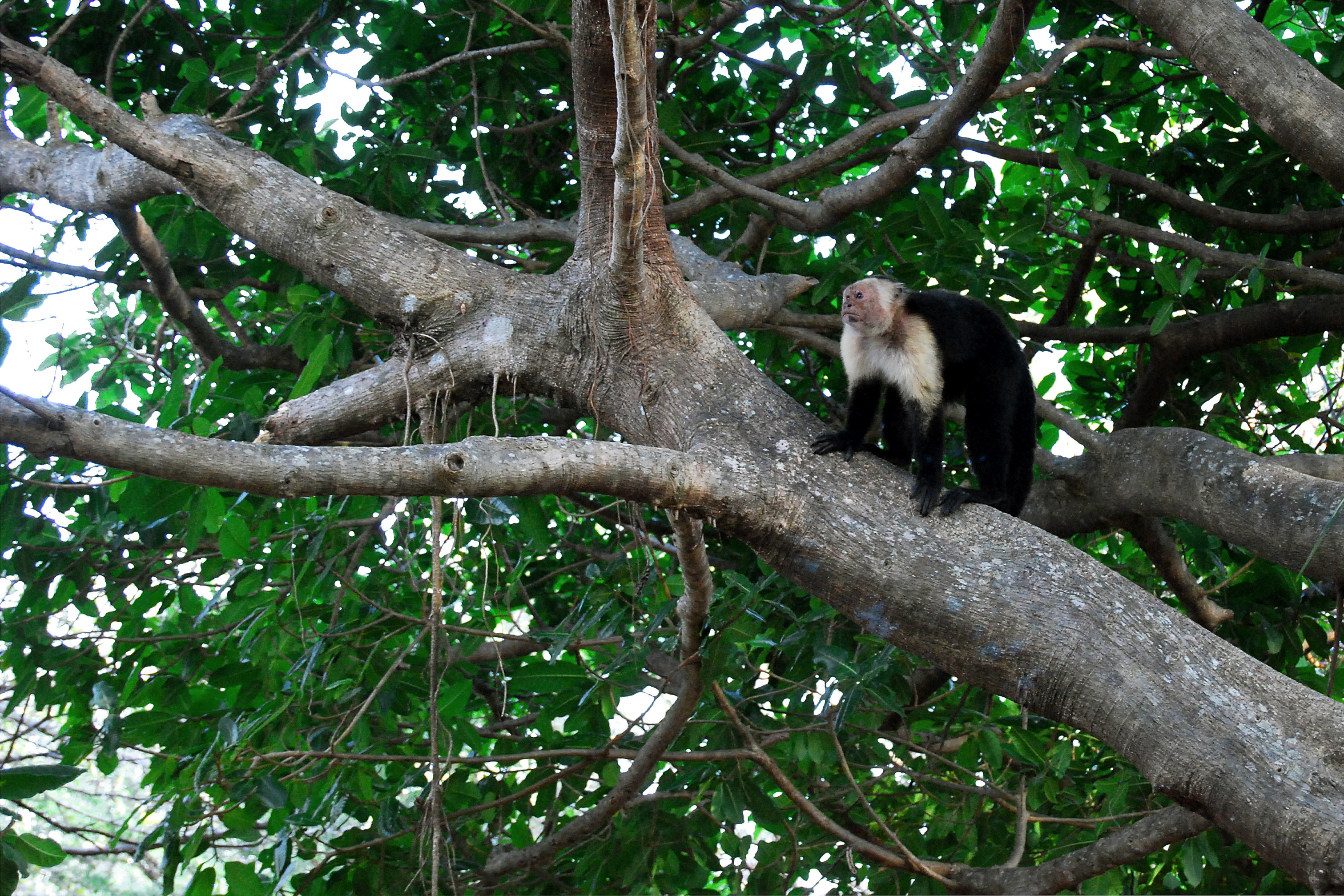
Santa Rosa protects one of the largest remaining stands of tropical dry forest in Central America, an ecosystem that once covered much of the Pacific lowlands from Mexico to Panama but has been cleared for ranching and agriculture across most of its range. Within the park's boundaries, the dry forest merges with mangrove estuaries, grasslands, and marine habitats to create a corridor large enough to support apex predators. Jaguars and pumas patrol territories that extend into neighboring Guanacaste National Park, taking advantage of the contiguous protected area that the parks form together. The forest itself cycles through dramatic seasonal changes: during the dry season, from roughly December to April, many trees shed their leaves entirely, transforming the landscape into a skeletal woodland of silver branches and dusty trails. When the rains return in May, the same forest erupts into dense green canopy within weeks.
Witch's Rock and the Marine Frontier
The park's Pacific coastline holds two beaches with very different reputations. Playa Nancite is the turtle nesting beach, restricted and carefully managed to protect the arribadas. Playa Naranjo, farther south, is famous for entirely different reasons: the surf break near Witch's Rock -- Pena Bruja -- is one of the most celebrated in Costa Rica, drawing surfers willing to navigate dirt roads and stream crossings to reach it. Offshore, the Islas Murcielago -- the Bat Islands -- anchor the park's Marine Sector, where dive shops from Guanacaste run trips to sites with bull sharks, manta rays, and reef ecosystems. Snorkeling and fishing are permitted within the marine zone, and the combination of protected reefs and open ocean currents creates unusual biodiversity for a coastal park. The water is warm year-round, but visibility peaks during the dry season when river sediment drops.
A Battlefield Preserved
At the heart of the park stands the Casona de Santa Rosa, a colonial-era hacienda that was the site of Costa Rica's most celebrated military engagement. On March 20, 1856, a Costa Rican army surprised and routed a force of foreign filibusters under the command of William Walker, an American adventurer who had seized the presidency of Nicaragua and planned to conquer the rest of Central America. The battle lasted only fourteen minutes. The Casona became a symbol of Costa Rican sovereignty, and when arsonists set fire to it in 2001, the nation mourned and then rebuilt the structure. Today it houses a museum with exhibits on both the battle and the park's natural history, linking the two narratives that define Santa Rosa: the defense of political independence and the defense of ecological heritage.
Dry Season, Wet Season
Guanacaste's climate divides the year into two distinct personalities. The dry season runs from December through April, when the sun bakes the forest floor and many trails are accessible only with a four-wheel-drive vehicle and a tolerance for dust. The wet season, from May through November, brings short, intense cloudbursts -- rarely the drenching all-day rains that visitors might expect -- followed by sunshine that steams the moisture off the canopy. During late July and early August, a brief dry spell called the veranillo de San Juan interrupts the rains for a couple of weeks, mimicking dry-season conditions. The park entrance, located about 40 kilometers north of Liberia on the Pan-American Highway, is open daily from 8:00 a.m. to 3:30 p.m. From the highway turnoff, a 7-kilometer road leads to the entrance station, and from there the park opens into a network of trails that range from afternoon walks to multi-day backcountry routes requiring camping gear and at least four liters of water per person per day.
From the Air
Santa Rosa National Park is located at 10.88N, 85.78W in the Guanacaste province of northwestern Costa Rica, between the Pan-American Highway and the Pacific coast. From 5,000-8,000 feet AGL, the park's dry forest contrasts sharply with cleared ranch land to the east. The coastline includes Playa Naranjo, Playa Nancite, and the Islas Murcielago offshore. Daniel Oduber Quiros International Airport (MRLB) in Liberia is approximately 40 km southeast. The terrain is coastal lowland with gentle hills. Dry season (December-April) offers excellent visibility; wet season brings afternoon convective buildup.