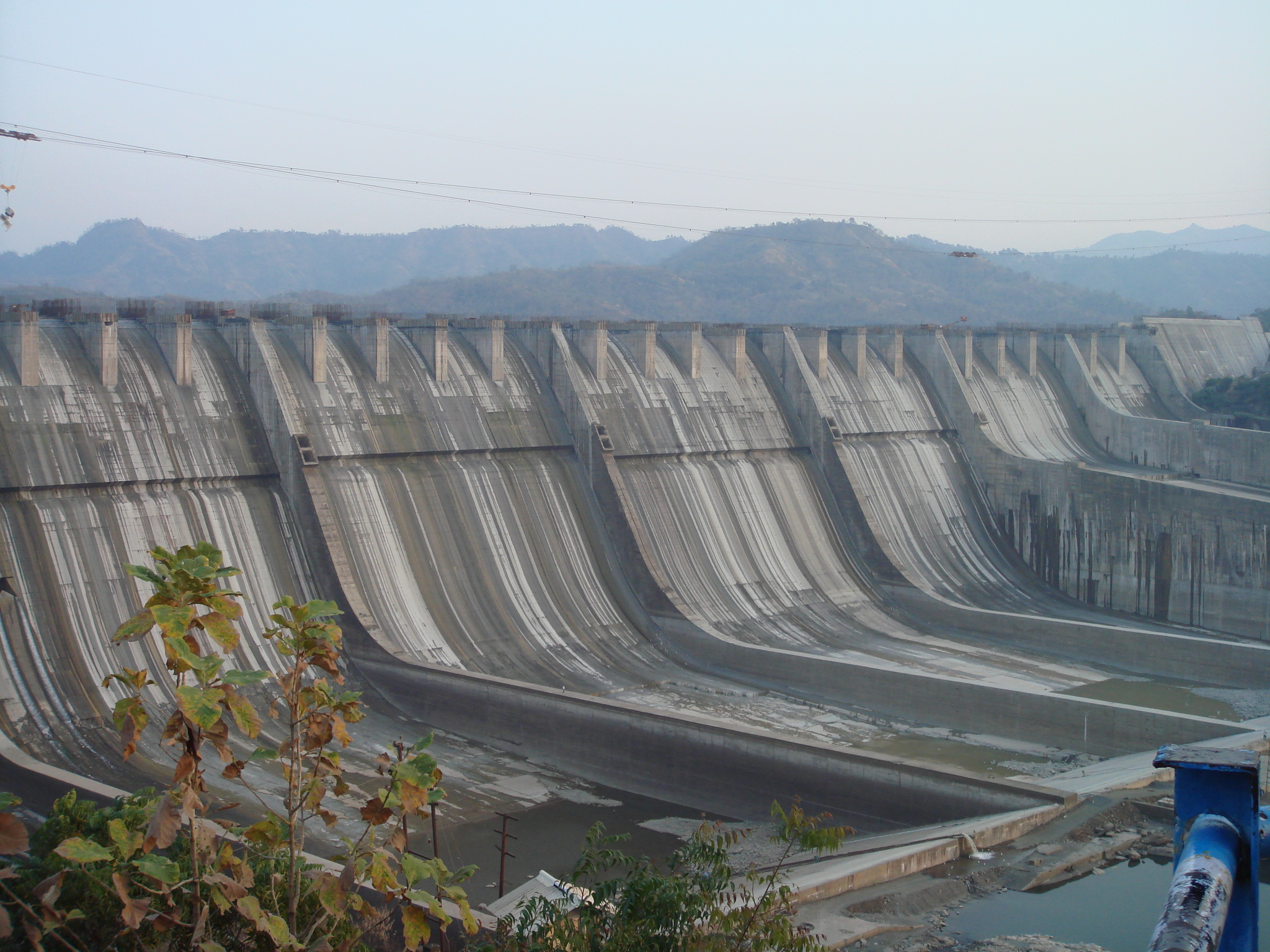
Sardar Sarovar Dam
Few structures on Earth have taken longer to argue about than to build. When Jawaharlal Nehru laid the Sardar Sarovar Dam's foundation stone on 5 April 1961, India was barely fourteen years old, and the idea seemed straightforward: harness the Narmada River to irrigate the drought-scorched plains of Gujarat, Rajasthan, and beyond. Fifty-six years later, when Narendra Modi finally inaugurated the completed dam in September 2017, the project had survived Supreme Court injunctions, a World Bank withdrawal, a mass protest movement that drew international attention, and a height that crept upward through a dozen separate government orders. The dam that stands today near Kevadia in Gujarat's Narmada district is 1,210 meters long and 163 meters tall -- the second-largest concrete dam in the world by volume, after the Grand Coulee Dam on the Columbia River in the United States.
A Dream Carved in Concrete
Sardar Vallabhbhai Patel, India's first home minister and the man who unified 562 princely states into a single nation, originally envisioned the project. The dam bears his name, and the world's tallest statue -- the 182-meter Statue of Unity -- now faces it across the Narmada gorge. Between Patel's vision in the late 1940s and actual construction beginning in 1987, decades of interstate water disputes had to be resolved. The Narmada flows through Madhya Pradesh, Maharashtra, and Gujarat, and none of the three states could agree on who deserved what share. A dedicated tribunal, the Narmada Water Dispute Tribunal, was established in 1969. It delivered its verdict a decade later, in 1979, clearing the path for a World Bank loan of US$200 million to fund what would become one of 25 planned dams along the river.
The Lifeline and Its Cost
The numbers behind the dam's purpose are staggering. Its canal network stretches roughly 75,000 kilometers across Gujarat alone, delivering irrigation water to nearly 18,000 square kilometers of farmland spread over 12 districts and 3,393 villages -- seventy-five percent of which are classified as drought-prone. Drinking water reaches 9,490 villages and 173 urban centers in Gujarat, plus over 1,300 villages in Rajasthan's arid Barmer and Jalore districts. The dam also provides flood protection to 210 villages and the city of Bharuch. Its power plant houses six 200-megawatt Francis pump-turbines alongside five 50-megawatt Kaplan turbine-generators on the canal intake, bringing total installed capacity to 1,450 megawatts. In 2021, for the first time in its history, the dam provided irrigation water during the summer months -- a milestone for a region where monsoon failure once meant famine.
Save the Narmada
No dam in India has generated more controversy. The Narmada Bachao Andolan -- "Save Narmada Movement" -- brought together activist Medha Patkar, social reformer Baba Amte, writer Arundhati Roy, and actor Aamir Khan in opposition to the project. Their argument was not abstract: each increase in the dam's height meant a larger reservoir, and a larger reservoir meant more villages submerged. The World Bank, which had initially funded the project, withdrew in 1994 after the Indian government could not meet the loan's environmental and displacement requirements. Two documentary films captured the human cost: Anand Patwardhan's A Narmada Diary (1995), which won the Filmfare Award for Best Documentary, and Spanner Films' Drowned Out (2002), which followed a single tribal family who chose to remain in their home rather than relocate as the waters rose around them.
Rising by Degrees
The dam's height did not reach 163 meters in one decision. It grew in increments, each one requiring a fresh battle before the Supreme Court or the Narmada Control Authority. From an initial 80 meters, the court approved 88 meters in 1999, then 90 meters in a two-to-one majority ruling in 2000. The Authority pushed it to 95 meters in 2002, 110 meters in 2004, and 121.9 meters in 2006. Heavy monsoon rains in August 2013 drove the reservoir to 131.5 meters, forcing 7,000 upstream villagers to relocate overnight. The final clearance came in June 2017 when the Authority ordered the closure of all 30 gates, bringing the dam to its full design height. On 15 September 2019, the reservoir reached its highest-ever level at 138.7 meters -- not the structural height of the dam itself, but the water surface behind it, a measure of the immense volume now stored in the Narmada gorge.
Solar Canals and New Horizons
In 2011, Gujarat announced a plan that turned the dam's vast canal network into something more than an irrigation system. Solar panels placed atop the canals generate electricity while simultaneously reducing water lost to evaporation -- an elegant two-for-one in a landscape where both energy and water are precious. The first phase covered 25 kilometers of canal with panels capable of producing up to 25 megawatts. From the air, the silvery ribbon of solar panels tracing the canal's path across the brown-and-green patchwork of Gujarat's farmland is unmistakable. Together with the Statue of Unity standing sentinel beside the dam, the site has become a symbol of modern India's ambitions and contradictions -- monumental engineering in service of millions, built at a cost measured not only in concrete and rupees but in the displacement and disruption of the communities that once lived where the reservoir now stretches 214 kilometers upstream.
From the Air
Located at 21.83N, 73.75E in Gujarat's Narmada district. The dam wall (1,210 m long) is clearly visible from above, with the massive reservoir extending 214 km upstream. The 182-meter Statue of Unity stands immediately adjacent, facing the dam. Nearest major airport: Vadodara (VABO), approximately 100 km to the northwest. Best viewed at 3,000-5,000 feet AGL for both the dam structure and the canal network radiating outward. The solar-panel-covered canals are visible as reflective lines across the landscape.