Sarek National Park
There are no marked trails in Sarek. No mountain huts, no bridges over most of the rivers, no convenience stores selling chocolate and blister plasters. Sweden's other national parks offer infrastructure that softens the wilderness experience; Sarek offers the wilderness itself. Established in 1909 as one of Sweden's first national parks, its 1,970 square kilometers of glaciated mountains, deep valleys, and braided river deltas remain among the least accessible landscapes in Europe. The Sami people, who have herded reindeer through these mountains for centuries, call this place home. Everyone else is a visitor, and the land does not go out of its way to accommodate them.
Rivers That Reshape the Valley
The park's defining feature is water in motion. The Rapa River, or Rapaatno, originates from the glaciers of Sarektjakka, the park's highest peak at 2,089 meters, and carves its way down the Rapa Valley to Lake Laitaure. In July, the river's average flow surges to 100 cubic meters per second as glacial melt peaks, carrying up to 5,000 tons of sediment in a single day. That sediment gives the water a grey-green opacity and builds the Laitaure delta, a braided expanse of shifting channels and islands that has become an emblem of the park. Viewed from the cliffs above, the delta's pattern changes with the seasons, a living landscape drawn and redrawn by the river's restless energy. In winter, the flow drops to a mere four cubic meters per second, and the delta lies still under snow.
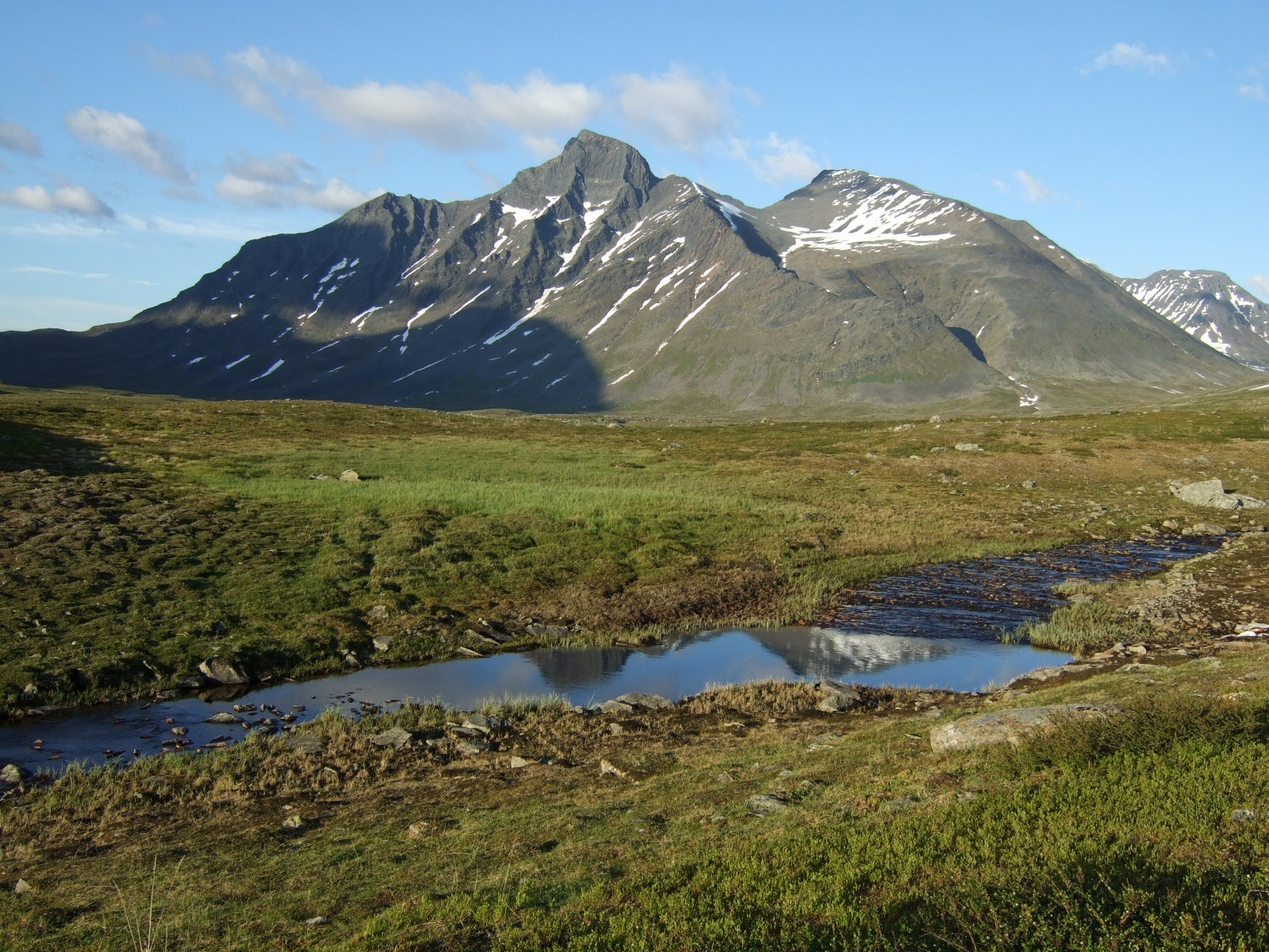
A Hundred Glaciers and Deep Time
Sarek contains over a hundred glaciers, making it one of the most glacier-rich areas in Sweden. The largest, Partejekna, covers 11 square kilometers. These ice fields are remnants of a much larger glacial system that sculpted the park's landscape over millions of years. The bedrock itself was laid down by the Caledonian orogeny, the collision of the Laurentia and Baltica tectonic plates between 450 and 250 million years ago that raised the Scandinavian Mountains. Glacial erosion carved the valleys, cirques, and nunataks that define the park today. The glaciers have been monitored since the late nineteenth century, when mineralogist and geographer Axel Hamberg began systematic studies. His work documented a retreat that has continued and accelerated since. At current rates, many of Sarek's smaller glaciers may disappear within decades, and the landscape they have shaped will be their only legacy.
Where the Wolverine Roams
Sarek's alpine zone begins where the birch forests thin and heathland takes over, dense mats of crowberry and cushion pink giving way to bare rock above 1,500 meters, where only eighteen plant species survive. The park shelters three rare mammals. Wolverines inhabit vast territories across the highlands, solitary and elusive. Arctic foxes, critically endangered in Scandinavia, breed in the park's high fells. Brown bears, numbering roughly 2,000 across Sweden, pass through the lower valleys. Below the alpine zone, the subalpine birch forests host moose, and the rivers support populations of Arctic char and brown trout. In summer, the bird life includes golden eagles and gyrfalcons, though the sound most hikers remember is not birdsong but the grinding silence of wind across empty rock.
The Sami and the Sacred Mountains
Humans arrived in the Sarek region roughly 8,000 years ago, following the retreat of the ice sheets. The ancestors of the Sami people were nomadic hunter-gatherers for whom many of the mountains held religious significance as sieidi, sacred places of worship where offerings of reindeer antlers were made. Over centuries, the Sami developed a reindeer-herding culture that persists today. Herds are driven between seasonal pastures, following routes that predate Sweden's national boundaries. The creation of the national park in 1909 recognized the Sami's continued right to herd reindeer and practice traditional livelihoods within its borders. Motorized vehicles are prohibited for most visitors, but Sami herders retain the right to use snowmobiles and helicopters when necessary. The park's management is divided between Sweden's Environmental Protection Agency and the county administrative board, but the Sami communities that depend on this land have their own deep knowledge of how to live within it.
Into Sarek on Your Own
Entering Sarek means accepting its terms. Without marked trails, navigation requires map, compass, and experience. River crossings can be dangerous at high water, and the weather above the treeline shifts rapidly from calm to storm. There is no guarantee of phone coverage, and rescue may require helicopter extraction. Most visitors approach from Kvikkjokk to the south or Ritsem to the north, both reachable by bus from Jokkmokk or Gallivare. The Kungsleden trail passes along Sarek's eastern edge, offering a gentler alternative, but those who venture into the park's interior find a landscape of overwhelming scale: valleys that take a full day to cross, glacial moraines stretching to the horizon, and a silence broken only by wind and water. It is, by any measure, the wildest place in Sweden.
From the Air
Located at 67.29°N, 17.67°E in Norrbotten County, Swedish Lapland. From cruising altitude, the park is identifiable by its heavily glaciated mountain terrain, the distinctive Rapa Valley running east-west, and the Laitaure delta visible as a braided fan of river channels. Sarektjakka (2,089 m) is the highest peak. Nearby airports include Kiruna Airport (ESNQ), approximately 120 km to the northeast, and Gallivare, served by the Malmbanan railway. The park has no roads or airstrips. The Kungsleden trail corridor runs along the park's eastern boundary.