Sault Ste. Marie Canal
In 1870, Colonel Garnet Wolseley needed to move troops west to quash the Red River Rebellion, and his route required passage through the locks at Sault Ste. Marie. The Americans said no. The steamer Chicora, carrying Wolseley's men, was refused transit through the U.S.-controlled locks on the St. Marys River, forcing the entire expedition to portage around the rapids on the Canadian side. The humiliation stung, and it planted a seed: Canada would build its own canal. Twenty-five years later, in 1895, the Sault Ste. Marie Canal opened on the Ontario shore -- not just a functional lock, but the largest and first electrically operated lock in the world. That story of defiance runs through this National Historic Site like the river current itself.
The Fur Traders' First Cut
Long before the Chicora Incident made the canal a matter of national pride, the St. Marys River's rapids had been a bottleneck for commerce. In 1798, the North West Company built the first lock on the Canadian side to move fur trade goods between Lake Superior and the lower Great Lakes. It was a modest structure, practical rather than grand, but it represented the first engineered passage past the rapids. That lock survived just sixteen years. On July 20, 1814, during the War of 1812, an American raiding force crossed the river, destroyed the North West Company depot on the north shore, and wrecked the lock. The British held the Sault itself -- the Americans never captured Fort Michilimackinac -- but the canal was gone. For the next eighty years, Canada had no lock of its own on the St. Marys River, and traffic moving to and from Lake Superior depended entirely on American goodwill.
A Lock That Made History
When the Canadian canal finally opened in 1895, it was an engineering statement. The lock was the largest in the world at the time and the first to be operated by electricity rather than manual labor -- a leap forward that signaled Canada's industrial ambitions. Red sandstone quarried during the canal's construction was used to build the complex's heritage buildings: the administration building, the superintendent's residence, the canalmen's shelter, the powerhouse, and the blacksmith shop. Most of the original lock machinery remains in place to this day, a working museum of late-Victorian engineering. The canal formed a critical link in the shipping route from the Atlantic Ocean to Lake Superior, running parallel to the American Soo Locks on the opposite bank. Together, the Canadian and American locks turned the twin cities of Sault Ste. Marie into a chokepoint of continental commerce.
The Day Three Ships Went Surfing
On June 9, 1909, the canal suffered one of the most dramatic accidents in Great Lakes shipping history. The Canadian Pacific steamer Assiniboia sat tied up inside the lock, the Pittsburgh Steamship Company's freighter Crescent City was entering, and a third vessel -- the Perry G. Walker -- was approaching from below. A miscommunication between the Walker's captain and engineer sent the ship plowing into the southern gate at roughly six miles per hour. The gate shattered. Water inside the filled lock erupted outward at over forty miles per hour, carrying all three ships with it like toys in a bathtub drain. The upper gates buckled from the surge. What stopped the disaster from becoming catastrophic was the Emergency Swing Dam, activated to block the torrent and allow repairs. Remarkably, not a single person was killed or injured. The lock reopened just twelve days later, on June 21, 1909.
The Only Swing Dam That Swung
That emergency swing dam remains one of the canal's most extraordinary features. It is the only emergency swing dam left in existence anywhere in the world, and the only one ever activated during an actual emergency -- that 1909 accident. The dam sits downstream of the lock, a hinged barrier designed to swing across the canal and block the flow of water if the lock gates fail. After the 1909 incident proved its worth, the dam became a point of engineering pride. When a wall failure in 1987 forced the historic lock to shut down indefinitely, the canal was designated a National Historic Site that same year. Parks Canada took over management, preserving both the dam and the surrounding heritage buildings. In 1998, a smaller modern lock was built within the footprint of the original, reopening the canal to recreational and tour boats, while major commercial shipping continued through the American Soo Locks next door.
Red Sandstone and Boardwalks
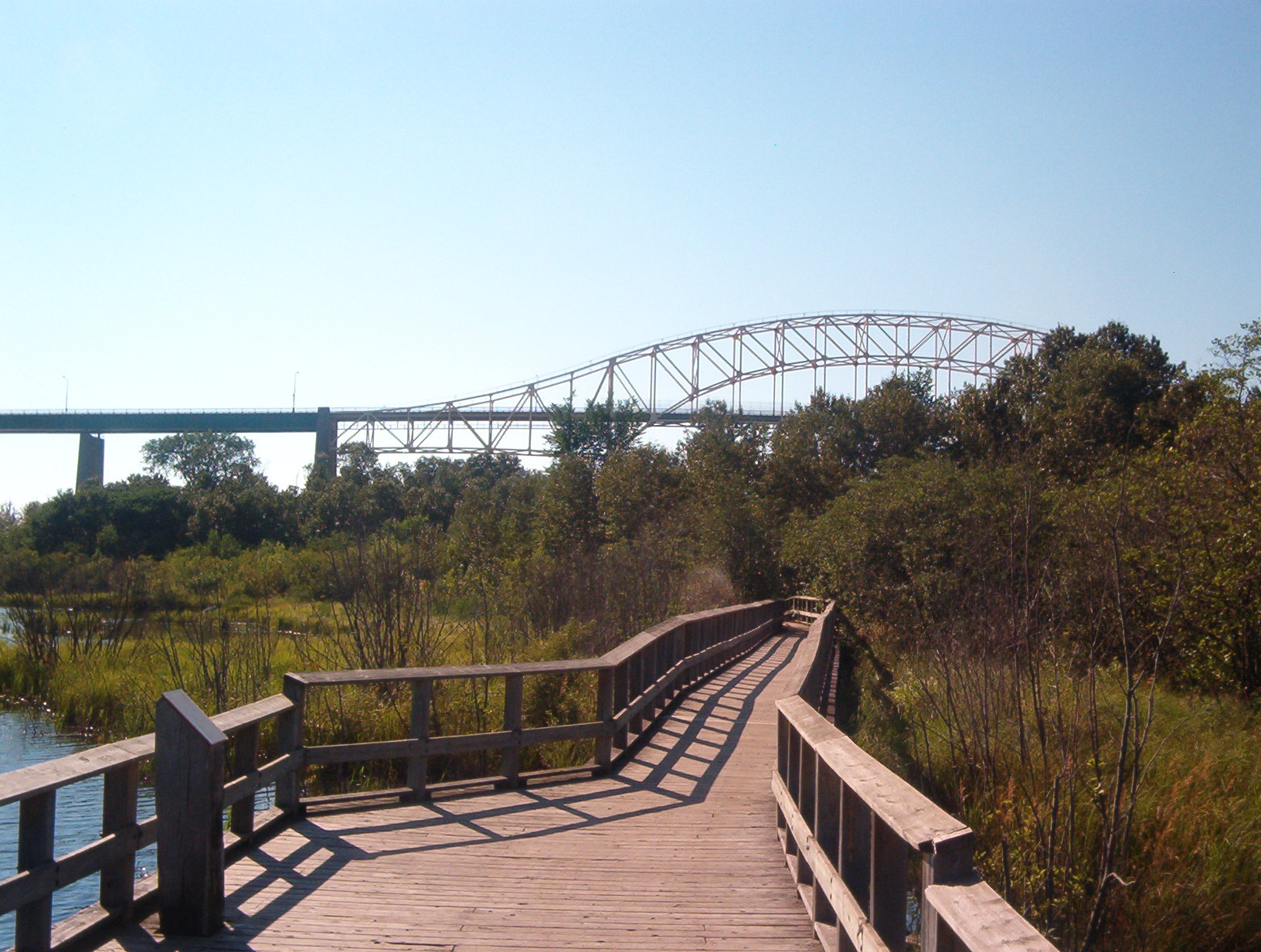
Today the Sault Ste. Marie Canal is as much a park as a working waterway. The red sandstone heritage buildings cluster along the canal banks, their warm color a contrast to the cold blue-gray of the St. Marys River. The Attikamek Trail follows the shoreline through wetlands thick with watershield plants, past ponds where the International Bridge frames the horizon. Guided tours run through the summer months, and the visitor centre operates from mid-June through mid-October. Pleasure craft pass through the modern lock, their crews working the same passage that fur traders, military expeditions, and Great Lakes freighters navigated before them. The canal remains a quiet counterpart to the bustling American locks visible across the river -- a place where you can stand among machinery from 1895 and trace the thread of a story that started with one refused steamer and one stubborn country's resolve to chart its own course.
From the Air
The Sault Ste. Marie Canal is located at 46.513N, 84.351W on the Ontario (Canadian) side of the St. Marys River, directly adjacent to the American Soo Locks. From the air, the canal is visible as a narrow waterway parallel to the river's rapids, with red sandstone buildings along its banks. The International Bridge crosses directly overhead. Recommended viewing altitude: 1,500-3,000 feet AGL for canal detail and context with the American locks. Nearest airports: Sault Ste. Marie Airport (CYAM) 8nm west on the Ontario side, Sanderson Field (KANJ) 3nm south on the Michigan side.