Savanna Portage State Park
Water flows two directions from this patch of Minnesota bog. Stand at Wolf Lake, near the park's eastern boundary, and the East Savanna River carries your reflection toward Lake Superior, the Saint Lawrence River, and eventually the Atlantic. Walk a few miles west to Savanna Lake, and the West Savanna River sends its current to the Prairie River, Big Sandy Lake, and down the Mississippi to the Gulf of Mexico. Two oceans, separated by a stretch of swamp and forest that Native Americans navigated for centuries before the first European ever shouldered a canoe across it. Savanna Portage State Park, established in 1961 and listed on the National Register of Historic Places in 1973, preserves this geographic hinge and the grueling trail that once connected half a continent.
Where Glaciers Drew the Line
The park sits on the floor of an ancient glacial lakebed. During the last phase of the Wisconsinan glaciation, the retreating Saint Louis Sublobe of the Superior Lobe left behind two connected bodies of water, Glacial Lakes Aitkin and Upham. As these lakes drained, they deposited sand and sediments across a low-relief plain. The Cloquet River once ran west across this plain to the Mississippi, but through the slow geological process of stream piracy, the smaller Saint Louis River -- running east toward Lake Superior -- captured the Cloquet and most of its drainage basin. The result was a continental divide written in wetlands rather than mountain peaks. Rolling hills of glacial moraine, part of the Saint Louis Moraines Subdivision of the Northern Minnesota Drift Plain, frame the boggy lowlands where two watersheds nearly merge.
The Worst Portage in the Fur Trade
The distance between navigable water on the East and West Savanna Rivers was not great, but the terrain made every step miserable. The portage trail departed the East Savanna downstream from Wolf Lake to avoid the worst of the bog, then pushed west through swamp and wooded upland to reach the West Savanna. Travelers approaching from the east had already endured an exhausting journey: exiting Lake Superior at Fond du Lac -- where Duluth stands today -- and fighting up the steep, rocky gorge of the lower Saint Louis River through what is now Jay Cooke State Park. By the time they reached the portage, voyageurs and coureurs des bois were carrying heavy packs and birch-bark canoes across ground that sucked at their moccasins with every step. Yet the route was indispensable: it was the vital link between the Great Lakes trading network and the Mississippi Valley.
Du Lhut, Aitkin, and the Fur Trade Highway
The portage likely saw its first European traffic as early as 1679, when Daniel Greysolon, Sieur du Lhut -- the French explorer for whom Duluth is named -- visited a Sioux village at Big Sandy Lake during his exploration of the Lake Superior region and the upper Mississippi. Over the next century and a half, the trail became a commercial corridor. Fur traders working the upper Mississippi Valley used the portage to move pelts east toward Montreal and trade goods west into the interior. The route's peak years came in the 1820s and 1830s, when the American Fur Company operated a large regional trading post on Big Sandy Lake under William Aitkin, whose name would later be given to the surrounding county. Missionaries, explorers, and government agents all trudged the same muddy path.
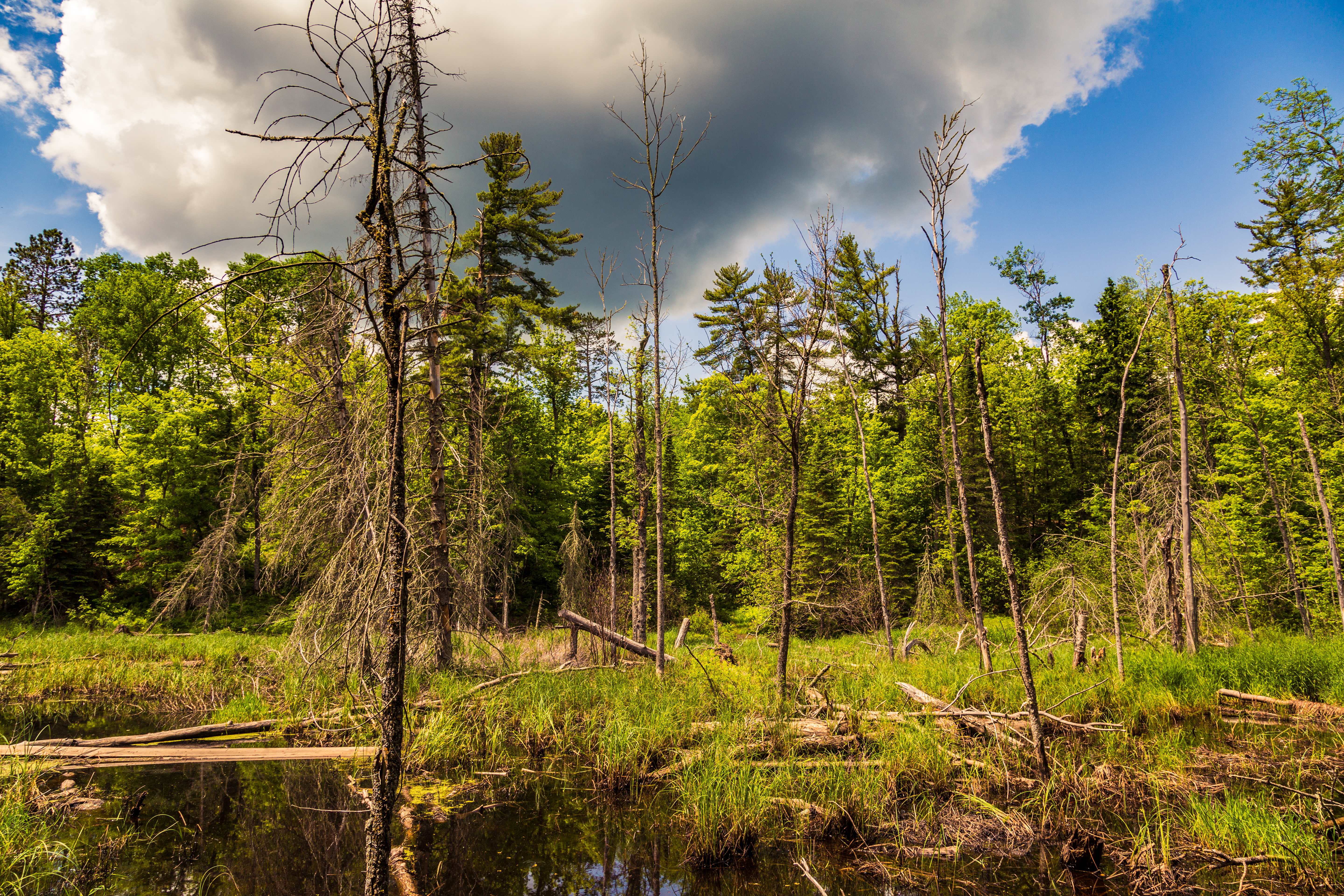
Hills, Lakes, and Bogs
The interest sparked by investigations into the old trail's route inspired the Minnesota Legislature to create Savanna Portage State Park in 1961. Today the park encompasses a landscape of rolling glacial hills, quiet lakes, and expansive bogs -- the same terrain that made the portage so difficult now makes the park so distinctive. The historic trail itself can still be hiked, though the swampy sections that tormented eighteenth-century voyageurs remain challenging footing. The park sits north and east of McGregor, Minnesota, roughly halfway between the Twin Cities and Duluth. It is a place where the drama of continental geography becomes tangible -- where you can stand on one of the least dramatic drainage divides on the planet and contemplate the fact that a few miles of bog once separated two oceanic destinies.
From the Air
Located at 46.8375°N, 93.1567°W in the rolling lake-and-bog country of central Minnesota. The park straddles the barely perceptible continental divide between the Great Lakes and Mississippi watersheds. From 4,000-6,000 feet AGL, the landscape reads as dense boreal forest interspersed with lakes and wetlands. Big Sandy Lake is a prominent visual reference to the southwest. McGregor, MN lies to the southwest; Duluth is approximately 75 miles east. Nearest airports include Aitkin Municipal (KAIT) to the southwest and Range Regional Airport (KHIB) to the northeast. The terrain is flat to gently rolling with no significant obstacles.