Sawtooth Wilderness
The name tells you everything: jagged granite teeth sawing into the Idaho sky, each summit a blade forged in the ancient fires of the Eocene batholith. This is the Sawtooth Wilderness, where 50 peaks rise above 10,000 feet and several hundred lakes mirror the drama overhead. President Theodore Roosevelt recognized this place in 1905 when he proclaimed it a forest reserve, but the mountains had been cutting the horizon for 50 million years before that signature dried.
Teeth of Stone
Thompson Peak, at 10,751 feet, crowns the range as the highest point in the Sawtooth Mountains. But the real story lies in the granite itself. The northern Sawteeth formed from the Eocene Sawtooth batholith, while south of Alturas Lake, the mountains rose from Cretaceous granodiorite of the Idaho Batholith. This dual origin created a range of unusual character: peaks that look carved rather than weathered, summits that seem too sharp to have survived the ages. Yet they endure, their edges honed by ice and wind into the serrated silhouette that gives the wilderness its name. From the air, the ridgelines look like saw blades laid across the landscape, each tooth casting its shadow into the valleys below.
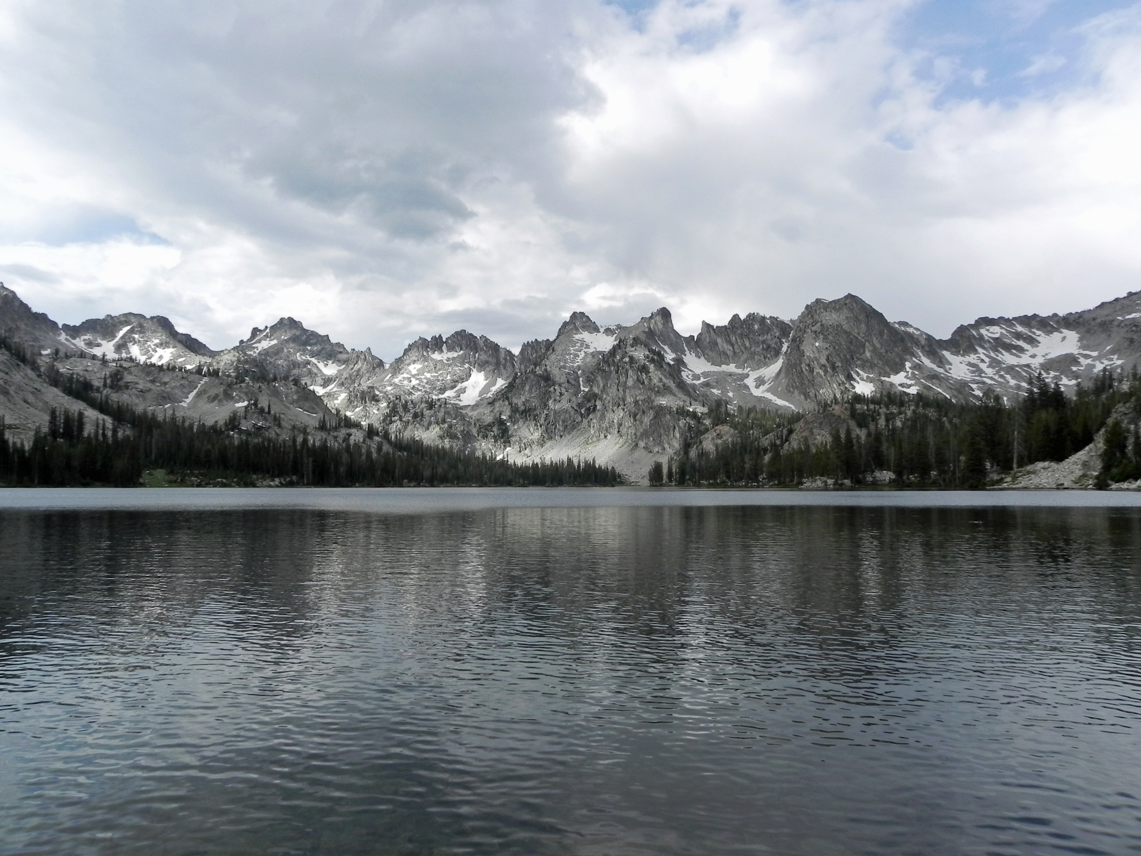
Lakes That Remember Ice
Several hundred lakes fill the basins of the Sawtooth Wilderness, and nearly all carry the fingerprints of glaciers. Sawtooth Lake, the largest, reflects Mount Regan's face on calm mornings. Alice, Toxaway, Ardeth, Edna, Hell Roaring, Goat, and Baron lakes hold their own territories in the high country. Many remain frozen until mid-summer, their surfaces locked in ice while lower elevations bloom with wildflowers. The Pleistocene carved these basins, and though the glaciers retreated, they left behind 202 perennial snow fields mapped across the range. No surface glaciers remain today, but rock glaciers creep along north-facing slopes, slow rivers of ice-cored debris still in motion. Cirques, moraines, horns, and aretes punctuate the landscape, a textbook of glacial geology written in stone.
A Senator's Vision
In 1937, the Forest Service designated the Sawtooth Primitive Area to preserve these mountains from development. But it was Senator Frank Church of Idaho who saw a greater future. In 1960, he introduced legislation to study the area for national park status, a campaign that would ultimately culminate in the Sawtooth Wilderness designation on August 22, 1972 under Public Law 92-400. Today, 40 trails covering nearly 300 miles weave through the wilderness, accessible from 23 trailheads. The tiny town of Stanley, population just a few hundred, guards the northern gateway in the Sawtooth Valley. Atlanta and Sawtooth City provide additional access points, though calling them cities stretches the definition. This is a landscape designed for visitors, not residents, where human development yields to wilderness.
Where Wolverines Hide
The forests of the Sawtooth change with elevation. Lodgepole pine dominates the lower reaches in nearly monotypic stands, giving way to Douglas fir and quaking aspen on the slopes. Climb higher and whitebark pine, Engelmann spruce, subalpine fir, and limber pine take over, trees that have learned to survive where winter never quite ends. Above treeline, alpine tundra spreads across the high basins, meadows that burst with color in the brief mountain summer. This habitat supports wolverines and the endangered Canada lynx, though sightings remain rare. These are creatures of deep wilderness, thriving precisely because the Sawtooth remains what it has always been: a place where people pass through but do not stay.
Waters Flowing West
Every stream in the Sawtooth Wilderness eventually reaches the Pacific Ocean. The eastern slopes drain into the Salmon River, itself a tributary of the Snake, which joins the Columbia in its push toward the sea. The western side feeds the South Fork of the Payette River, while the southern end contributes to the Boise River. This hydrological web connects the wilderness to watersheds hundreds of miles distant, carrying snowmelt and rainfall from 10,000-foot peaks to the Pacific shores. The Graham Guard Station, perched on the far western edge by the North Fork Boise River, records temperature swings that would challenge any thermometer: mild winter days giving way to sub-freezing nights, a climate that varies more between sunrise and sunset than between many seasons elsewhere.
From the Air
Located at 44.00N, 115.07W in central Idaho. Thompson Peak (10,751 ft) is the highest point; maintain altitude above 12,000 ft for safe clearance over the range. The Sawtooth Valley and Stanley (ICAO: none nearby; Friedman Memorial KSUN 60nm south, McCall KMYL 75nm west) provide visual references. Best visibility in summer months; winter brings significant snow cover that highlights the jagged ridgelines. The saw-tooth profile is unmistakable from any approach, with the granite peaks catching alpenglow at dawn and dusk.