Sawyer Camp Trail
Three hundred thousand people use Sawyer Camp Trail every year, making it one of the most popular recreation paths in San Mateo County. The six-mile trail follows the San Andreas Fault rift valley alongside Crystal Springs Reservoir, the water supply for San Francisco, through a landscape of serpentine soils, oak woodland, and coastal scrub that feels remarkably wild for a path sandwiched between two freeways. Dogs are not allowed. A center stripe keeps joggers, walkers, and cyclists from colliding. Distance markers tick off the miles. It is civilized wilderness, California-style.
Leander Sawyer's Inn and the Jepson Laurel
Leander Sawyer purchased land in this valley in 1853 and probably lived in a small adobe near a natural spring. He kept an inn to feed picnickers and lodge horsemen traveling through the area, and during the 1850s and 1860s he grazed cattle to keep the brush down for incoming wagons. Near the trail stands the Jepson Laurel, an ancient California laurel tree that has been fenced to protect its root system from soil compacting by foot traffic. The San Francisco Water Department, on whose property the tree stands, assumed responsibility for its preservation. In 1981, San Mateo County Parks built a picnic area near the tree, making it a destination within the larger trail.
Walking the Fault Line
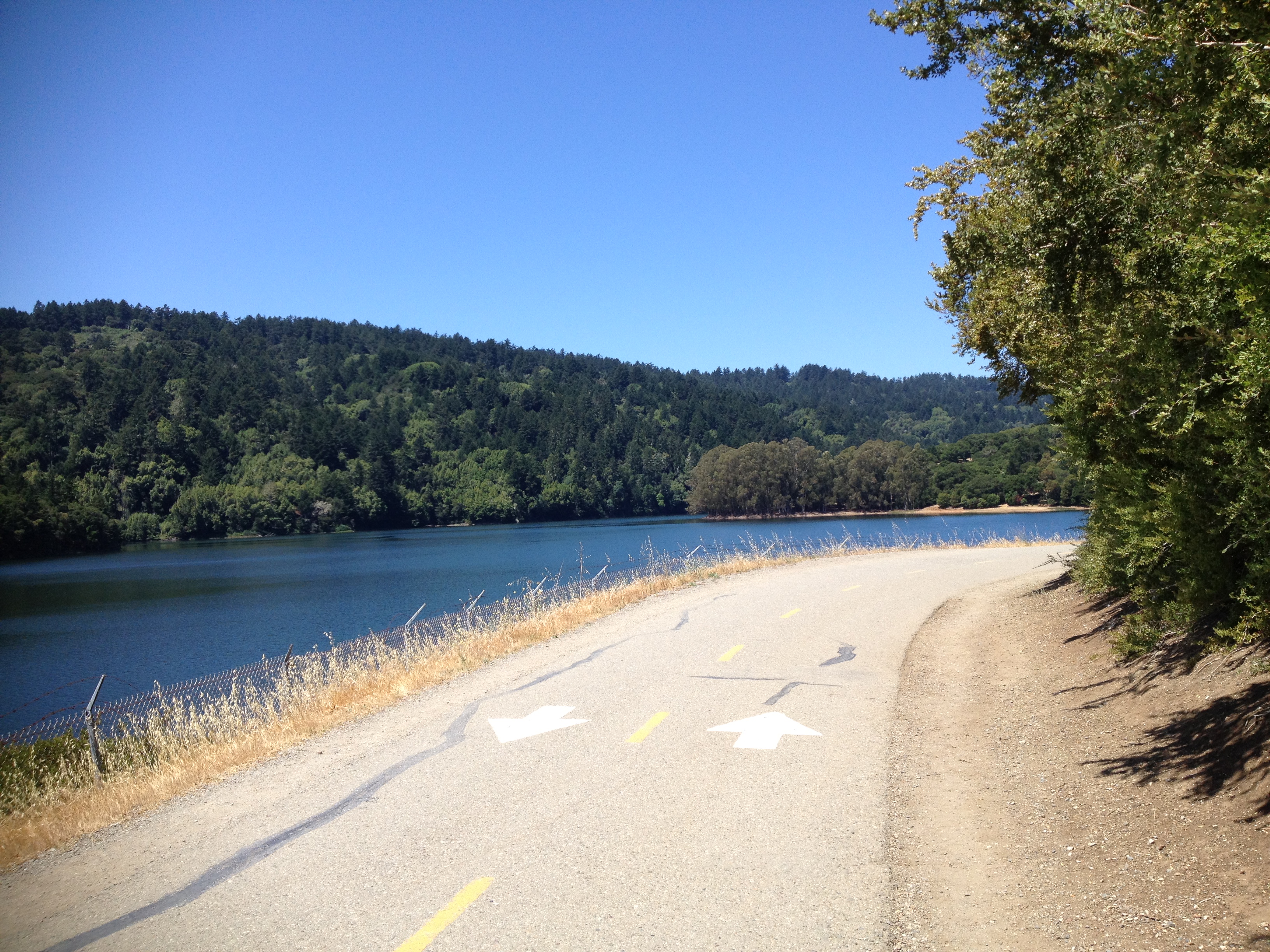
The trail runs through the rift valley created by the San Andreas Fault, one of the most geologically active corridors in North America. Crystal Springs Reservoir fills the valley to the south, its surface reflecting the sky and the wooded slopes of the Santa Cruz Mountains. San Andreas Lake sits to the north, the body of water that gave the fault its name when geologist Andrew Lawson first identified the fault trace here in the 1890s. The trail begins at a parking lot just north of Crystal Springs Dam and follows the east side of the reservoir through northern coastal scrub, grassland, and California oak woodland. The serpentine soils along the route support a distinctive flora adapted to the challenging chemistry of this unusual substrate.
A Reservoir's Length of Quiet
The trail's popularity is a function of its simplicity. The paved surface accommodates all fitness levels. The scenery -- reservoir, mountains, wildlife -- provides constant visual interest. Deer, ducks, and rabbits are common sightings. The absence of dogs keeps the experience calm. The trail is officially a segment of the longer Crystal Springs Regional Trail, and its views of the Crystal Springs Watershed are among the best on the San Francisco Peninsula. For commuters who spend their days on the congested highways that bracket this valley, the trail offers something genuinely rare: six miles of flat, car-free passage through a landscape defined by its geological violence but experienced, on foot or on a bicycle, as profoundly peaceful.
From the Air
Located at 37.59°N, 122.41°W in the rift valley between I-280 and Highway 35 (Skyline Boulevard). Crystal Springs Reservoir is the prominent body of water visible along the trail. San Francisco International (KSFO) is approximately 5 nm east. The San Andreas Fault trace runs directly beneath the trail.