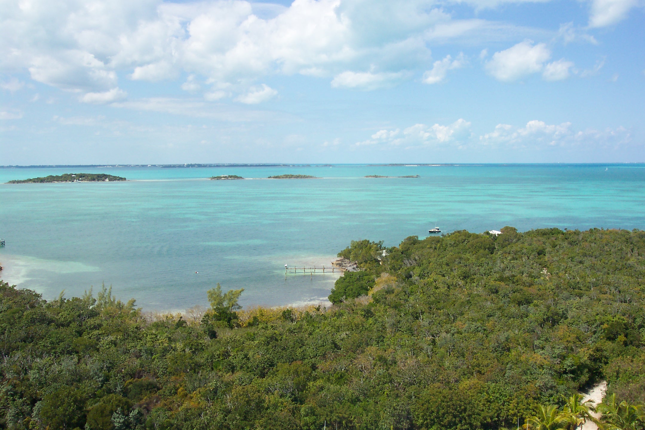
Sea of Abaco
Sailors in the Abacos have a name for the moment the ocean turns on them: Abaco Rage. Beyond the chain of barrier cays that shelters this 100-kilometer lagoon, the Atlantic seafloor drops more than 200 meters in the space of a few kilometers. When ocean swells hit that sudden shallowness, they slow, stack, and build into waves that can overwhelm small boats in the narrow channels between the cays. The Sea of Abaco - sometimes called Abaco Sound - is a place of contradictions: a sheltered marine highway popular with boaters that conceals breaking shoals, treacherous reefs, and one of the most impressive coral systems on the planet.
The Marine Highway
Stretch a line from Spanish Cay in the north to Little Harbour in the south, and you trace the full length of the Sea of Abaco - roughly 62 miles of saltwater lagoon flanked on one side by Great Abaco Island and on the other by the chain of barrier cays that separate it from the open Atlantic. The Bahamians call Great Abaco the "mainland," and it forms a nautically impassable wall along the entire western edge. Only the navigable channels between individual cays provide access to the ocean beyond. The widest stretch of the sea, northwest of Marsh Harbour, exceeds 10 kilometers. Most of the Abacos' largest settlements cluster along its shores, and boaters use it as a protected corridor through the islands - though "protected" is relative. Depths are generally only a few meters, and around the Sand Bank Cays between Treasure Cay and Whale Cay, vessels drawing more than 1.2 meters are warned to stay away entirely.
Coral Kingdoms
The Sea of Abaco is entirely saline. None of the surrounding islands produce significant surface runoff, which is part of why the water is so remarkably clear - no sediment clouds the view down to the reef. That reef, the Great Abaco Barrier Reef, is sometimes ranked as the third-largest barrier reef system on Earth. What makes it particularly notable are its stands of staghorn and elkhorn coral, species that have declined catastrophically elsewhere in the Caribbean. By one account, the largest stand of elkhorn coral in the world grows within the Sea of Abaco, near Sandy Cay south of Man-O-War Cay. Coastal mangroves fringe the bordering islands, and the marine life is diverse - a functioning ecosystem in waters shallow enough to wade through in many places.
Built from the Dead
Beneath the Sea of Abaco lies the Little Bahama Bank, a massive carbonate platform assembled from the accumulated remains of millions of years of marine organisms - corals, foraminifera, the calcium carbonate skeletons of creatures long gone. The islands that enclose the sea are themselves composed of ancient sand dune systems that hardened over time through a process of cementation, their calcium carbonate grains fusing into rock. Geologists call this material eolianite - literally, rock made from wind-blown sand. The coastal cliffs and ridges of Great Abaco Island, which frame the western edge of the sea, are composed of this substance. Walk the shore and you are walking on compressed time: sand that was once seafloor, then dune, then stone.
Reading the Charts
Navigating the Sea of Abaco requires attention and humility. North of Marsh Harbour, the sea trends northwest to southeast. South of it, the orientation shifts to roughly north-south. The difference matters because wind direction and fetch change with the geometry, and what counts as safe passage at one end of the lagoon may be dangerous at the other. Paper charts covering the area include NGA Chart 26321, Hope Town Approaches, and NGA Chart 26300, Little Bahama Bank to Eleuthera Island. Notable features within the sea include the Parrot Cays, Sand Bank Cays, and Fish Cays - names that tell you what people found there. The Sand Bank Cays area is notoriously treacherous, its breaking shoals invisible until you are among them. Even experienced Abaco boaters treat this stretch with respect.
From the Air
Located at approximately 26.63°N, 77.14°W in the Abaco Islands of the Bahamas. From altitude, the Sea of Abaco is unmistakable: a long, narrow lagoon running roughly 62 miles between Great Abaco Island to the west and the chain of Abaco Cays to the east. The turquoise shallows contrast sharply with the deep blue of the Atlantic beyond the barrier cays. Marsh Harbour, the principal town, sits on the western shore near the widest point. The Great Abaco Barrier Reef is visible as lighter water along the eastern edge. Nearest airport is Marsh Harbour Airport (MYAM). From above, the shallow reefs and sand banks that make surface navigation treacherous are clearly visible - a rare case where the aerial view reveals what the sailor cannot see.