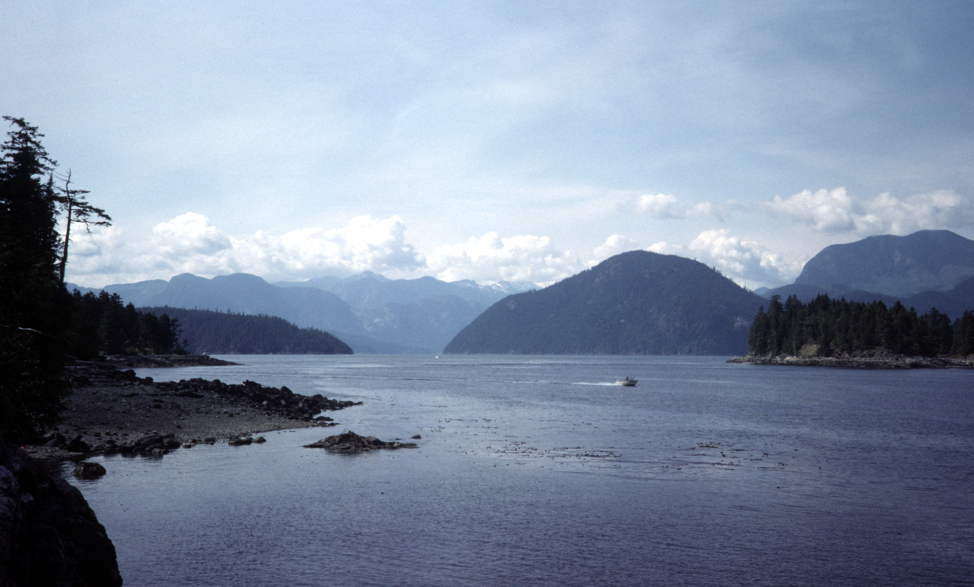
Sechelt Inlet
The isthmus is less than 1.2 kilometers wide. That narrow strip of land at the town of Sechelt is all that prevents the Sechelt Peninsula from becoming an island, and Sechelt Inlet is the body of water that almost completes the cut. This fjord on British Columbia's Sunshine Coast reaches inland from its mouth at Jervis Inlet, fed by two side-inlets and drained through a bottleneck so narrow that the sea itself becomes violent trying to pass through it. The Chinook Jargon word for what happens at that bottleneck is skookumchuck -- strong water -- and anyone who has watched the Sechelt Rapids during tidal flow understands why the name stuck.
Strong Water at the Gate
Near its mouth, Sechelt Inlet constricts into the Skookumchuck Narrows, and the effect is dramatic. The entire tidal volume of the inlet -- along with that of Salmon Inlet and Narrows Inlet -- must force its way through this narrow passage. During peak flow, the water does not merely move; it rages with near-waterfall fury, producing standing waves, whitecaps, and whirlpools even when the air above is perfectly still. Other British Columbia fjords have similar rapids at their mouths, a consequence of shallow, narrow entrances trying to accommodate the massive water volumes stored in deep fjord basins. But the Skookumchuck Narrows is exactly as its name describes: exceptionally narrow, which compresses the torrent beyond what is typical elsewhere on the coast.
Branching Waterways
The inlet is not a single channel but a network. Salmon Inlet branches off to the south, extending roughly 23 kilometers to end at a small power dam where the Clowhom River enters. Narrows Inlet forks in the opposite direction, running about 15 kilometers to the mouth of the Tzoonie River and passing through its own constriction, the Tzoonie Narrows, before rejoining the main inlet just inside the Skookumchuck. Together, these waterways create a complex system of fjords-within-fjords, each with its own character -- the dam-controlled stillness of Salmon Inlet, the tight squeeze of the Tzoonie, the deep main channel reaching back toward the peninsula's interior.
Almost an Island
The geography here reads like a near-miss. Sechelt Inlet carves so deeply into the coast that only the slender isthmus at the town of Sechelt prevents the peninsula from floating free. Stand at the head of the inlet and you can see Sechelt's harbor on the other side -- the open waters of the Strait of Georgia barely a kilometer away. This precarious geography defines everything about the place: the tidal ferocity at the narrows, the sheltered calm within, the sense of being surrounded by water even when standing on solid ground. The inlet's mouth opens to Jervis Inlet, which in turn leads to the Malaspina Strait and the broader ocean beyond.
Dolphins in the Deep
From early April to late September 2007, more than 200 Pacific white-sided dolphins took up residence in the inlet. These social, acrobatic mammals seemed to relish the attention of their human observers, approaching boats and performing aerial displays that drew kayakers and wildlife watchers from across the Sunshine Coast. The dolphins' extended visit illustrated what the inlet's constant tidal motion produces: a rich marine environment where nutrients churn continuously through the water column. Porpoise Bay Provincial Park sits at the inlet's head near Sechelt, while Mount Richardson Provincial Park protects the steep terrain along its flanks, making the inlet accessible to both waterborne and land-based explorers.
From the Air
Located at 49.63°N, 123.84°W on BC's Sunshine Coast. The inlet is dramatically visible from altitude -- a long, narrow fjord reaching inland with the Skookumchuck Narrows visible as turbulent water at its mouth. The isthmus at Sechelt is strikingly thin, barely separating the inlet from the Strait of Georgia. Salmon Inlet and Narrows Inlet branch off as visible side-channels. Nearest airports: Sechelt-Gibsons Airport (CAA3) and Vancouver International (CYVR, ~50 nm SE). Best viewed at 3,000-5,000 feet AGL for the full fjord system. Tidal rapids at the Skookumchuck Narrows may produce visible white water during peak flow.